Thank you for posting your stories here on my blog. I'm certain we will all enjoy reading each others adventures along the canal.
Jeff Maximovich
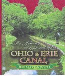
The Johnny Apple Seed of the Ohio & Erie Canal
Certain stories are subject to ALL RIGHTS RESERVED which will be acknowledged at the beginning of the story. No part of a specific story may be produced, stored in a retrieval system or transmitted in any form or by any means without written permission of the author except by a reviewer who may quote brief passages in a review to be printed in a newspaper, magazine or journal. Any stories which fall under the terms listed, are not to be used for cinematic purposes without permission.
The Johnny Apple Seed of the Ohio & Erie Canal
Sold in most book stores use this ISBN #1424128765
2,142 comments:
«Oldest ‹Older 201 – 400 of 2142 Newer› Newest»380- We would enjoy learning of the Sandy & Beaver System. Living in Magnolia has always kept up our interest. We still, often visit the old mill and wonder on the outskirts now and then re-discovering bits here and there. How about some good ole’ schooling with facts on the (Sandy)!
383- I was emailed today and was asked to list the towns the Sandy and Beaver Canal passed through going east, here are some. The canal started at Bolívar, then went onto Sandyville, Magnolia, Waynesburg, Malvern, Oneida, Pekin, Minerva, Bayard, East Rochester, Lynchburg, Kensington, Hanoverton, Dungannon, Guilford Lake and what’s left of Cold Run Reservoir. Continuing on, we have Lisbon, Elkton, Fredericktown, Calcutta, and Glasgow, Pennsylvania. I set out on walking the P&O Canal and so far have covered 40 miles. On that stretch, I have found some great sites which will appear on this website when the journey has been completed.
385- I would like to enhance listing 383 concerning the Sandy. Its eastern division consisted of 57 locks located between Lockbridge and Glasgow. The western division made up 33 more locks from Hanoverton to Bolivar. Its summit was the Guilford Lake region, formerly the Cold Run Reservoir.
386 Being a member of the CSI, we have are fair amount of individuals who carry out in the same manner as the disgruntled Mr. Seed. Watching this site over time reveals his identity. I spoke with a fellow member of the CSO who along with I feel he is none other than the one who goes by ASTRONURSE. If he's not the notorious Mr. Seed, he’s an associate.
387- I would actually have some respect for this guy “seed” if he could take the time and list his own website for all too see, so we can frequent it. One the flip side, its obvious he is disgruntled, for if not, he would be a little more pleasant instead. I have watched this site through its many transitions, it’s come far. His real name should be “Mr. Weed”. For he’s an unsightly-ugly patch which needs to be pulled from a nice lawn. I recommend that he is given no liberty on your website and should be removed systematically. I could recognize his style no-matter whose name he connects to it, I’d be certain you can do the same. Don’t give him an inch to operate.
I live on the Big Sandy; hopefully you document this canal as well as you’ve done the Ohio and Erie. Are any locks on the Sandy & Beaver on federal land?
388-To Cheryl Lynn from Sandyville. He's bordering total abolishment from this site as it stands. I absolutely have his identity narrowed down to two culprits. I know this because people like to talk about what they do, especially on underhanded matters. He talks a little too much about his involvement on this site; someone called me on the phone to discuss him. Not everyone he deals with thinks he's cute. From now on Mr. Seed will be erased when found on this site. That goes for any listings which are similar to his style. In return, let's lay off the CSO and any canal associated organizations and keep this site about canal literature and history. This site is steering off course again, stemming from that we have to clean it up. I know readers enjoy the bickering and love to respond to it. Let's get back to good honest canal associated postings. Thank You, Canalwayman; Jeff Maximovich.
391- Once again, let's drop all the nonsense, for it's gotten carried away in another direction. For those who have previously posted negatively, your listings will be removed sooner or later as this site gets filtered out. Do not get upset, we’re supposed to be adults, myself included. This up and coming October I'm planning on cutting out on the Sandy and Beaver Canal for a solid week. In case you didn’t pick up on it, that was an invitation for anyone who would like to come along. We'll be staying out on the towpath and hopefully during that week we cover ten or better miles a day. The plan is to start in Bolivar and walk to Glasgow Pennsylvania following the towpath. Anyone who feels as if they have the stamina, come along. Later in the year, I would also like to invite anyone who would like to accompany me from Cleveland to Portsmouth on the towpath of the Ohio and Erie Canal. The Sandy and Beaver will open up many surprises because I understand that no-one has actually walked its distance, one-foot after the other since the canal days.
392-Hi Canalwayman. I personally apologize for the idiots who make up the Canal Society of Ohio. I was a member but gave it up 10 years ago. Within the cso was so much undertone and backstabbing among some its members it affected my health. May I suggest becoming a member of a superior organization which is the Canal Society of Indiana? It is run with respect to its members who get full credit for their discoveries. We would love to have you.
Would you give a full explanation by which means or how it come about that the Minthorn Lock was actually discovered? What’s your opinion of a lock sitting dead smack in Bolivar?
Canal Society of Indiana
5908, Chase Creek Court
Fort Wayne, Indiana
36804
393- That walk sounds great. Post how we are to clean ourselves and eat.
393-
I have to agree,Lusks Lock is the most spectacular lock that can be seen anywhere on Ohio's canal system. Another good one,Lock 19 on the Hocking canal and located near Nelsonville should be of interest to Mr.Maximovich.It's called (no joke) "Johnny Appleseed Lock". W.A.Seed
394-Mr.Seed I'm actually pleased that you wish to come onboard. Just yesterday I've gotten so much input about the lock numbering on the Sandy and Beaver, I found it confusing. As it stands the first lock that we’ll come across will be the one in Magnolia going east. Different publications have the number of locks on the Sandy inconsistent to one another. One has the number over one hundred, if that’s the case well be hitting the locks better than one per-mile on average, we’ll see. In comparison, the Ohio and Erie Canal will prove to be a walk in the park next to exploring the Sandy and Beaver. The Ohio and Erie has adjacent roads and the Sandy cuts into the country side for long stretches. Hopefully by the time we set out our information will be in order so we can accurately identify structures along the way.
Linn Loomis, from Newcomerstown has some input on the matter and is expected to give the numbering of the locks and where they’re going east to west. His information should be helpful.
I really need to give it some though about how we’ll bathe and eat along this trek from Bolivar to Glasgow. If I were alone, it would be easy, by mimicking the way I survived along the Ohio and Erie Canal by placing supplies in waiting areas along the trail. I don’t know this system well enough to organize that procedure yet. I’ll be checking out the spread on the distance from town to town and perhaps when upon arrival we could have individual pick-ups and resume the following day where we left off for those who wish to advance to the next stop. By the time this event gets underway these things will be worked out. I am open for suggestions from anyone who has an idea. I would also be interested in the names of the locks, creeks and water crossings to compare to what I already have for the sake of accuracy.
Mr. Seed, many of my readers do not care for you and I often get bombed with emails concerning you. I’ll admit you can cause quite the stir around here. I was told yesterday if you continue to post on this site they’ll quit looking at this site. Here’s how I see it. I’m still in charge of things on this site and so far except for getting a little angry you’ve actually brought to us some good and helpful information. Stemming from that, you have a “free pass” on this site to say what you want. I’ll be honest; I’m not an all pleased by the posting yesterday by someone calling the members of the Canal Society of Ohio a bunch of idiots by a member of the CSI. I personally have contact with members of the CSO who in my opinion are experts I really get tired of all the discontent among a few my readers who seem to be narrow minded. For those who feel as if I’m wishy-washy when it comes to Mr. Seed, he stays on.
395-Minthorn Lock. In developing a new spillway on Buckeye Lake back in August of 1991 the construction process stumbled across the remains of the Minthorn Lock. They were taken by surprise by this find; it left them without the immediate answers of what to do with this great piece of archeology. The pieces were carefully numbered and disassembled for its reconstruction in the future.
Within the next few weeks, I’ll produce a very complete slide show concerning this matter and with it the whole Buckeye Lake region. The show is loaded with actual pictures of the uncovering and disassembly process. At this time, I would like to make a point, if not for the in-sight and determination by Ohio’s historical Society and a hard push from the CSO; the Minthorn Lock would have been totally demolished. We should thank them.
396-I studied an old canal map of the Bolivar area and to my surprise there set a lock at the connection point of the Ohio and Erie to the Sandy and Beaver Canal. As far as I can tell, the lock was no lift lock, but more of a guard locks that sat on land on the Sandy and Beaver at the western end of the Bolivar Aqueduct. It only seems appropriate to have it to protect the water supply on the Ohio and Erie in case the aqueduct may have failed. A guard lock usually accompanies aqueduct crossings, this was common construction practice done all over the state, they worked as a shut off valve if need be. The Circleville Aqueduct had one built into it as well as any stream or river crossing be-it a guard lock or lift lock for with either, they had the ability to stop the water flow. It’s my opinion a lock was in Bolivar, it would have been a guard lock which sat dead smack in the middle of downtown facing east on the sandy.
397- It’s hard to envision what the Mustill Lock area looked like while in operation. Which side of the lock was the towpath on heading north?
398- The towpath contrary to what it may seem was on the opposite side from the lock at the Mustill store site. Its main thoroughfare bordered the eastern bank of the canal. The store side of the towpath was a busy area surrounding the activity of the businesses in general vicinity.
399- For those who may have an interest, on Saturday the 30th of August, a few of us are going to explore the Dungannon Tunnel area. If you would like to come along, you’re invited
400
I'm not very well aquainted with the S&B having only hiked some of the Elkton,Magnolia,& Beaver Creek State park areas of it. Have you come across any existing culverts on it during your preliminary exploration of it? I know that much of it runs at the base of hills & creeks probably drained into its prism but there should be some structures on its summit level.-- W.A.S.
401- Today is the 21st day of August 2008, and we here in southern Ohio along the Scioto River are experiencing a dry spell like none that I can recall. The river near Waverly is barely flowing at only inches in depth. If this was happening during the canal period, would such conditions have an affect on canal traffic? I was in Portsmouth yesterday and we were able to walk out on the delta close to the Ohio River, but the loose sandy bottom made us nervous on the slow running Scioto as we moved in closer to the Ohio River.
August 21, 2008 6:35 PM
Information correction to entry 381 concerning the sandy and Beaver Canal said...
402-previously-381-The Sandy and Beaver system consisted of 90 locks and 30 dams. The Sandy joined the Ohio and Erie in Bolivar Ohio by use of the Bolivar Aqueduct and spanned across the state ending at the Ohio River at Glasgow, PA.73 mile from its western connection. On the Sandy and Beaver sits the most spectacular lock I’ve ever known of. This lock defines the great ingenuity of its builders who was expert stone masons, the lock is branded accordingly proving that it was no-less than the Mason’s who practiced their trade. Lock 27, named Lusk’s in located two miles east of Elkton in Columbiana County and had a lift as much as 14 feet, making it one of our states deepest. This lock has such a well thought out design as a few more on the Sandy. This site and has a majestic winding staircase on the eastern approach on both sides of the structure, thus making easy access to manage the lock entering or exiting the canal boat. I counted 15 maybe 16 steps which are precisely cut as well as the complete chamber and both approaches.
August 16, 2008 6:56 PM
August 18, 2008 6:46 PM
«Oldest ‹Older 201 – 207 of 207 Newer› Newest»
Post a Comment
Home
August 18, 2008 7:13 PM
August 21, 2008 6:44 PM
«Oldest ‹Older 201 – 229 of 229 Newer› Newest»
Post a Comment
Home
Subscribe to: Post Comments (Atom)
403-I find this canal system a bit more of a challenge than the Ohio and Erie. I have ran into some structures along the way but failed to make any documentation. As you have, I visited some of the key places on the Sandy. By doing so it sparked my overall interest to make a go at this by doing the Sandy rather than the Ohio and Erie Canal. By doing the sandy, hopefully will give us all a good insight on how this system worked, and just what’s left out there. I’ve been going over the terrain on Google earth and I’ve been mapping the total trek hoping to be able to identify where I’m at using GPS. As I stated, I hope to have something tangible in hand before I leave and good solid facts when I finish up. I have some of my canal historian friends working overtime in preparation so I can identify accurately what I’m looking at. A few of them have voiced that they would like to go but in ones case, (Jokingly) he said that age has set in. He always wanted to foot this system but the years have just melted away. When I finish this work, this particular historian will receive a lot of credit for his part.
404-Weather conditions were the deciding factor whether anything moved on our canals. I was in Barberton yesterday, and on my return trip to Canton I followed the canal route and stopped at the Tuscarawas River crossing at the Van Buren Bridge. The water may have been 3 inches deep where I stopped. Conditions as these would stop any navigation on the canal system for lack of water
405-Ohio’s rivers which were selected as the water sources for the canals had dams which guaranteed a water supply in the canal prism.
406-water shortages were a common occurrence in the lower end of the Ohio and Erie Canal. Buckeye Lake previously the both Old and New Reservoirs hadn’t the capacity of the water abundance developed in the Portage lakes region. The southern end suffered more often in drier weather in comparison to its northern end. When the water levels begin dropping almost systematically that hurt the milling business first by slowing the water used for hydraulic purposes. The canal would start pulling back the water to run their operation to keep the canal full was more important. To conserve water levels only a minimum amount of water passed the spillways, tumbles and millraces.
407-July 16, 1843 on the Ohio and Erie Canal, on the boatmen’s behalf new freight rates go into effect. The canal boats are moored fast all over the state as the boat captains and owners refuse to move into the channel under the old contract rates. Coal mines refuse to honor new contract for several days as stock piles begin to grow and the steady loss of commerce is escalating for the coal shippers. Violence breaks out among the boat captains defying the strike who begin operating under the old contract and the steadfast boats men who are sitting out the strike. Four days later on July 16, the contract was ratified by the shippers and the strike ended.
408-In 1844, Ohio court ruled that a southern slave holder passing through Ohio with his slaves lost ownership of them while on Ohio lands.
409- Canalwayman-if you aren’t already aware, that on the Sandy and Beaver are some locks on state land in the Beaver Creek State Park lays locks, 27 through 42.
410-Responding to entries 397 & 398 concerning the location of the towpath at lock 15, the Mustill Store site. As in posting 398, the person who responded and answered was correct, the towpath was on the other side of the lock to its east. Getting to the store was not a problem with each lock having a crossover bridge. The crew or passengers could simply disembark on the western side of the lock just as well. The towpath actually took another route than the walking and riding path designated for our enjoyment after or north of lock18 heading north. The next lock was number 19, called Blackdog Crossing, named after the trains which crossed Tallmadge Hill, which weren’t the favored subject of any canal boat captain. Lock 19, was northwesterly at about 5 degrees from lock 18, and was in the area of Hickory St. and the Memorial Parkway Hill. The towpath continued at the same angle towards the railroad tracks than then ran along the hillside passing lock 20 and 21 the Wilderness Locks, which were in rather close proximity to each other. The walking path actually crosses the original towpath at the sewage overflow area which was formerly the home of lock 21. Again the original towpath followed the river shortly then headed off being crossed by the walking path again before it heads northwesterly angle away from the walking path as the walking path goes and meets the confluence of the Big and Little Cuyahoga Rivers. This particular area of the original towpath has vanished, nor can it be navigated because the Akron sewer trunk sits pretty much in the actual canal bed in parts and along side in others, all the way to the sewage plant in the Cuyahoga Valley.
411- I gave some thought to posting 410; were there many places where the railroad eventually passed over the canal from Cleveland going south to the Ohio River during the canals operational period?
For general information, are you planning on being armed when you set out walking the Sandy and Beaver Canal? The purpose for this inquiry as ridiculous as it sounds may protect you. I do my share of hunting here and over the eastern border into PA. I’ve been told that “Black bears” have been spotted along with “Coyotes” in the woods between magnolia and Sandyville. Many of these out-of-the-way places are so desolate the wildlife thrives. I live in Bolivar, I’ll tell you straight up, I seen a huge cat of some type one early morning back in may out in a field. I do maintenance on oil wells and I have seen some strange animal tracks which may resemble a bears on more than one occasion. Be careful and be smart.
412-In response to posting 411. Nowadays it’s almost crazy to go off and explore endlessly in unknown areas without some means to protect yourself. No-one can predict what types of dangers lurk deep into the woods away from the normal stream of life. You might have a bear or coyote situation; those could be some of the elements which you need to be prepared for. People living away from society for one reason or another, would be my biggest fear. This reminds me of an event which happened about 30 years ago in Munroe Falls, of all places. My friend and I were following the P & O Canal along the tracks and ran into a group of people camping between the river and the tracks and they were on motorcycles, probably passing through. They were drinking and weren’t wearing much. We were in the wrong place that’s for sure. We spotted them before they seen us and cleared the area. Something like that could have had a disastrous turnout.
About the areas where the railways passed over the Ohio and Erie canal. I never really kept any log on this subject and I’ll shoot from the hip remembering any crossings which come to mind. I can’t differentiate whether they were present during the canal era or come along later on. From the northern terminus at lock 44 to Rathbun’s lock 41, the Five Mile lock; there was probably at least a ½ a dozen crossings. One that stands out the most is the crossing of the Nickel Plate Railroad trestle about a mile and a half in from the terminus where I ran into plenty of trouble a couple years back walking the canal. I would have never expected so-many homeless people who were just plain angry at the world to be living below this bridge. They’re scattered all around the dark and dreary tracks along Cleveland’s slums. I was prepared to deal with them and done so, the proof is this, and I’m telling you about this event now.
Heading south, We have the tracks which sat high above the canal near the Canal Reservation Museum parallel to 49th St. I can’t really recall anymore crossings until I was along side the river and passed through a couple of corrugated culverts which the train tracks ran above the canal between locks 31 and 32, another was near Deep Lock Quarry lock 28. It was there were the tracks crossed the canal to the opposite side of Riverview Rd. heading towards the bottom of Portage Path and Merriman Rd. where the tracks again passed over the canal. Moving south, a set of tracks passed over the canal near lock 20, going into the original sewage facility that set in that area long ago but on the eastern side of the river. That facility was destroyed in the 1913 flood. I can’t recall anymore crossings until we reach the area just south of North St. where the canal would be crossed a few more times going up the staircase into downtown Akron. We had a crossing near the Diamond Match facility just south of Lock 1 near the area near the end of the upper basin. Tracks were uncovered there a couple of years ago that ended at the canal where a bridge exist now at the B.F.Goodrich complex. We had a couple more crossings near Cargill Salt Co. and another set of tracks crossed the canal in back of the Carnegie neighborhood of Kenmore on the bend heading into Barberton. On the southern end of Barberton the tracks crossed the canal on the “loop” just south of the Barberton Aqueduct. I don’t believe that the tracks passed over the canal along the stretch between Barberton and Clinton but did so further south at the Millport area between Canal Fulton and Massillon, and twice more in Massillon at Rt.21, at the steel bridge, another set of tracks were removed. Another crossing was near the Tuscarawas River in Navarre on its eastern end of town south of Canal St. We had another crossing before Sr.212 on the walking path on the same railway line crossed Rt.212 again going into Bolivar at the “S” curve. Going out of Bolivar we may have a crossing and another further down heading towards Rt.800. Canal Dover had two crossings, one of which was at the northern end of Sugar Creek Basin near the Arizona Chemical co. I’ll give it another shot at listing the rest of them another time, hopefully soon, starting at Canal Dover tracking onto the southern terminus at the Ohio River. This description may be subject to change, it may need some crossings added or removed.
413- I grew up in south Akron living on Boxwood Street we often played along the canal. We made a make shift raft and floated out into the swamps that are west of Main Street playing in an old shipwreck lying on its side. Now years later and much wiser I believe this shipwreck was a canal boat, is this a possibility?
414- Responding to 413. It’s no accident that the swampy area that runs on both sides of Waterloo Road isn’t canal-related. Waterloo Road in that particular area was built over marshlands and in its early years was subject to sinking. Through the years, enough fill was added that it eventually became solid ground. Before the road came along, that area was a part of the swampy northern end of Long Lake which borders the towpath even today all the way to Waterloo Road. You mentioned Boxwood St. Well, that almost runs into a man-made channel which was dug from the Ohio and Erie Canal that went into some type of a basin. Today, it is a filled in swamp. If you go to Nesmith Lake Blvd. and turn east on Rexford, that will take you directly across from the channel which leads into the swamps. I spent an enormous amount of time back in there in the winter months so I could navigate easier on frozen water. I wait for the change of seasons so I can investigate different areas along the canal. On the opposite side of Waterloo Rd. crawling around the swamps last winter, a hidden channel opened up in the reeves that lead into Long Lake. I feel that the channel across from Rexford once may have connected to Long Lake as a part of flood control or for another purpose from the lake. I can’t say for certain what the purpose of the channel behind Boxwood St. was, but we surely can’t rule out that the swamp wasn’t once a basin of some type and it is highly probable that a canal boat is rotting on the bottom. I feel the channel was navigable to say the least. The easiest way to get to this channel would be to follow Firestone Blvd that begins as Dartmore St. to its end, and then you’ll only walk 50 yards at the most to reach the channel. I don’t recommend going out into this swamp because of the poisonous snakes which live in there. To get a really good look at the swamp, it can be viewed from S Main St. between Wilbeth and Waterloo Rd. looking west. This channel may have even be a feeder because that swampland has a high water table and it could have been utilized for canal purposes.
415- In regards to posting 413, what where years you played out in the swamps, your age please??
416- In posting 413, I should have listed the years which we grew up, that would be in the early fifties.
417- It’s quite logical that several boats could be back in there and so many places along the canal. I went back in there today to look around and its no accident that channel was dug probably in the same time frame as the canal was dug. As Canalway man claimed the area has a high water level and around are pumps in different places to keep the flooding in check. Doing a little research reveals that the canal at its beginnings was at the level of Long Pond then later the pond was raised to another level to be called Long Lake. I strongly feel that before the water level was lifted and Waterloo Rd, was their, that channel hooked into Long Pond. The entire northeast end of Long Lake resembles the everglades and over on the other side of Waterloo Rd is the same. I wish I had more time too look around.
418-I was fascinated by the branch canal near South Main Street. Subsequently I would never have thought it was back in there after years of research. What a strange occurrence, when you think you knew everything then something like this manifest from memory of an adult who once played in a vital piece of canal history. This new area warrants an investigation.
419--Mr.Maximovich, We set out along the trail of the Ohio and Erie Canal Friday last week by car and made it to Dover. We anticipate arriving in Dresden Sunday. Last year I could not find Adam's Mills lock 28 no-matter how many attemps were made. Where is it?
420-The stature of the Sandy and Beaver Canal leads us to believe that it is no less than a failure by design and was a financial disaster to say the least. It followed suit of Ohio’s entire canal systems with hardly a chance of being reincarnated for future use, and it withered away with the rest of them. How did the idea ever come about to harness the waters of the Sandy and Beaver Creeks to put in another canal system as the Ohio and Erie was showing signs of beginning to fade away?
421- In response to 419. Lock 28 is very difficult to locate even being only twenty five feet from a main hi-way. Lock 28 sits a half mile back in the direction of Coshocton from lock 29. It sits on the same side of the road on a rise in the road 660 feet into Muskingum County. A point of reference would be an area where several trucks park at a concrete plant or something of that nature across the road. It’s west of it. I would strongly advise wearing protective clothing because the rose bushes and thorns are so abundant. It’s in there. A small stream runs in the center of it so if you find it you’ll eventually find lock 28. Good Luck!
422- The Sandy and Beaver Canal had high expectations which were dreams of speculators with high ambitions and narrow wallets. They haphazardly made assessments and buried the real truth of what faced the future of the Sandy and Beaver if this project moved forward. It’s said that a projection of at least 10,000 loaded boats a year would pass from Pittsburgh into Ohio loaded. That figure boils down to 27.5 boats a day with 50 tons or better in their holds. The canal was a failure; it’s debated whether any boats made the passage entirely.
423-It’s said that only one boat made the entire passage from east to west on the Sandy and Beaver Canal. The first boat through as documented through the Dungannon Tunnels was on January 8, 1848 and arrived in Bolivar on the 11th.
A resident of Dungannon named James Hagan claimed that during the hey-day of the Sandy and Beaver at least ten boats a day passed through between 1850 and 1851. The last boat to pass through the tunnels was “The Hibernian” in early 1852.
424-Today I went out on the trail of the Sandy and Beaver Canal in the area of Dungannon. Strangely enough, I thought that one day would be enough time to fulfill my research of the tunnels. I worked the area northwest of town and followed the canal into the eastern portal of the tunnel. To my surprise the entrance is still open and has an area of about 18, inches of air along the roof going deep into the tunnel and the lower end is filled with water. It’s clear to see that a landslide broke loose from the hill above and partially blocked the entrance. The water on the approach was very shallow and was fed by a creek that blended into the canal near its entrance. Looking around, it’s clear to see that the creek gets out of hand during heavy downpours which may have contributed to the cave in. Entering the tunnel I had to hunch down; as the water deepened I was able to nearly stand but preceded no further do to the dangers at hand. The flash light lit up the entire upper part of the tunnel but it faded into the total darkness and I seen no light further down, I really don’t know how far the tunnel goes. With just a slight amount of excavation, that would release the backed up water and expose the tunnel. A Dungannon citizen, told me that a canal boat rest inside, trapped since 1850.
427-The Sandy and Beaver Canal was marked for failure by the birth of the Cleveland and Pittsburgh Railroad. The Pennsylvania and Ohio railroad was chartered by the act of the Ohio Legislature on February 3rd, 1832 to extend from Pittsburgh to Massillon by way of the Ohio River Valley and the valley of Little Beaver Creek, New Lisbon, Canton or such other points as might appear suitable.
428- The tunnel opening was difficult to locate through the extremely heavy brush and rugged hillsides. Although once located, it would be rather easy to give directions to it. I somehow left out an important point in my previous entry about the tunnel. During my expedition, I went around to the other side by way of Tunnel Hill Road, finding a couple of airshafts near a cornfield. I certainly found the eastern portal to the western tunnel. My plans are to proceed into the tunnel with a floatation device in the near future. We were back at the tunnel today, September 2, 2008 and are making assessments on how to make this excursion a safe one.
429-Many people objected to the railroads crossing their lands with the dangerous “Death Wagons” and denounced it a wholesale murder. The treacherous locomotives that breathed fire were sure to burn every barn within a mile of the tracks. But finally perseverance and stamina won out and soon the first train arrived in Wellsville from the western terminal of Cleveland on March 4, 1852 amid a huge celebration.
430-Hello all you canawlers, can answer this you question? what was the Mahoning Route?
431- The Mahoning route was the proposed route of the Pennsylvania and Ohio Canal through Warren.
434-
It's possible that both entry 396 & 432 are correct. As I've said before,I'm not an expert on the S&B canal but a guard lock near its junction with the O&E would have made sense during its brief existance in order to maintain navigation between the 2 canals & weir off excess water. Gates at the aqueduct would have sufficed when the S&B was no longer navigated & only a short section of it was maintained as a water feeder by the state. An examination of pre 1883 & 1850's OPW survey plats would probably settle this dispute.--W.A.Seed
435-Today I ventured around the western end of the Sandy and Beaver Canal to find that much of the former canal has been erased by the Bolivar Dam Project. I did find traces of the canal and some ruins which I need to identify before listing them. My adventure will soon begin and I'll be updating this site regularly on my achievements. I walked out into the shallow Tuscarawas River and easily found where the support columns once stood which held the mighty wooden aqueduct spanning the river. Many of the timbers ended up as supports in nearby barns and structures when the aqueduct fell. They were scavenged up. I spoke on this before but anyone can easily find the Sandy and Beaver Canal on the opposite side by following the power lines high on the poles coming from Bolivar crossing I-77 which ends up directly next to the canal across the way. If you really look hard the U shape of the canal sides and floor will appear right in front of you.
In posting 432-I obviously nauseated some-one and I really apologize for doing so. I wish to thank who-ever jumped in and straightened the whole mess about the lock location in Bolivar, We can learn from this site when people who care about the actual history jump on board. At this juncture in time many canawlers follow this site and even if something is questionable, I would tend to have you post it. By doing so, some-one who knows the correct history may make the necessary adjustments which we can all benefit from. This sight receives many emails in a single day from those who are enlightened about the rich history of our canal systems. We then often post their request and statements under anonymous, whether it is good or distasteful, many are deleted. I have those who scan this site on a daily basis who have the power to remove or edit postings. If you posted and the wording has been changed, we apologize for changing the grammar. If you read my work, it could use some grammar adjustments time to time. I again wish to thank all of those who are involved, readers and those who list with us. I wish to extend my thanks to W.A.Seed who jumps in with his technical ethics, who is a very educated canal historian.
437- By design, the Ohio canal was incapable of spilling into the Sandy and Beaver in the town of Bolivar with the western end of the wooden aqueduct higher in elevation than the Ohio Canal. This was a factor built in so the boats descended into Bolivar. The Sandy and Beaver Canal was secondary as a useful water supply incorporated by the Ohio Canal. In turn for the water considerations from the Sandy, tolls were not applied to boats entering or exiting the Sandy Canal.
438- The waters from the Sandy were 26 feet higher in elevation with a 1/2 mile of the connection point in Bolivar. The Ohio Canal welcomed the connection to assure an abundant water supply which flowed at a constant rate over a weir into the Ohio Canal.
September 5, 2008 7:51 AM
On the trail of the Sandy and Beaver/Canalwayman said...
439 September 5, 2008 my re-walking the Sandy and Beaver Canal has already shown signs that it will become quite the challenge. Unlike the Ohio and Erie Canal which follows a very predictable course the Sandy apparently made use of Sandy Creek on several occasions as a linear slack water crossing. I found myself covering the same ground back and forth trying to pick up where the canal entered the creek or started back up again. I’ve been making notations of each and every thing and their locations to compare with some really great information at home. I’m not letting the information sway me in any way. By doing research out on my own hopefully will reveal a great amount of discovery, and I’ll compare my notes with the information I have. If things don’t add up, then I’ll get back out there. So far I can’t make heads or tails of any of it but once I learn how the planners of the canal thought, and picked up their style of doing things, I’ll learn the system and know what to expect. I don’t really have any facts to reveal tonight to put into print. I’m taking off time to re-due the Sandy and Beaver Canal. I’m already aware that others have re-traced this trail ahead of me; maybe I’ll see something which was looked over. By the time the day played out, I was very tired and weary anticipating the arrival to my truck backtracking the area from Bolivar to Sandyville. I packed several peanut butter sandwiches and consumed better than 10 bottles of water and all the junk food I could handle. I left water in various places as I advanced further towards Bolivar, so the next time out I won’t have to carry as much. My experiences on that stretch are not even close to being complete. Tomorrow is another day and hopefully I can tune myself to understand the way things were done on this canal system.
September 5, 2008 3:57 PM
Loroy said...
440- Can we expect another spectacular photographic spectrum of the sandy and beaver as you have done on the Ohio and Erie Canal? Have you given any thoughts about locating the Sandy and Nimishillen Canal?
September 5, 2008 5:20 PM
Listing the locks in order on the Sandy/Canalwayman said...
441- I will be doing a complete photo layout of the Sandy and Beaver Canal as soon as I understand it. The last thing that I want to do, is to start listing sites incorrectly and go through all of that, by having experts on the Sandy discredit my findings. I will be using the Aurora List of 1845 as the numbering system to fall back on. I was in conversation with a fellow researcher last evening who told me that in the 1950s he located a structure back in there which doesn’t belong. The Sandy and Nimishillen Navigational Co. was contracted and was born to make the connection from Canton to the Sandy and Beaver making the Ohio and Erie Canal just as accessible to Canton as it was to Massillon. The connection was to promote a growth spurt and hopefully Canton could share in the same wealth the canal has brought to Massillon. Long ago, I made an extensive research of the northern end of the Nimishillen into Canton, by doing so, that gave up some insight on how things were done. At first, I was looking for a canal which through me off course, but I soon realized the Nimishillen was the proposed water way to meet the Sandy. I’ll keep on posting what I fall upon as I make my way towards the eastern terminus. This may take some time. Going through some old archives and maps last evening with an associate shows that the stone work through McKinley Park along the western branch of the Nimishillen falls back into the waterway construction era time and strongly looks as if the dams that parallel the scenic drive into the park were once to elevate the water level for the proposed water way. This isn’t fact, but surely has the staircase leading to the waterway which exists today leading to the creek from Tuscarawas Ave.
September 6, 2008 3:38 AM
Want to know said...
442- Canalwayman, do you feel as if you'll be at expert status when the completion of the Sandy and Beaver canal is in your wake.
September 6, 2008 4:16 AM
Saturday.September 6. 2008 exploring the trail of the Sandy and Beaver Canalwayman said...
443- Saturday, September 6. 2008…. When and if I ever finish the trail of the Sandy and Beaver, by then I will have accumulated where the locks and dams and structures are. It would take years to learn all the technical aspects of this system. I would tend to say that I’ll probably fall short of being an expert. This canal is nothing at all like the Ohio and Erie. It doesn’t have the adjacent roads to follow as the Ohio and Erie Canal has. Most of it so far has switched courses from this side of the creek or pass over another. The Sandy has so many dams which equates to having as many slackwater crossings. Today started out bad for me doing investigations on the sandy. I’ve been so turned around, and lost, trying to get my bearings; I decided to backtrack again this time from where Sandy Creek passes below Sr.800. in doing so I locked the keys in my truck accidently. I had the door open and a truck was bearing down, and I closed the door to keep it from being hit, realizing then the keys was on the seat. That mess took 2 hours and the assistance of the Ohio State Police to unlock it. I should have taking that as an omen to start again another day. Once that problem was ratified, I went into the woods to locate the connection of the Sandy and Nimishillen Creeks and to find the lower end of the Sandy and Nimishillen Canal which I fell right upon. The canal is to the north of the Sandy running parallel to it in this area and I’ll mention when it crosses a creek or dam. I spotted what certainly resembled a black bear on the opposite side, of course in the direction I was going in. I contacted the local authorities who backed up the statement made in listing 411 on this sight about bears and coyotes. In town talking with some locals, they all have either heard of others spotting bears or witnessed them themselves. This throws a wrench into the gears. From now on, I’ll reluctantly will be armed to protect myself. Today I did manage to locate Dam No.8 and next to it the remains of lock 29. It would appear that lock 29. was harvested for its stone blocks. I located a set of Railroad abutments once used by the B&O Railroad which was abandoned sometime in the 1930s when the Bolivar Dam was built. During the same period, the town of Sandyville was uprooted and moved to higher ground. Between 800, and the connection of Nimishillen Creek to the Sandy a large cascading waterfall comes down the hillside flowing into the Sandy, it may be man made. When everything finally is completed, it will then be listed in order, so bear with me until then.
444- You probably crossed a black bull or cow. I will agree that anyone going through the deep woods should have some protection. There have only been two sightings of black bear in Tuscarawas County in the last decade. Regardless, you must protect yourself.
445-I returned to the area today where the Sandy and Beaver Canal crosses Nimishillen Creek at Dam. 8. Contrary to information which states the lock and dam are at the confluence of the two streams, they're close, but further north up the Nimishillen. Lock 29 which was evasive yesterday, was found 150 feet north of the dam on the opposite bank just beyond an abandoned road and bridge. I took deep water waders with me which made things much easier, rather than to walk around which is so time consuming. I followed the canal bed until it vanished below a railroad and then some beyond it, the canal blended then vanished into a field. That's where I'll pick up on the next outing.
We started the day further north where the east and west branch of the Nimishillen merge together, 12 miles north of the confluence of the Big Sandy. Long ago, the Sandy & Nimishillen Navigational Co. began the project to connect Canton with the Ohio and Erie Canal by use of the connecting canal that used the Nimishillen to convey to the Sandy and Beaver system. The Sandy and Beaver Canal tied into the Ohio and Erie system at Bolivar. Today the passage took us only about 6 hours which reveals plenty. It’s not really known if any boat travel used the system from Canton to the Sandy. By examining the waterway, it’s clear to see that the Nimishillen was the canal as it crossed the open country. A lot of water-logged timber lies on the bottom which is as heavy as lead. I feel that on this canal that many dams were used to guarantee enough depth to float boats. It’s not hard to visualize a few bypass canals in different areas to navigate around the dams. I can’t say whether it had locks or not but I didn’t see any indication that there were. Some places might lead me to believe that a mill or two could have been present once. I would be certain the creek was groomed here and there and the connecting canal was the Nimishillen, not something that was dug out. At different places where the water slowed closer to Canton where the stream was wide, a dam would have had to be put in use for this waterway to be operational. Several other places on the creek had rapids, a place where a dam would be necessary. I pondered whether Rt. 800 could have been the canal bed but quickly ruled that out. When we reached the area of Dam 8 where the Nimishillen was crossed by the Sandy and Beaver, we also knew that it was the connection of the Nimishillen Canal to the Sandy system in the slackwater pool behind the dam. I was told that the Nimishillen Canal passed by the eastern end of Sandyville against the rise separate from the creek. I investigated that entirely and it would be hard to believe that is a canal, although it looks similar to one. I believe that was a road instead. If you stand on the bridge at Nimishillen Creek on Crossroads, you’ll see pylons which are driven into the creek on the southern side. It’s my opinion that the same road which passes by lock 29, zigzags around and crosses the creek next to the new bridge and ended up on the other side, easily mistaken for a canal bed.
Today didn’t show any signs of unusual wildlife back in where I seen something moving yesterday. It’s quite possible that I seen a cow, but that would be highly unlikely; there are no pastures in the area. I could have been anything.
446- Canton was off the beaten path for considerations of a major canal. This hindered Canton and the wounds cut deep as its politicians rallied to move the county seat 6 miles west to the connection point of the Ohio Canal at Massillon. To ward off the harsh reality of loosing the county seat, the Sandy & Nimishillen Navigation Company was the brainchild of the prominent politicians from Canton to save their own skins and the seat as well. The work was completed at the same time as the railways were proposed into Canton. Not a single boat neither went through the canal in either direction as the story goes. The connector was soon forgotten and just faded away into time as the Sandy and Beaver Canal was soon to follow. Out of the numerous canal systems throughout Ohio, It’s ironic that the only one which is legitimately still intact and was the least known of them all. The Sandy & Nimishillen Connector Canal hasn’t gone anywhere.
Canton was situated between the eastern and western branches of the Nimishillen and a great city would rise in the middle. Water navigation was common place to early Canton using both streams to the Big Sandy onto the Muskingum River. Canton was able to move freight in and out through Bolivar using the Ohio Canal. Both branches of the Nimishillen connected with Tuscarawas Ave. the only road having both. Tuscarawas Ave was the Canton- Massillon Pike. Canton tried to implement the pike but found their goods as being second rate sitting at the docks in Massillon. Massillon made sure their goods moved first causing a huge stir between both cities almost a war started.
I would like to extend the gratitude of others and myself for your ambition and vigor. Keep up the good work.
447--Canalwayman in posting 443 is goes on to say you come across the remains of lock 29. In posting 445 you claim again to find the lock mentioned in listing 443. Did you find this or not, or was you mildly confused? “THERE ARE NO BEARS IN OHIO”
448- According to the O.D.N.R. over 100 bear sighting are on record. That doesn't include the 100s which haven't been accounted for. Ohio is home to just about form of wildlife with the exception of Armadillos’ and Wild Boars and Moose. The Western Diamond Back rattler has recently moved into Southern Ohio. To be so smug and assume your stand on bear sightings would make the individual posting in listing 447 either an expert or an idiot. Personally, I would rather be prepared for anything, than to be a half eaten person who took the incredulous stand on the subject.
Canalwayman, you certainly are an ebullient researcher. Keep it going!
449- I wish extend my gratitude for those who donate to this cause and stand by me. I would do this research regardless whether any financial aid become available or not. It’s a passion for me to research the canals which helped prosper our state in its early days. I was very reluctant, to even mention, that I may have seen a bear, by doing so; some may think I’m adding drama to my adventures. That’s not the case at all. There is so much to do and talk about doing this research that we don’t have to fantasize about Lions Tigers and Bears. I contacted the ODNR and reported the possibility that perhaps a bear is near Sandyville, just to fulfill my duty as an explorer. I wasn’t convinced at all, that the remains from lock 29 were that of which were piled up at Dam.8 on the Nimishillen, found Saturday. The truth of the matter was, if a lock was torn out, some impression of its former resting place would be evident by the large whole in the earth. I couldn’t find anything whatsoever, except some loose block stones which match those of a lock piled at the dam. I pondered this situation for hours on end, only to determine this needs further investigation. I listed the remains of a lock as being found. At my office, I turned to a book which was written better than fifty years ago which went into great detail about the Sandy and Beaver Canal. The wording was confusing and would tend to make one think the lock was at the sight of Dam.8. The lock position was 150 feet up the Nimishillen and across 100 feet inland to the west, just beyond an old concrete bridge. This lock was called Stone Lock 29 and when in service featured having a wooden bottom. There really wasn’t much left of the structure, but it was the lock in question. An old out of service road coming from Crossroads crossed only inches to the east of the lock between the Nimishillen. It would have been easy for those who wanted the stones for ornamental purposes to retrieve them over the course of 160 years. Yesterday wasn’t without incident, we ran across some hunters who were poaching out of season who brought down a large buck. Also, I fell and as I was trying to break my fall managed to drive a long thorn into the soft meat of my left palm and it snapped of below the skin. I tried to remove on sight, but it was broken off a 1/8 of an inch below the surface. Over the course of several hours my palm was swollen to nearly twice its size and was throbbing profusely. I finished my days work regardless. At home we tried to dig it out and just couldn’t manage to get a hold of it. In the end, we had it removed by which it was cut out at an astonishing ¾ of an inch long. In the short time the thorn was inside my palm it infected so badly that puss was squirting out of the wound when opened. Thorns in several cases have a form of venom which re-acts swiftly and causes great pain. I have fallen before and required stitches and had numerous accidents requiring attention throughout my years as a researcher. I really dislike walking through tall grass where it enables me to see what’s ahead. I’ve been injured more times because of that then any others. I was in tall grass a few years back looking for Lock 18 in Lockville Ohio and fell off into Walnut Creek a good 15 to 20 foot drop and was injured falling into shallow water onto rocks below the water which sent me home for a few weeks. I came back and found the lock at a later time. Hopefully my readers find this sight enlightening and educational. Stay with me while I re-trace the towpath of the Sandy and Beaver Canal in its entirety. In comparison, the Ohio and Erie was very simple.
450—I was hunting turkey near Malvern ten or so years back when I stumbled onto a black bear. He stood and rested his arm on a tree his height was no less than 6 feet tall. I was as startled as the bear and began to back up slowly and it charged towards me. I had only bird shot in a 20 gauge pump and shot it directly in the face, this set him back slightly then he re-charged as I pumped five more shots into it. The bear was severely wounded still was able to leave the area. A rule of thumb to remember never be un-armed. I would rather argue with a game warden about being armed than be the main coarse.
451- I live in Sciotoville and we have bears!
452- I really appreciate your fortitude for tackling the Sandy and Beaver Canal. 60 years ago, R.Max.Gard, J.C.Hassler and several other dedicated historians finalized their extensive research re-blazing the Sandy. This research went on nearly ten years; they found out early on tracking the former canal was nearly impossible. Again, someone is pioneering the historical route of a great endeavor. When your work is complete, it will be interesting to compare what’s changed over the time span half a century old. Most of the early pioneers who tracked the S&B are now gone. Back in 1984 a couple of us assembled and began going over some research, this was blocked by the extreme overgrowth making progress impossible and some of us were old then. 35 years takes a huge toll on the body. Your mind is raring to go; the body soon realizes it cannot deliver what is capable of doing as a younger man. The roads which once made their connections to the canal in different places were gone overgrown to be replaced by major highways. When again re-blazed will be a great achievement and a feeling of self dedication and pride on your behalf.
453-Difficult would put it mildly. I really took on something here. I thought the overgrowth of the Ohio and Erie Canal was extensive, in comparison, I’m almost embarrassed to claim my research on the Ohio and Erie Canal was difficult. I’m hoping once I make it past the flood plain area behind the Bolivar Dam the vegetation eases up some. It’s actually a jungle with vines, tall grass and just about any conceivable thing which will grow, it even sounds like one. What happens is, the plants are in competition to out grow each other and grow tall. You can’t see what’s on the lower end near your feet so you learn to walk differently by dragging your feet rather than lifting them. I always try to get elevated on what’s left of the towpath if at all possible to get out of the marshy canal bed to avoid snake bite. On my last outing we saw a pit viper class snake on open ground near a power line easement. The bugs are treacherous and ticks are a big problem, they seem to really get into places. Because of that, I went and bought some clothe from the thrift store which can be discarded after use to avoid bringing the ticks home. My wife had one on her arm and after an extensive check, one imbedded on the top of my head. I never felt it, it was found after an extensive check brought on by my wife finding one on her. I welcome anyone who would like to come along for this historic adventure which will go on through the winter months. So far, everyone who has joined up has already quit after the first day. I don’t blame them at all, to continue, you would have to share the same hunger as I do. It is quite difficult, but I never tire as I’m looking around. I’ll bet that I climbed a railroad fill at least 20 times trying to get on course while my help for the day just stayed on top and said so many times “it’s not here”, to be stunned by my perseverance when I found what was being looked for. You have to be cut out for it. There is always some trace of the past, even if you have to imagine how things were and that works out quite well when its all you got to go on. An older gentleman in Sandyville, in his 90s had a couple of good stories and helped in directions to different areas which were in search of. He said you’ll see a new bridge which goes over the canal and beyond it there’s a old cement something or nother. I looked and never found the bridge, but found where a bridge was and never found anything beyond it as claimed. It was to over grown. I’m determined to cover the entire canal and with the support of my wife and family and others who share similar interest, for what its worth I will complete this journey. Anyone is welcome to come along, contact me at-- canalwayman@yahoo.com
454-I stand in disagreement with listing 446. Why would Canton ship from Bolivar using the Ohio Canal? How was the freight moved from Canton to Bolivar? How was did they crossed the Muskingum entering Bolivar? It seems inconceivable that in the 1820s into the 40s that strong enough bridges spanned our rivers.
455- Before bridges, ferry crossings were the normal way of crossing larger streams. Eventually all over the state bridges were emplaced to convey the stage coaches east to west, north and south. Although poorly designed, they worked for the times at hand. Most of them were suspension or log design with restrictions, one being they hardly ever exceeding fifty feet. That's where the ferry boats came into play until bridges were built strong enough to fill the gap.
Our pioneer roads started as Indian trails then were used by the military during conflicts and pre-Revolutionary War campaigns and thru the war then after to incorporate by the stagecoach lines that frequented the known settlements here in Ohio. Canton suffered at the hands of the Massillon shippers who reluctantly moved their products to ports throughout the canal network hoping to vacate the county seat from its then location into Massillon. Canton’s shippers steadily moved freight in and out of Bolivar by-passing Massillon’s docks, by using roads to transport goods to be shipped off the docks at Bolivar. The roads were poorly managed and often washed through by the rising waters of the Tuscarawas River, a problem which still exist 175 years later. Trains were only a vision during these times, as the years moved forward visions turned too realities and soon Massillon began suffering as Canton had for years. Canton sailed by there neighbors to the west within a decade surpassing Massillon’s abilities to push freight by use of the Ohio and Erie Canal. With Canton new found railways, Massillon slumbered, Canton expanded into the 20th century at an alarming rate.
456-The Zoar Valley acted as a freight terminal centrally located on the canals northern half. Let’s not forget Navarre, Bethlehem or Rochester who housed great amount wheat. All three were not only antagonized among themselves with bitter disputes whole heartily disliked the shippers in Massillon as well. Brought on by the pricing war, Massillon shippers and warehouses felt the sting of the bidding war going on to their south. The three hamlets were locked in such an on-going price bidding dispute against one another, it had effects throughout the state. The bottom was dropping out for the price of housing wheat. Everyone was making out except the warehouses; the canal boats capitalized during this time and were busier than ever moving grain and the farmers loved this drop in the cost of storing grain. Something needed to be acted upon to stabilize this upset in pricing before the smaller warehouses were ran out of business. The Farmers Merchant Association rose in the wake, almost too late to save many, and set fixed pricing to establish fairness for all.
457- In correction of 436. Whoever you might be, you need a refresher course regarding the Ohio and Erie Canal. Don’t always believe what is in print, for instance a popular publishing has the Scioto River- Big Belly Creek where the Columbus Feeder actually crosses the Big Walnut near the connecting point to the Ohio and Erie was outside Lockbourne. The Scioto River rises in Logan County coming down from the north, the Big Walnut branch known as an easterly branch of the Scioto passes close to Lockbourne rises in the northeast quarter of Delaware County. The Big Belly section is in Columbus and the Ohio and Erie Canal never crossed the Big Walnut at the connection point of the Columbus Feeder. Not to say that the Ohio and Erie Canal won’t make several crossings of both streams in other locations.
458-The Columbus Feeder transferred the water from the Scioto into the Ohio and Erie Canal through use of a slackwater pool implemented on the Big Walnut. This water way doubled as a transportation canal in and out of Columbus. Columbus dammed the Scioto to assure an abundant supply was available for the O&E Canal. The name "Big belly" was more known to an area of Walnut Creek in Mifflin Township at Gahanna where the creek was several hundred yards wider at the bend. The Gahanna portion never extended deep into Lockbourne. The Scioto extended its water to that point by use of the feeder; the Scioto River ran 5 miles westerly.
459-Hey Canalwayman; try following the Columbus Feeder for once, it vanishes and reappears in a total maze of confusion. The dam yet spans the Scioto at the opening of the feeder then the feeder vanishes quickly. I re-edited this posting for not having a number.
460-To answer why not try walking the Columbus Feeder. I gave it a try a year or to back with very little success. Most of the feeder canal south of Columbus has been industrialized, covered over. I took out 2 days to do this and only found bits and pieces here and there. In Columbus, I stood at the point of the connection of the feeder behind the dam and found some long sections west of Sr. 23 before the industrial areas along the Scioto where there are areas that materialize from time to time. Looking around you can find some of the feeder from Shadeville onto where it met Walnut Creek. Where the feeder tied in with the Ohio and Erie Canal is basically covered by road. Both the eastern and western guard locks are still near Lockbourne at Walnut Creek, the slackwater dam seems to be gone. I was never at that point in a low water conditions which may prove the dam is still there.
461- I don't believe the dam on the Nimishillen which I named as being #8 holds up as being correct. The dams were on the Big Sandy through that area and not on the Nimishillen. I welcome any input concerning this canal system. This weekend, I will again go back in and hopefully will be following the handy work and helpful research of one of our better known researchers who has re-blazed this section of the canal long ago. I read his journals and was astounded by his perseverance and the quality of knowledge.
462-Terry I've been out exploring the Sandy and Beaver Canal and I'll tell you it’s tough. So far I have working the area from Sandyville towards the Bolivar Dam, and its keep me quite confused. I didn't want to rely on previous exploration, then after reading your journals, I believe that you'll be my guide by following your work. Last week, I was at the eastern opening of the Big Tunnel at Dungannon. My new inspirational partner wants to go in, and after a few days to think it over the risk outweighs the rewards and I'll never pass any further than I have. Terry I think your work is excellent; your style of writing is very descriptive. May I post your journals on my website? I would love to share your great adventure with the many readers who frequent my site. I would appreciate any insight you can muster. Terry I have never been in such an overgrown area yet. This canal makes the Ohio and Erie research look like an outing. When I'm posting about this adventure may I quote from your previous journals as I go along using your input to help identify things as you done with Max?
Jeff Maximovich
Canalwayman
Hi Jeff:
Sure, use whatever of my "guide" you wish. Just point out that most of the hiking I did for that guide there was over after November 2, 1995.I was in a bad auto accident the very next week that put me "on the shelf" as far as hiking and writing for close to a year.
That section between Sandyville and Bolivar is one of my favorite sections. The stuff in there (and not in there) disagrees with Max's guide. I knew Max well and he always said that his co-author wrote that. I met the coauthor (Bill Vodrey) and questioned him. Then he and Max agreed that a "third man" wrote that section. You can tell from the guide that it was probably written in the late 30's shortly after the highway in there and the RR were moved to higher ground due to the dam.
The old road in there was quite passable, though covered with small trees and brush, when I first started hiking it in the 60s and 70s. When I went back in the 90s, I could hardly get through. I can't imagine what it has been like for you.
My book is due to be printed later this month or early next month. I have been talked into being at the Buckeye Book Fair in Wooster on November 1 to sign books.
Best Wishes:
463--Mr.Maximovich; Good luck doing the Sandy and Beaver Canal. When Max covered the trail of the Sandy and Beaver it was nearly 80 years ago. The canal was basically intact in those days. Mr. Woods is very thorough who has clearly recognized what you’re up against, he’s been in there. As an amateur researcher, I often pondered going out and looking for lock sightings back in on the Sandy. I think now that I’ll just read about it.
464--By which means did the Sandy and Beaver Canal cross into Pennsylvania? I would think they had a towline of one type or another crossing the Ohio River.
465-The Sandy and Beaver Canal never crossed the Ohio River but did in fact connected to it. Near the mouth of the Little Beaver creek and just beyond towards Pennsylvania the S&B Canal ran along the northern rim of the Ohio River Ohio from Glasgow to Beaver where it then tied to the Beaver Division of the Shenango Line Canal. The S&B ran north of the Ohio River and had a channel cut to the river at Glasgow.
466- I am anxiously awaiting your completion of the Sandy and Beaver Canal system. Reading your entries made me evaluate the findings at the canal connection to the Nimishillen. Your first speculation stands correct. The course of the canal would require dams at various places and crossing that stream called for a dam. The Nimishillen was primarily used as a water supply for the Sandy well ahead of the conception to canalize it coming from Canton. The Sandy and Nimishillen Navigation Company was a bandage and a deception tool designed boost city wide morale, bringing hope and prosperity to those commercially who suffered financially. It was never intended to operate as a trade route and the hush-hush negotiations of the impending railroad were kept under hat until the B & O was heading towards Canton. Massillon was content by their use of the Ohio and Erie Canal who had neither considerations nor cares when the city leaders heard word of the railways racing towards Canton. Oblivious they were, they had no insight how fortunes would soon change. I was back along the Sandy over the time span beginning in the 60s and continued into the late 80s. The dam at the Nimishillen is #8 and the block stones resting there were part of the eastern guard lock on the canal where it met the creek.
467-I read your book and watch this site and to say the least it’s interesting at that. This site has opened up a whole new world of research, but I often wonder if it’s all worth wild. Injury would be my deterrent keeping me from the heavy wooded places where you and others have frequented over the years. Have you ever taken into consideration what’s involved rescuing someone buried deep in the woods? Reading where you slipped into Walnut Creek may have ended your life as you recently posted as doing searching in high grass. What was the worst injury you have sustained and is your involvement and research for posterity purposes?
468-Does anyone know the name of the mill situated at Reservoir Park in Massillon on Sippo Creek?
469- The building at Reservoir Park in Massillon was the former site of the Ohio Water Company who also constructed the dam alongside, backing up enough water for the city of Massillon’s use back then. The dam was built at the southern end of this man-made reservoir; its water supply being Sippo Creek. The building has a date of 1934 carved in as I can remember. The building is probably older.
In response to posting 467. I hope my work is reviewed for ages to come. I feel that every bit of this research is worthwhile or I wouldn’t do it. Whether the Sandy and Beaver was a success or not, it still retains historical importance and the people who are interested, should be able to read and access what’s known about it. Hopefully, this site is a source to do just that.
Have I been injured? I have been injured a couple of times doing research to a degree which caused an interruption in my work. In January 2005, I fell through some ice which put me in the hospital with life-threatening complications from swallowing water. I stayed at Massillon Community Hospital until I recovered.
On another occasion after slipping on ice, I injured my inner chest cavity falling. I felt a tremendous blow. This resulted in being diagnosed with a pericardial bruise with complications which lasted over a year. During that incident, I was astonished by the amount of time that transpired when I fell. I thought that I fell and immediately stood up, but in reality laid at that point for 45 minutes unconscious. This injury caused head trauma and I was put out of service from that fall.
I’ve been ripped open, torn by falling onto sharp rocks and been covered head to toe with poison ivy. I almost drowned by being pulled under water wearing deep water wading pants. I try to be careful but as fatigue sets in, you get sloppy and that’s when you drop your guard some and these things can occur.
470—Canalwayman,,, we went looking for the easterly opening of Dungannon’s big tunnel hoping to venture inside. What’s your honest opinion about entering? After watching this site from where you began, it’s clear to see you often take chances. What makes that danger any different than the others, why are you backing off? Don’t you know going in snapping pictures would make historic news and would spread like wildfire throughout the canal community, go for it, or reveal where the opening is so we can make history.
471-Here are the directions to the opening at the big tunnel in Dungannon. From Canton go 30 east past Kensington to the Dungannon turn off follow Rt.407 about a mile then turn again right on Cr.838 called Haessly Road then about a mile up on the left sits a white house with a barn to its rear. The opening sits in the creek bed behind the home. This can be marked also by an easement road which goes south up a hill. You’ll see an airshaft or its remains at the point of the road and the creek. Good Luck. I went into the tunnel to the point where the water deepened and stopped there. I had a bad feeling about the whole thing and I felt almost nauseous at the thought of entering any further. There are just too many things which could go wrong inside, you would be stranded and at the same time would put the lives of them who would attempt to perform rescue operations. What disturbed me most of all is the thought of what lives in the water inside the tunnel. That could be filled with water moccasins and large snapping turtles or worse. I wouldn’t have any reservations about entering if the water level was dropped about 10 feet. For almost a minute I was anticipating doing that crazy exploration, then common sense gripped me. All I can say, is to be careful.
WPA--Bolivar Dam said...
472- I’ll have to make a point of seeing this tunnel opening over at Dungannon. The following is just for general information. The Bolivar Dam project was carried out by the civilian soldiers who worked under the nationwide WPA projects during a great time of despair. An unthinkable amount of fill was in need to build the earthen dam across the western end of the Sandy Valley near the town of Bolivar. The entire Bolivar region was work encampments; Bolivar again experienced a bolster in their economy. The men worked without modern equipment except for a few technologic breakthroughs known as steam shovels. The fill needed was excavated leaving huge shallows in the earth both Tappan and Atwater Lakes were formed. A temporary railroad was built from them to move the earth into the area of the Bolivar project. In exchange for moving the necessary earth the railroad was given their fill at a low rate. The fill they needed to raise the railway above the flood plain was low cost fill; they paid no-more than 5 cents per yard.
September 13, 2008 12:40 PM
September 13th 2008 investigating Old Sandyville/Canalwayman said...
473-September 13th 2008 was my wife Laura’s birthday. Yesterday investigating along the Sandy and Beaver was a soggy outing for sure. I set out to get a good overview of Old Sandyville and familiarize myself with the surroundings. From the center of old town square to Sandy Creek, it was approximately 750 feet apart and the old Sandyville site sat only 16 feet higher than the river depth today. Being so low in elevation with the river, put the town in constant jeopardy from the yearly flooding brought on by the swollen stream. Sandyville sits just west of the confluence of the waters of the Nimishillen which can get out of hand in bad weather adding to the swift rise of the Sandy. Only 3 homes and an old church are all that remain of the old town and they’re on Front St. near canal St. the Sandy and Beaver Canal cut diagonally through old Sandyville; if you really look hard you’ll find some ruins. When the Bolivar Dam Project was finished, it became apparent that the Sandy River Valley would become a holding tank with the waters extending from dam inward beyond Magnolia.
Yesterday snooping around, I stumbled onto a swift running canal on the northern side of Sandy Creek below the bridge on County Road 108 near the connection of Dover Zoar Road. I immediately wondered why the canal would be at this location, only because I have previously tracked the canal crossing land going into old Sandyville. The river was about 4 feet higher than usual with all the rainfall. With the river running high, it had the same affect as being dammed. Being high, the water found and filled an old millrace, and that’s what I had mistaken for an additional canal in the area. I followed the millrace only to be overwhelmed by finding the foundations of rather large milling operations from the past. This ruin’s foundations are entirely intact with its channels and cement pylons; the waterwheel mount is still there. This operation was built on concrete supports to obviously elevate the main floors above the rising waters of the Sandy. I’m still wandering about the block staircase coming up from the race itself where the race is unusually much wider in span than the standard millrace. Could this had been navigated I wondered? This milling operation would have been the far southeast end of town near the river, probably built before the Sandy and Beaver canal developed in the area. This ruin site is worth a good examination to say the very least, it’s easy to find now that it’s been located. For those who are interested, go to the town center marker of Old Sandyville at the corner of Front and Sandyville Roads. From there, walk towards the River Bridge, then cut into the field to your left and walk along the far end of the corn field about 150 paces; it will materialize on your right hand side. This site extends from the edge of the hill to the millrace and is 150 to 200 feet in length built parallel to the Sandy. I am going to resort to book research this area and hopefully soon I’ll be able to attach a name to this old mill site.
Interesting enough, only common sense tells one this, to have a millrace, there has to be a dam somewhere, so, I walked the edge of the Sandy and about half the distance from the river bridge and the railroad trestle I found some traces of concrete on its bank accompanied by a single rather large block stone. That would indicate a former dam was there. Splitting the difference between the dams going upstream, I found where the water was spilling into the race. I wander if the canal planners and engineers used previous dams and structures on the Sandy and then numbered them in series.
September 14, 2008 11:26 AM
Novice historian said...
474-Nice work! I couldn't wait until we could get out there and look over the mill site you discovered over the past weekend. What a fantastic find. We were there at sun-up. Stark County should consider making a state park of the mill. That's probably one of the most complete foundations ever found in northern Ohio. I tend to think canal boats loaded at the site and re-entered the Sandy & Beaver Canal further downstream at the slackwater pool location at dam#9 or 10 where the canal switched over from the north bank to the south heading into Bolivar. I watch this site and reply often and I'm certainly a believer in your achievements. I have studied the Sandyville area along the canal including from dam#8 to the railroad, across the corn field beyond Sandy town square, I never looked over there were you found the mill. I know this is a discovery, only by knowing others who worked the area. I heard a mention of a mill that existed once, but never its whereabouts were disclosed. Nice work!!! You're the best so far!!!!
September 15, 2008 10:31 AM
Anonymous said...
475-The mill located near Sandyville has an interesting past. This mill known as the Welker Mill, established in 1811 was there decades before the Sandy & Beaver entered the area. The mill operated more than a century before moving into the City garage building formerly in the newer Sandyville. The Bolivar Levee was responsible for the relocation of it and the small town Sandyville. It’s said that the mills gate waters were further upstream at the connection point of Nimishillen the Sandy Creek and canal. Boats moored at the site using Sandy Creek to enter and pass on through by means of the navigable millrace then onto the creek again to re-enter the slackwater pools provided at state dams. I also have heard that the Welker milling operations sat at State Dam 8 on the Sandy and Beaver west of Old 8, now 800. I never went in looking for the mill, for some reason we never expected this to still be there. I can’t be absolutely positive what you ran across is Welker’s Mill. I found another area between the tracks and old town where supposedly a general store operated until 1935 in association to the mill being a popular stop along the railroad. The tracks were removed at the same time as the whole region became a flood basin. The tracks now sit 20 feet higher than the B&O line who first laid down rail in the 1860s. Down south, a railroad line was temporarily built in the 30s running along parts of Old State Route 21 which was removed for its steel “between” 1942 to 44 during the war. Many section of this old rail thoroughfare can be seen east of I-77 north of the Sr.36 where the railroad ties mark the landscape looking like steps. The line was put in to move earth and the necessary materials up to the Bolivar and Zoar Levee building project.
September 16, 2008 11:26 AM
Terry Woods found the Welker Mill 30 years ago/Canalwayman said...
476-A fellow researcher named Terry Woods was back in there years ago investigating the Sandy and Beaver and he stumbled into the old Welker mill site back in the 1970s and his findings are as follows: The words of Terry Woods.
“A short stretch (less than a quarter of a mile) of canal channel
now runs west from this lock site directly to the high earthen
embankment of the Cheesy System R.R. The line was moved here
from east of the Nimishillen Creek and raised considerably when
the Bolivar Dam was constructed across the Big Sandy. According
to Harry Welker, Max Gard and other sources, the junction of
the Nimishillen & Sandy and Sandy & Beaver Canals was directly
under this newer, R.R. embankment.”
“Another short bit of canal channel runs west, away from the
R.R. Embankment for just over a quarter of a mile. The distinct
channel that was the Welker Mill Race stops abruptly at an
earthen embankment at the edge of a corn field. A side-cut to
the left (south here) of 75 yards or so fed the mill. The mill's
foundation and pen-stock can still be found in a thicket of
trees and brush near the bank of the creek.”
September 18, 2008 9:34 AM
«Oldest ‹Older 201 – 297 of 297 Newer› Newest»
Post a Comment
Home
Subscribe to: Post Comments (Atom)
September 18, 2008 9:45 AM
Enthusiast said...
477- Following your directions put me right ontop the ruins of Welkers Mill, that's quite a spectacular find. We found a date of 1844 on the western end. I tend to think the head waters were derived from the southern bank of the Big Sandy Creek rather than at where the two creeks merge at lock 28s gates. The millrace has been refilled by the effects brought on by the swollen creek last week. Following the race westerly below the bridge and onward reveals some interesting block work where it meets the Sandy again. Nice work!
September 19, 2008 5:55 AM
478- In response to listing 477. I believe the water entered the mill race for Welker’s Mill of the northern bank of Big Sandy Creek rather coming in from the south. It's easy to get turned around in there and loose direction and headings without a compass or a navigational device. If in fact you did find another mill site in the Sandyville or surrounding area, please be more specific and we'll go in and have a good look. It's possible you stumbled onto something else.
479-September 19, 2008. I worked all day on the far side of Sandyville my heading is Bolivar. I come across some interesting things along the river and once I can identify them, I'll then post my findings. Anytime you're back in the deep woods and come across huge sandstone blocks, chances are they belonged to a former site, be-it a dam, a lock, or what ever. I would be more inclined to give the correct information on the first round than to recant and make changes down the road. I have enough information to go by from both Mr. Woods and Linn Loomis, to weather on through and determine what's right and wrong about site placements. Keep watching because after I hit Bolivar, I'll return to Sandyville and then head towards Minerva eventually arriving in Pennsylvania.
480- The strongest of all wooden aqueducts spanned the Tuscarawas River from an easterly rise into Bolivar connecting the Sandy and Beaver Canal with the town of Bolivar. At Bolivar the Sandy Canal tied into the mainline of the Ohio and Erie Canal. The span was an eight mile in length and was kept full during its operational months assisting the Ohio and Erie with an abundant source of water. The Y shaped members had enormous strength in comparison to previously used designs that sagged under load. Over 120 members carried the extreme load consisting not only of the structure, canal boats weighing in over one hundred and fifty thousand pounds fully laden and thousands of tonnage of water alone. The Bolivar Aqueduct was a modern marvel of its time.
481-Just curious,How were they able to assure a water tight seal on various structures?
482--To insure water tight and the least bit of leakage, "Coping" was applied to all of the inner surfaces of the structure that were in contact with water. Coping is a form of smearing clay or trowel-ling the soft material into cracks using it as a under lament keeping the water out. Coping was the best technology known in those days and served well in other applications such as log homes and especially well along foundations. Nowadays we use tar and silicone products. Coping clay contained water, henceforth expanded during cold and freezing conditions, which in turn, created a swelling condition between the joints thru-time caused breakage through separation. Eventually, the structure succumbed as deterioration crept in, nails rusted away within a few short years, before you knew it, they fell. The Bolivar Aqueduct was built on the rest joint design were the supports were notched out to accept the arms of the Y design and relied on pressure and weight to hold it together, built along the same idea as a “Lincoln Log” play set we all enjoyed as children. This design could withstand enormous down-load, but, lacked drastically in side support against swaying. Swaying ended the short life of the Bolivar span do to the constant pushing caused by the tremendous pressure brought with flooding and rushing waters of the Tuscarawas River which was a seasonal event. The structure would have stood up to time, if, it weren’t built overtop a can-be treacherous river.
483-How about some history about the Bolivar Aqueduct.
482-The Bolivar Aqueduct known also as the Sandy and Beaver Aqueduct was built and completed between 1843 and 1848 and fell in 1883 from lack of maintenance and the destruction it withstood by the Tuscarawas River and the rotting timbers at the waterline made it a sagging structure in its last decade. This aqueduct stood better than 3, decades after the closing of the canal, it stood without a maintenance program, and funds dried up long before. 1852, marks the year when the tunnel collapsed in Dungannon and abruptly suspending any further use of the Sandy and Beaver Canal. In the years leading up to its collapse at Bolivar the rickety span was used as a link between eastern and western Bolivar and it began falling in stages toppling and listing towards down river, aided by the frequent push of the Tuscarawas River. When it fell the locals gathered much of its useful lumber for further use in construction projects elsewhere. The Society of the Separatist, a sect of religious believers in neighboring Zoar was responsible for all of the lumber needs used building the aqueduct. The Society had the most powerful mill in the eastern United States with capabilities beyond its years. Built in 1817 using German technology, its tooling was brought from abroad. The mill was constructed at the rapids on the Tuscarawas River in the Zoar Valley and could easily rotate large diameter metal saw blades with power to spare.
Previous aqueducts often were converted into crossing other than intended for. The Circleville Aqueduct at lock 32, in Pickaway County was a pedestrian crossing and road until it fell in 1915 by arson.
To build an aqueduct on the Sandy and Beaver for crossing the Tuscarawas River was a poor judgment call and a better idea could have been used for sure. The architects builders and planners wanted to be known for their part of building this great structure, when in all reality they could have saved time by copying methods that had been previously used with success on the Ohio and Erie Canal. The Sandy and Beaver Aqueduct was the longest ever constructed and the designers wanted the canal system to hold that record. By claiming their span exceeded all others, could possibly bolster their reputations. They probably took a good look at a similar situation down at the Franklin County and Pickaway County line at the Columbus Feeder area of the Ohio and Erie Canal near Lockbourne. The same features existed at that point; by following it characteristics would have made a much safer and easier river crossing up north over the Tuscarawas near Bolivar. The Columbus feeder dropped down to Walnut Creek having its own water supply from the Scioto doing so by using lockage then crossing behind a dam, using a slackwater pool on Walnut Creek. The Sandy and Beaver canal could have done the same, by using locks to descend into the Tuscarawas having the Big Sandy Creek supplying the necessary water to operate locks. As in the case of Lockbourne, the other side was supplied with the water from the Ohio and Erie Canal, the Columbus Feeder and the dammed water at Walnut Creek. The Bolivar situation again was similar, on the Bolivar side enough water was available From the Ohio and Erie Canal to work a set of locks descending into the Tuscarawas River, and with the use of a dam and slackwater pool, the aqueduct could have been avoided all together. Now whether the Ohio and Erie Canal Commission was willing to connect may be a whole nether story. The above was only opinion and speculation on my behalf, on how the aqueduct could have been avoided.
It’s possible the initial intent was to rise above the rising capabilities of the Tuscarawas River in bad weather. That makes no sense at all, if that was the idea; it falls short of being practical, because if the rivers are that swollen, all traffic would stand still on both the Ohio and Erie and the Sandy and Beaver Canals.
483-Canalwayman i dissagree with you about the Bloivar AQqueduct, Why? It sat on 212 west of town. The proper name was the Sandy and Beaver Aqueduct.
484- Disagreement has always sharpened the knowledge level and controversy gets to the root. Posting 483 needs some uplifting knowledge, for instance, the Tuscarawas Aqueduct runs parallel to Sr.212 in Tuscarawas County northwesterly of Bolivar, not "Bloivar". I've been doing research a long time and yet have heard of "BLO-I-VAR" where is this located. This aqueduct site in question has and will always have its remains at canal mile 79 southeast of Navarre. Bolivar is the home of our former Bolivar Aqueduct formerly of the Sandy and Beaver Canal.
485-Responding to 483, I appreciate your opinion on the Bolivar Aqueduct. Although incorrect, regardless, you're watching this site. I myself have mistaken the Tuscarawas Aqueduct to be the Bolivar one early on. To the person who listed 484, I appreciate your opinions as well, but listing 483 felt correct, although we both disagreed with him, that's the process at work. We should try being a little more tactful in the future and refrain from pulling a knowledge play on those who respond on this site.
Today, I was back out on the Sandy and Beaver Canal covering the miles between Sandyville and Bolivar. The problem here is, the thick brush hinders my ability to move quickly and slows things considerably. I have to go at it from both directions hopefully finding things missed the first time around. Today I walked a three mile stretch several times looking for lock sites and dams which Terry Woods and his former researchers have covered many times looking for the same. I wasn’t hoping to correct either of them, but sometimes other forms of search may un-cover things missed previously. At this juncture, I’ll finally have the western end of the Sandy wrapped up in a few weeks and will really take a good look at Bolivar where the two canals met. So far just about everything that’s supposed to be out there along the Sandy has disappeared. Once completed on the western end, I’ll move towards Magnolia on my way towards Pennsylvania. As soon as this has been documented and I’m totally familiar with the surroundings from west to east on the Sandy system, I’ll walk to entire length and stay out on the towpath hopefully until complete. I welcome any takers who would like to come along. The trail will be re-blazed and we’ll be able to go straight thru. Stay tuned!
486-Canalwayman can you give a history lesson about our mill here in Magnolia? Do you have any authentic real life canal stories?
487-Magnolia Mill. When the course of the Sandy and Beaver Canal was set in stone and was definite, it began the wheels turning along the canal’s chosen path in various places. Many of the spots where locks would be installed were wilderness areas only months before. In Magnolia, Ohio after the battle was won to branch a section of the Sandy to operate water-driven mill by use of a mill race, Richard Elson began construction of one of the largest flour mills to ever operate along any of Ohio’s canals. With its close proximity to Bolivar, Elson began moving flour via the Ohio and Erie Canal. In the later days in the life of the Sandy and Beaver Canal, the mill still operated and shipped by canal boats until the Bolivar Aqueduct collapsed in 1883. Soon after, the mill went onto a more productive source to power the machinery called “electricity”.
488-Mr. Maximovich I recently read your book and found within its pages quite an adventure. Many out of the ordinary things can happen on such a long trek. I love the book and hopefully we'll hear from you again.
489- I also read the book and enjoyed it. Could you give some examples of what cargo rates were back in the canal era? This is for a school project, I wrote an essay on the life and times on the Ohio and Erie Canal.
490-Here are some helpful cargo rates set forth by The Navigation Transfer Association of Ohio. Organized August 1, 1903.
LIME- 20 cents per bbl. of 200 lbs. to Port Washington
30 cents per bbl. of 200. to Roscoe Village.
STONE- $2.10 per cord from 11 mile lock to Breakwater.
HAY-$1.10 per ton from Navarre to Akron.
85 cents per ton from Fulton to Akron.
LUMBER-From Dover to Roscoe, $1.35 per ton.
Oak from Zoar to Akron $2.35
Demurrage from time landed at dock of $5.00 per day.
“Demurrage”. The delaying of a vessel beyond the specified time for departure because of loading or unloading.
SIMILAR RATES SET IN 1890.
From all of Dover’s coal banks.
To Navarre .65 per ton
To Massillon .65 per ton
To Akron .80 per ton
To Cleveland and the Cuyahoga River $1.00 per ton
From coal banks between Dover and Zoar
To Massillon .60 per ton
To Akron .75 per ton
To Cleveland and River .95 per ton
CARD RATES ON LUMBER
From Cleveland to Akron and Barberton, 92 cents over the toll gate per mile. Cleveland to Clinton, Fulton, Navarre, $1.22 1/2 per mile. Cleveland to Bolivar and Canal Dover, $1.35 per mile.
Cleveland to Roscoe, $1.70 per Mile.
Cord wood/fire wood
Wolf Creek to Massillon .80
Stone quarry to Massillon .80
Bolivar to Lockport .80 Port Washington to Lockport .80
SEWER pipe from Barberton
$20.00 per load of 65 tons over toll
DYNAMITE DEMURRAGE
$5.00 per day. Light or loaded; pay to start as boat docks.
SHINGLE and LATH
5000 feet of lath equal 1000 feet of lumber
What’s lath? One of a number of strips of wood or metal serving to support plaster, shingles, slates, etc
RATES ON FIRE CLAY
.65 per ton
491-I would like to add to the cost of transferring freight dated October 25, 1847. Damarin & Henking operating out of Portsmouth shipped to ports up and down the Ohio and Erie as well as the points along the Ohio and Mississippi Rivers, A bill of lading #2421, list 3 barrels of molasses @$14.52, 4 drums of sugar @$9.53, 6 boxes of candles@ $3.00, 2 drums lard@ .90, 1 keg of tobacco@ $1.97 AT THE GRAND TOTAL OF $29.92
492-Which state had the Bidwell Canal?
493-Concerning posting 491, from what port, to what port were the goods moved?
495- would you take the time and list the names of the canal boats?
494-The Bidwell Farm bordered the New York State’s Erie Canal and currently offers a museum. I found something interesting which should give an adequate answer to posting 493. Bidwell’s Sandy and Beaver Line operated on the Sandy and Beaver Canal and the Ohio and Erie Canal as well. It was a transfer company, not a canal. The Bidwell and Sandy & Beaver Line worked out of Pittsburgh and Glasgow, PA and also had connections to New York’s system as well using the Pennsylvania canals.
496- I’ve been out going over the Sandy and Beaver canal, what’s left of it. I’ll post on the names of the canal boats this evening. Following that, we’ll cross reference to if the same boats left the Ohio and Erie Canal to navigate the P&O and the S&B systems as well. This research I’ve been doing is quite time consuming by trying to re-document the Sandy and Beaver, afterwards the Pennsylvania and Ohio Canal will be next. I wish that I started on these projects ten years sooner; I’m starting to show my age. At 52, sometimes I cover better than 10 mile’s through heavy brush in a single day which starts about at 8: am ending at sundown, but, I love it. My objective in doing this research is simple, let’s see what’s left of it, maybe someday with enough help we can criss-cross our state with former towpaths converted to bike and hike trails filled with rich history.
497-Boats of the Sandy & Beaver Canal. Alpine,Belle,Belle No.2,Benjamin Hanna,Bloomer,Brilliant,Buckeye,Canal Boat “48”,Clara Fisher,Comet,David Begges,Diurnal,Elkton No.1,Fairfield,Florah,General Taylor,George Abbott, George Oglevie,Gray Eagle,J.P.Hanna,John Hays,John Spear,Keystone,Lady Taylor,M.B.Lowery,Malvern,Mary Ann,Neptune,New Lisbon,New Lisbon 2,Ocean Wave,President,R.D.Carothers,Return,S.D.Black,Seabird,Star,Sultana,Swat Arrow,Telegraph,Thomas Fleming,Uncle Sam,W.B.Goodin,W.M.Roberts and WM Pettit.
499- That's a very impressive list of our canal boats, although I fail to see the "Canal Fulton". I love the History of Stark County but fall short in the areas or stops along the Ohio and Erie Canal in the county. As listed, we all are aware of Canal Fulton, Massillon, Navarre and Bolivar. How about all the villages, hamlets and settlements elsewhere along the way, or those that bordered the canal which are never mentioned, if any?
500-In response to listing 499, there wasn’t a canal boat named Canal Fulton, but, there was a boat named Fulton. When I started my research following the Ohio and Erie Canal, I also focused in on the principal towns such as Massillon, Canal Fulton and the larger ports of call along the canal. I knew that smaller areas and hamlets existed all through the state on our towpath. At the time, I never really had seen the significance of naming them as I was moving down the towpath only because I didn’t know them positively or their histories. Since then, I really dug deep into our history and become familiar with all the places which were on the Ohio and Erie Canal. For the biggest part, the areas without locks never developed, as they fizzled away thru time. I’ll list the ones I know of starting around Canal Fulton and we’ll take it to the Tuscarawas County line at Bolivar which does not sit within the limits of Stark County. If you the reader want a good history of any of the areas mentioned, we’ll do so at your request.
Towns, hamlets and settlements along or close to the Ohio and Erie Canal. A few of these were waterfront towns along the Tuscarawas River as well.
Canal Fulton, Milan, Crystal Springs, Bridgeport, Millport, Butterbridge, Paul’s Station, Claytown, Massillon, Duncan’s Mill, East Brookfield, Heck’s Corners, Little Hungary Padegonia, Bethlehem, Navarre, Italian Hill, Rochester, Tarrymore, Blaugh and Moraviantown, then Bolivar which was the first settlement along the Ohio and Erie Canal entering Tuscarawas County, or the last outpost leaving Tuscarawas County entering Stark County.
501-Where was the change bridge section of the O&E Canal located and how did it come to be named that?
502-Was crossing aqueducts ever a real concern, did boats ever fall off of them or get stuck?
504-Bibler Lock number 8 sits above the change bridge section of the Ohio and Erie Canal coming down from the reservoir. Below the lock was a well-known area to all who plied the canal called the Hogback which was a much wider section of the canal near Leonard’s Bridge. From there, it led towards the place of the “Change Bridge” or switch, called the “High Banks”. A switch-over or change is usually a bridge or an area where the towpath changes sides. At about canal mile 200, an aqueduct was constructed across Walnut Creek named the Walnut Creek Aqueduct which partially collapsed in about 1880 due to flooding. From the aqueduct, the canal turned to a southerly course then swung southwest and paralleled along the western embankment of Bader Road where a bridge spanned about 60 feet and some 20 feet above the canal which carried Bader Road. It was there in the high banks area where the towpath changed sides from the eastern to western bank and it was the first switch coming down from the New Reservoir. The next switch was atop the Lockville Staircase at the grist mill at lock 11 and there weren’t many more changeovers between there and Portsmouth, another was in Waterloo.
505-Responding to listing 502. The Ohio and Erie Canal had four rather high aqueduct river crossings that probably caused plenty of concern and certainly caused fear for all on board. They were the Peninsula crossing over the Cuyahoga River at Lock 29, the Walhonding River crossing at Roscoe Village, the Circleville Aqueduct at lock 32, and the North Fork Aqueduct near Newark between locks 9 and 10. I know the areas of all previously mentioned and when the canal was in service, the canal boats were a good twenty feet above the running stream or river below. The Walhonding River also known as the White Woman River, was undoubtedly substantially above the other three. As I understand, plenty of fear escalated among the crew who anticipated these crossings. The crews feared slackwater crossings as well in certain sections of the canal while the water conditions were high. A certain boat captain once chose to cross the slackwater at the Columbus Feeder while the water was high on Walnut Creek; they nearly lost the boat as it crashed into the slackwater dam. The Walhonding Aqueduct crossing was said to have struck fear in those who crossed over it. The boats’ slow pace and the heavy load created movement. The span moved and rocked and constantly creaked during the slow journey. The crew held their breath and anticipated solid ground. When the other side was finally met, the crew let out a sigh of relief. A well-known canal researcher explained to me how the water supply over the Walhonding depleted the canal when the water was let onto the aqueduct. It was kept empty as was the Circleville crossing until a boat needed to cross. The water kept moving by utilizing a separate wooden channel on the northern side of the Circleville Aqueduct to assure the canal stayed full further down. It wasn’t necessary to do that at the Walhonding crossing as it had a water supply at the lower basin. Water flowed at the Peninsula and the North Fork crossings keeping the canal moving. I have a story about the Circleville Aqueduct crossing at the Scioto River where it is well-known that getting stuck along the bottom was a common occurrence when the payload was heavy. I stood at the ruins at the eastern abutment and studied the Scioto crossing at Circleville. The water comes from the Circleville Basin which had only the Ohio and Erie Canal to replenish the basin. There was no real supply except for Walnut Creek about 8 miles to the north to enable the canal to flow and assure enough water for the Scioto River crossing. A guard lock sat at the eastern end of the Circleville Aqueduct to safe guard the water supply that was known to be at a shortage often. During a crossing at the Scioto, once a boat glued itself to the muck that sealed the bottom of the span as the water wasn’t enough to lift and float the boat across. The remedy was to fill the span to a dangerous level, much more than it was intended for to free the boat off the bottom. I have another story where the crew only felt relief as the boat crossed the supporting columns, because for just a split second on the long 425 foot long structure, it was quiet. Once passing the columns back onto the load-bearing span, the structure would let out an array of creaks and groans. The only aqueduct which stood the test of time was at Circleville. The others fell to weather and flooding. The Circleville crossing succumbed to arson in 1915. The Cuyahoga crossing was the lowest of the four in elevation above water or stream, but the Cuyahoga was the swiftest of all of the rivers that created its own fear. Looking down into the swift-moving waters below the Peninsula crossing, struck plenty of worry in the crew; it was the shortest of the four. The North Fork crossing sat plenty high above the North Fork of the Licking River which was neither deep nor rapid through that area. The span was rather long.
506-I researched your list of canal boats which was rather extensive and thorough. Here I have only a few additions which close in on completing the list. The Star, the Sherman, Legal Tender, the Lester, the Rebecca, the Eagle, the Evening Star, the Steward,
507-It seems as if keeping the canal diggers in a drunken stupor could have adverse affects. Was it actually deemed a necessity to keep the men drunk to work?
508-I read some of your work, being an employee of the postal service I have inquired whether the Ohio and Erie Canal boats ever transported mail. To their knowledge mail never moved by canal. It’s still a possibility it may have. What’s your source of information leaning in that direction?
509-The Ohio and Erie Canal upon its completion was the only and most reliable connection from Lake Erie to the Ohio River. They immediately began moving mail through the state and when the trains arrived they took over the job. Before the canal, mail moved by stage coach lines and by horseback. By horseback the postman sounded a tin horn or trumpet well in advance to let the settlers know they were approaching. The people would gather around and collect their mail.
From an extensive research conducted by a Mr. Ray Zunk a resident of St. Mary’s, Ohio holds evidence that the canal moved mail. He holds the necessary documentation to verify that the Ohio and Erie Canal moved post.
510-I cannot think of a single reason why the Ohio and Erie was kept from moving the mail. It makes more sense the canal boats hauled payloads of postage to simplify the Postmaster Generals work in a new and underdeveloped state without roads.
511- Hey Canalwayman what’s the difference between a turn bridge and a switch bridge, are there any left which can be viewed? Are any canal bridges left standing today?
512-Was it commonplace for the local farmers to feed the crews of passing canal boats?
513-where were the navigational rules of the canals adapted from?
514-There’s not much left to go by on the subject of original bridges spanning the canal. I wouldn’t even have to think on that subject long and hard to give the whereabouts of the only bridges left today which can reach back into the canal era. As far as a turn bridge, we do have one to look at but we’ll get to that later. A turn bridge rides on an axle which swings out of the way to let a boat or a train pass. A change bridge as I previously explained is where the towing team of a canal boat can switch to the other side of the towpath. Sometimes that was necessary because of obstacles, mainly structures or streams, making the transition a must. Bridges played important roles and multiple ones during the canal era. Of course, they enabled one to cross. A secondary use - they often were used for loading boats from a door, sort of a trap door which opened for quick loading or had removable planks. The bridges which are left today are few in numbers from Cleveland to Portsmouth, with Portsmouth still having one at the terminus lock 55 at the Ohio River where long ago, River Road once passed over. Canal Fulton has a steel span which was moved from further down the canal and placed on the section where the St Helena II operates its seasonal rides. Just south of Canal Fulton at Crystal Springs Roadside Park, sits another bridge buried deep in the thicket at the north end of the parking lot. It was removed off its former abutments and dragged into the woods. The Zoar area still has a standing bridge across from the Zoar Inn built in the 1880s which crossed both the Tuscarawas River and the canal. That’s all I can muster up, although there are several bridges which were rebuilt over old structures spanning the canal throughout the length of the Ohio and Erie Canal. The only functional turn bridge that operates on a daily basis would be in close proximity to the former northern terminus of the Ohio and Erie Canal at lock 44 in Cleveland. The Center St. turn bridge is still fully operational. Canal Winchester had one, Newcomerstown had one and several other towns along the way had them where railroads and roads crossed the canal near the same ground level. There are several train crossings yet that are lifted high above the former canal.
515-The navigational rules were adapted over from New York’s Erie Canal with moderate changes. How about this one for starters? Below were some informal rules written entirely by the canal men who plied the canal.
If the canal boat needed fuel to keep stoves lit or for cooking, the top rail of a farmer’s fence was fair game. This caused some uproar between the farmer and the canawlers. This unofficial rule was repealed at gunpoint in many circumstances. For instance, in about 1850 in northern Ohio, an angry farmer had his fence overhauled by holding the boat crew at gun point until the job was completed. He caught them busting his entire fence down to be used in a stove on-board. The word of this traveled fast and the angry farmers who were fed up with these types of antics got results by taking the law into their own hands.
Again, the farmer was the target of an unfair ruling. At first, when the canal was opened, the local farmers offered the first three rows of crop to subsidize the meals needed on-board the canal boats. It didn’t take too long before the farmers got really tired of this generosity that was abundantly being taken advantage of. What happened was this, it would have been okay to harvest the first three rows as agreed for boat usage, but the three rows turned into six rows, then nine rows and so on. As the rows were being depleted, the farmer had to watch his fields at gun point.
Another rule that the boatman applied to really aggravate the farmers was that the farmers were not allowed to use the towpath for road travel. If they were on the towpath when a boat was approaching it often ended in a fist fight.
The farmers again were in an uproar when their livestock began to disappear. The boatmen said anything outside the farmer’s fence is fair game. What happened was this - the boat crew climbed fences and stole livestock and of course in their defense when the law got involved, they simply said it was a stray on the towpath. This was causing a great riff between the boatmen and the farmers who in the ultimate end had a great dislike for one another.
The rules which were passed from the Erie Canal to the Ohio and Erie Canal are as follows:
When a faster boat was overcoming a slower boat, the slower boat was to lay- too or stop, dropping its line below the water allowing the swifter boat easement.
Both packets and fast packets always had the right of way over all other boats, in the channel and at locks. The other boats were to move aside giving the packet the right of way. I doubt if all captains were so generous as to always set their own needs aside.
When two boats were approaching each other, the one going with the current which was the boat descending, as a common courtesy stopped and let the ascending boat cross its lines. The descending boat sunk his lines to avoid entanglement.
The speed was a whopping 4MPH.
What happened when two boats arriving at a lock at exactly the same time? The right of way was given to the boat above if the chamber was already full and if not, passage was given to the lower boat if the chamber was empty.
516-What caused the distilleries along the Ohio and Erie Canal to swiftly go out of business? Why were hogs so important around distilleries? What method of milling was common before water wheels were put into use? What were Ohio’s unofficial banks in the early days of the state? When was the grain warehouses converted into grain elevators? What other great undertakings began on July4.1825 other than the Ohio and Erie Canal? In 1850, Ohio supplied 1/3rd of the nation’s lumber needs, which state took the number 1 spot?
517-To answer all of the questions listed in posting 516 here we go. Taxation! was the major cause that inevitably shut down mostly every distillery across America during and after the Civil War. It was then that bootlegging was invented. Taxation put the lid on sealing the fate of most every distillery along the Ohio and Erie Canal.
Hogs played an important role in operating a distillery site by eating the spent mash, a by-product of making whiskey.
Turn style milling operations were the most predominant style used across our nation before the water wheel was put into action. A turn style mill required a stationary stone called the “Bed stone” along with the “Runner stone” that was initially moved by having oxen or mules walking in a monotonous circle day in and day out dragging the upper stone in a rotating motion.
Because of the lack of trust by the local farmers to have an institution hold their earnings, mill’s often acted a banks and were the center of all commerce in the early days. They established credit for farmers and the mills were usually accompanied by a mercantile or hardware. The every day life and activity centered on the milling operations and distilleries.
Grain warehouses were common along the towpath and for the time being worked well to service canal boats. They had a slow and cumbersome way of moving the product off and on the boats, usually by manual labor which was time consuming. When the railways started showing up, technology was along side. Quick to act, the grain warehouses made several changes, they usually moved off the canal to relocate along the railroad tracks. It wasn’t to long before the granaries expanded upward several stories. To load cars more efficiently the same method of loading grain into the cars was mimicked by using towers copying the locomotives way of taking on coal and water. The train cars had bottom dumps enabling them to disperse the product very quickly as well.
July 4, 1825 marked the beginning of the Ohio and Erie Canal as well as the Miami and Erie Canal. Let it be known that same day marked the start of the east-west National Road across Ohio, an extension of the Cumberland Rd from Wheeling.
Michigan bumped Ohio out of its top spot for handling the nations need for lumber. Ohio held this record simply being the cross-roads of America having their railways criss-crossing in every direction that enabled the lumber to set course to far away places. Michigan had an abundance of white pine, a more manageable product and burned hotter than Ohio's wood. Going into the 1880s California was the nation’s leader supplying the nation’s needs.
518-We know now what a change bridge is and a turn bridge are, what's a turn basin?
519-Reading some history about the Ohio and Erie Canal and Its impact on Barberton reveals a plethora of pictures at the local library. One of them has the Barberton Aqueduct with children jumping off into the water. I viewed your pictures of the Barberton Aqueduct and it doesn't seem as if it's the same structure, one being wooden and your pictures display a concrete structure. Was there two of them?
520-The Barberton Aqueduct was originally built over Wolf Creek, and yes, children could play and jump off into the water on its first structure, not the second that was put in nearly 80 years later. The original aqueduct was in constant jeopardy from the rising waters of Wolf Creek and Hudson Run during storm conditions. During the canal reconstruction the entire course of the creek in that area was re-dug to parallel the canal on its western side between the railroad tracks and entered the Tuscarawas River after crossing below the new aqueduct. The first of the two sat just south of Wolf’s Creek lock number1. Lock number 1, marked the southern end of the Portage Summit. After leaving the lock heading south and you no more than cleared the lock you could visibly see the aqueduct within 150 yards. The waters of Wolf Creek passed below and tied directly into the Tuscarawas only a stone throw to the east. The original aqueduct was replaced in 1908 during the reconstruction project which took place from 1904 to 1908, rebuilding the canal’s northern end only. When the aqueduct changed locations an earthen and stone dam was laid in exactly where the former span sat and a canal channel was dug through it. This retaining wall doubled as a towpath and a canal bed and blocked the original course of Wolf Creek, diverting the water down the new channel. When I first located the ruins of the newer Barberton Aqueduct, I thought its building date was 1898, but I rescind that statement, and agree it was built in 1908. The Barberton Aqueduct was the second of two water spans to be removed on the Ohio and Erie Canal, both of which succumbed to age and rot and rushing water. Down in Fairfield County at the bottom of the Lockville Staircase at Creek Lock 18, its aqueduct was removed for the very same reasons as the Barberton structure. Once removed and a dam was placed below the lock downstream. With the dam raising the water level, the new method to cross was done through a slackwater crossing that was much more reliable. Unfortunately the canal only remained open a couple of more years. By the 1880s the Canal Commission withdrew any further funding to rehabilitate any thing on the canals lower half, basically below Circleville. The Lockville stretch lasted only a short time and traffic ceased entirely below the Licking Reservoir years before the northern end closed. With the new slackwater crossing at Creek Lock 18, brought new problems as well for the towns such as Waterloo who sat at a dangerous level prone to a fierce flood if the dam wasn’t managed well. Well this happened time and time again washing out thousands of acres of fertile farmland and crops. By 1911, the state removed the slackwater dam between Waterloo and Lockville to relieve the threat of flooding.
521-A turn basin is a wide section of the canal big enough to rotate a canal boat by swinging it in the other direction. Turn basins were a must and were placed along the canal so the boats could make a return trip or to the point of origin without going to far down the canal. Waterloo had one; Canal Fulton still has one that’s in full use during the tourist season used by the canal boat St.Helena II.
522-Which Ohio city was named after a Greek Phrase meaning "City Of Stone"
523-Which three streams make up the Gahanna River?
524-Canal Boats of Ohio/Canalwayman said...
503-previously 498-I have some canal boats names to add to the list above that plied basically the Ohio and Erie Canal. As times changed and other canals were finally finished the same boats used the Sandy and Beaver, the Pennsylvania and Ohio and all of Ohio’s canals including the western canals. Usually the eastern Ohio boats stayed on their canals, as the same for the western boats. There was no connection between them, except for the use of the Ohio River or Lake Erie, either had a towpath. One of them was previously listed as those being on the Sandy and Beaver system, namely the “Fairfield”. The Fairfield was in home waters on the Ohio and Erie Canal. The “Big Sandy Beaver” “The Magnolia” and the “Cruiser” belonged to the Sandy system which was unlisted in posting 497.
The list as follows: Blooming Youth, Chippewa, Cashier, Minnehaha, L. Walzer, Allen Tremble, Pioneer, Constitution, Arrow, Pioneer, E.R.Held, Cat Of Camp Creek, Cupid, R.R.Porter, Messenger, Navarre, Boston, Carrier, Champion, Chillicothe, Independence, Sherman, General Grant, Corn Crib, Diver, Quickstep, Masonic, Waverly, Mercer, Ensign, Cataract, Emma, Otto, Sam Cave, Fulton, Governor Foster, Evening Star, Akron, S.C. Bliler, Legal Tender, The Star, Three Bothers, The Fairfield, Pilgrim, The Sylph, Tidal Wave, Amazon, Rosalia, Quaker, Rocket, Indiana, Montpelier, Sky Rocket, Tecumseh, Iron Valley, Monroe, Morning Star, Portage, Albatross, J.A.Garfield, Northern Star, Big Sandy Beaver, Irene, Ohio, The Belle Of Logan, Massillon, Circleville, Dick Gorman, Portsmouth, Sportsman, The Bluebird, Destroy, Twins, Emma, J.P.Sharp, Rutinger, Richmond, Athenium, Victory, Governor Cambel, Midnight Robbers, Cincinnati, Red Rover, U.S.Grant, Governor Brown, The Magnolia, The Cruiser, Western Star, Bantry, Seneca Chief, Black Strap, Robin Hood, Aristocrat, Tidewater, The Ark, Bowling Green, Free Trader, Indian Chief, Twin Sisters, Rising Sun, The Marine, Niagara, Captain Jinks, Nightingale, Westward Ho, Fairy Princess, The Queen City, The Hoosier, The Brooks, Pathfinder, The Wave, Davy Crocket, Yorktown, Valley Mills, Speedway, Little Robbie, Song Bird, The Corsair, Darby Ram, Fred Warner, Eden, The Troy, East Wind, Nova Scotia, Flying Cloud, J.P.Burton, Floating Artist, The Stranger, Forrest Road, George Stewart, Hurricane, Reform, Josh, The Rosalie, Locomotive, The Warren, Meteor, The Tom Marfield, Midnight, War Eagle Of Roscoe Village, Ocean Queen, Wild Horse Of Mill Creek, Palace, Shadow catcher, Paw Paw, Saw Log, Saloon of Yellow Bud, Pugtown, Rat of Portsmouth, DeCamp Statler, Chas.T.Hayman, Mohawk, Lady Hamilton, Excello, Strife, Rotman, Rapid Transit, W.T.McLean, Gadlance, H.W.Myers, Legacy, Col.Bachtell, Veteran, E.Moore, Shipe, River Mills, Monticello, St.Helena, Giraff, Massillon Mills, Dover Mills, Quaker Mills, Paris, Dredge boats 1,2,and 3, State boats 1 thru 5, Marfield Mills, Maggie Cast, Risor Bros, W.M.Baldwin, St.Louis, Col.Chapman, Billy Barger, Two Sisters, G.M.Reed Jr, The Friendly, The Charlotta, The Duck, Dick Gorman, Sand Piper, Liza Jane, Dora, Arvine, The Maine, Red Rover, Rebecca, Lester, The eagle, U.S.Grant, Lady Jane .
525-Lithopolis is a Greek word which means "City of Stone". Lithopolis innitially named Centerville was forced to aquire another name with four other Centervilles throughout Ohio.Lithopolis is the name of a specific grade of sandstone quarried nearby there.
"Gahanna" the word is a derivative of an Indian name meaning "three unite into one". Gahanna was made up from the following streams,Big Walnut,Blacklick and Alum Creek.
526-Responding to posting 507. Whiskey to the men then was no different than drug abuse today. During the construction process consisting of the digging and building the necessary structures to complete the Ohio and Erie Canal the Ohio distilleries were running at capacity. They hadn’t yet had the ability to supply the alcohol needed to keep the army of diggers suppressed enough by keeping them well liquored up, only to continue working them as slaves. With New York’s canal system fully operational by then meant their distilleries were running at full strength and their biggest buyer was the Ohio market who desperately needed a river of whiskey in order to keep the men in a stupor state to continue working. If you weren’t an alcoholic when you started digging, you would be one by the time the canal was finished. The Canal Commission and state depended on the fact the men would become totally dependant on booze, by doing so having control over them. These men would work all day and pass by a meal to get their share of whiskey and basically lived on whiskey. Their health was deteriorating for lack of a balanced diet and they weren’t able to ward off infection and were dying at an alarming rate, many of them hugging a jug of whiskey at death. Whiskey was widely known as a cure all for many ailments so when the workers got sick, they consumed more and more and felt relief, because they were drunk and it didn’t matter any more.
527- was stealing cargo and piracy ever a factor along the Ohio and Erie Canal?
528-Mr.Maximovich; I never heard the descriptive way you portrayed the alcoholic problems facing the canal diggers. Your words were well chosen, nice work!
529-Ross County holds onto some of the richest history of the canal era. Chillicothe was instrumental in bringing in the Ohio and Erie Canal. Have you ever explored on or near the Paint Creek Aqueduct? I understand that it was the longest span on the canal.
530-on an overal view would you say the canal infrastructure held up timely?
531-The length of the Paint Creek Aqueduct was approximately 400 feet, 25 feet shy of the Circleville span.
Here are some bits and pieces. 1913: FLOOD destroyed Paint Creek aqueduct because of flood damage. The Baltimore & Ohio rail line built a temporary track which ran in front of Chillicothe High School, where Yoctangee Parkway is today. All 48 acres of Yoctangee Park was full of water from this flood, sending water down Paint Street. This is considered to be the worst flood in Chillicothe's history.
Hickory Street was destroyed from south of Main St. all the way to Fifth Street. Several deaths occurred as a result of this flood, primarily on the east side of town.
The crowning event in the early history of Chillicothe was the completion of the Ohio and Erie Canal to the city. The people had looked forward to this event with the firm conviction that the beautiful little city would then take on a new lease of life and business activity, and soon become an extensive manufacturing center. In this they were only partially correct, though the advent of this public thoroughfare, which connected the great lakes and the eastern markets with the interior of the State, was a wonderful stimulus to business interests. The people had been enthusiastic supporters of the enterprise, and when DeWitt Clinton came to the town on his way to throw the first shovelful of earth in the opening of the mammoth ditch, he was royally received, feted and banqueted. In the spring of 1831 the excavations were finished to Chillicothe; the dam across the Scioto was nearly completed, and the aqueduct over Paint creek was well under way. The canal was an assured fact, and the "Gazette" says that "never before had building been so lively."
On Monday, August 29, 1831, two canal boats came down as far as Circleville, and there was inaugurated an expedition to that place to see the novel craft. Various preliminary "cruises" were made to within a short distance of Chillicothe; but on the 22d of October the crowning event occurred. The opening of the canal was celebrated with great jubilation. It was the greatest event which had yet occurred in the history of the city. It was hard to believe that a public waterway was thus established through which merchandise and passengers could be transferred from Chillicothe to New York and intermediate points with scarcely a change!
532-Here are the words and worries from a Cleveland merchant concerned he may be swindled by the hands of a canal boat captain, as follows:
Sent by telegraph to all stations from Bolivar to Cleveland.
Canton, Dec.1.1853
From Messers Bradshaw and Wales Massillon.
Gents:
“The Boat Ocean Wave, Captain David Black, left Sandyville last night with a cargo of coal to be delivered to me at Cleveland. I have good reason to believe the captain may put my cargo up for sale at Massillon and I wish that all you keep an eye out, and if he should offer it for sale, then stop him from doing so. I enclosed his receipt for the coal consigned to me at Cleveland so if need be you can show any one who would purchase it has no legal rights to it and cannot sell it. Please give the above your fullest attention and I will compensate you for your efforts.
Yours Truly, C. Dickinson”
533-I have two questions, the first of them; name the slackwater dams on the Tuscarawas River and which year was the canal shortened to 157 miles in length?
534-I probably cannot give the exact date when the decision was made determining when only the 1st and 2nd sub-divisions would remain open, making the entire Ohio and Erie Canal a 157 miles in length including only five miles of the Walhonding canal. In the winter of 1896 give or take a year, 19 miles of the Walhonding were permanently closed and its most southern five miles that connected to Roscoe Basin at the O & E remained intact. Over the course of the last decade leading up to this decision the annual reports were made and each year, it seemed as if the monies needed would be in the millions to appropriately rebuild the entire canal. The bulk of any business was carried on in division 1and 2 and for the biggest part the lower half of the Ohio and Erie Canal was dead, or near death. Chillicothe filled in their canals by the end of 1909 and that meant removing the Fourth and Fifth St. locks and filling in all the basins. By 1915, one would have ever known that the great Ohio and Erie Canal once ran diagonally thru town. If I had to guess when the final decision was made to close the lower end for canal traffic below Dresden, it would be in 1904, when the go-ahead was given to build the northern end only from Cleveland to Dresden Junction.
Dams on the Tuscarawas / Muskingum were originally only four, that number has changed. The dams were at Zoar, Dover, Trenton and the slackwater pool below Dresden Junction on the Muskingum branch, all others were on the Tusc.
535-You did well answering the questions above. On which part of the Ohio & Erie was a historic temporary safe haven for Christian Indians named Pilgrims Rest?
538-I wish to start out by saying strongly that I don’t really care what happened with the Historical Society or any other groups as listed in posting 536.
Pilgrims Rest was a Moravian Mission dating 1786-87. Its location was near Tinkers Creek and the Cuyahoga near later Canal Rd. Returning to Ohio from Detroit following the massacre of Christian Indians at Gnadenhutten in 1782, Moravian Missionary David Ziesberger along with John Heckewelder settled their Indian congregation at that site because it was still too dangerous to return to the Tuscarawas Valley. This site was soon a village named Pilqerruh in Indian language (meaning Pilgrims Rest in English). They weren’t at the site long; many hostile forces, mainly Indians, wanted to kill the Christian Indians for changing to the white mans’ ways. The Continental Army and British forces alike would just as easily want them dead. They moved to Erie County and weren’t heard of much after that.
Today, the Schoenbrunn Mission is southeast of New Philadelphia. Ziesberger collectively established several missions throughout the Tuscarawas River valley from Coshocton to the New Philly area along the banks of the river. An outlook post and village, now gone, was called Morning Star. Morning Star sat high above the valley floor on a steep hillside facing west from a rise along the Tuscarawas River in the Tuscarawas valley. From its position, the spotters could easily look north and see Schoenbrunn and look south and see Gnadenhutten and beyond. If a raiding party was along the river or soldiers were coming, they would smolder kindling to warn the villages. A white smoke signaled they were up north, a dark smoke meant the intruders were coming up from the south. I walked the ridge looking for Morning Star without too much luck. I stayed up on the hill for an evening and found only one area where I could see the evening lights of both. I must have been at Morning Star.
539-Tinkers Creek Aqueduct doubled as a what?
540-Okay Mr. No-it-all Canalwayman which soap gained popularity favored among the canl boat crews and was advertised as being the canawlers favorate.
542-Tinkers Creek Aqueduct carried the water for the Ohio and Erie Canal and worked as a man operated waste weir having as many as 6 sluice gates controlling the water level from the Pinery feeder some miles south.
Ivory Soap became an every day name along New Jersey’s Morris Canal before it ended up a household name everywhere. Its ability to float, made it popular among canal boat crews who often dropped the soap into the canal and could fetch the Ivory brand, loosing all others. Every store along the canal offered Ivory, as well as along the Ohio and Erie Canal too boot.
On every (Special Ivory Soap Commemorative Wrapper) spelled out these words: “ Just a little more than 100 years after our country declared Independence-Ivory first floated. The first cake of Ivory was sold in October, 1879, the same month that Edison’s first light bulb lit up the night.
Ivory made a promise then-that it would always keep the public trust in its value and purity. And Ivory has kept the promise, and in so doing, has maintained its role as the favorite soap in America”.
543 As a resident of the Cincinnati area,I appreciate entry 542's product plug for Procter & Gambles Ivory Soap. Their plant was & is only a short distance from where the Miami & Erie canal once ran.
In response to entry #537. If you feel that way about public funding of towpath trails in this state then you must never use them. The public loves them & it ensures that these areas are preserved. State & federal dollars have been squandered on a lot less worthy products than those trails.
Entry #536 isn't worth responding to.
On #520. Thats the first I've ever read that the slackwater crossing below Lockville had once had an aqueduct. When was this structure removed and the dam built ?-- W.A.Seed
545- The aqueduct at Creek Lock 18 at the bottom of the Lockville staircase is listed on several canal reports under aqueducts and some other areas have it listed in miscellaneous repairs. I can find repair reports on it towards the end of the 19th century and into the 20th . The latest report having it that I stumbled across was in 1906. Then other information and stories tell of the Slackwater Crossing at the Walnut Creek Lock 18. Mr. Seed, you of all people should be aware that the table of distances in Mr. Gieck’s book also has it listed as a slackwater crossing. My information tells me that the guard lock abutments washed out in 1880 after a severe storm and according to information out of Fairfield County the dam was rebuilt the same year. The original dam was built by William Tong from Carroll in 1832, and rebuilt several times since, the state removed it in 1911. Strangely enough, a slackwater crossing at Walnut Creek at lock 18 is listed in an 1859 canal report, unless incorrect. If you have information which makes a correction, we welcome it for the sake of accuracy.
I tend to agree with your outlook about the negative opinions about the towpath. No-one forces anyone to use the towpath. I appreciate all the remodeling of the towpath, although, I feel they who ever they are who’s designing the hike and bike trail should sort of keep it reminiscent of the canal era.
I would like to keep this site to the historical facts and stories. People read this and learn things on a daily basis about the Ohio and Erie Canal. I went through the bickering and challenges of disgruntled historians and it can become very tiresome. If their piece isn’t derogatory and has no bad language they can post. Today, I researched and found the article about the mismanaged funds posted yesterday about the Historical Society, it was never really proven that any wrong doing took place. The article did report that changes were made.
546-This goes out to a W.A.Seed and all other concerning the position and whereabouts of the Walnut Creek Aqueduct. Take it from an expert, the span sat half way below Bibler Lock number 8 and Carroll near the proximity of the change bridge in Havensport. The mix up can be fully understood without the clarity of accurate information which has been published. With absolute clarity a slack water was at Creek lock 18. One should consider that the Ohio and Erie crossed Walnut Creek twice.
547-Reply to #546
I make no claim to being an expert on the O&E canal but even I know that it crossed Walnut creek three times. The 3rd location being a slackwater crossing immediately below the lock at Millport.---W.A.Seed
549-responding to 547, The Ohio and Erie Canal crossed Walnut Creek twice and passed through it once at Creek lock 18. I posted listing 546 and was clear by saying the canal crossed twice.
550-In response to listing 546. You made it perfectly clear about your clarity. I would have researched that just a little before calling myself an expert. When you're dealing with W.A.Seed you’re dealing with one.
The third and most southern Ohio and Erie Canal crossing of Walnut Creek was further down the canal beyond the Columbus Feeder at canal mile 228, give or take. The Walnut Creek Dam & Guard Lock sat near the Hargus Creek Culvert along the Millport and Bloomfield section. The first of the three crossings passed a slack-water crossing at the bottom of Lockville’s staircase. The next was near Havensport using an aqueduct as a conduit to pass over Walnut Creek and the same method was implemented further down the canal at the final and third crossing.
To the individual who posted in 546. There is nothing wrong by thinking your right about something, but when you act so sure and be full of yourself, that’s when you get bitten. I’m going to refresh myself on all three of the water crossings at Walnut Creek, perhaps, I have things confused..
553-
I had no intentions of creating a uproar on this site-again.
To #546 & 549- I may have misunderstood your explanation of the Walnut Creek crossings, To me & others,it may not have been as clear as you'd intended.
To Mr.Maximovich- Since you're heading to S.E.Ohio,check out what the Scioto County canal folks think may be a weigh lock site. I looked it over 3-4 years ago & checked it off as an old bridge abutment.==W.A.Seed
554- Mr.W.A.Seed, one of the things that I was targeting this weekend was to go over what you mentioned about bridge abutments in Scioto County. Down here they’re convinced that it’s a weigh lock. With the new information which has recently come forward reveals the block stones which are stacked at McDermott Pond Rd. at 104, are in fact bridge abutments. A walk over bridge sat right there. I really couldn't swallow the theory that a weigh lock was needed down at that point in southern Ohio. While down here and doing another leg of research by request concerning the aqueducts, it seems that all of the aqueducts along 104, except for two are one the western side of the roadway. Crooked Creek, Pee Pee Creek, No Name Creek Culvert, Sunfish Creek Aqueduct and Camp Creek are west of the road. I found the southern abutments of the Camp Creek Aqueduct are still in tact. Bear Creek , Scioto Brush Creek and the remainder of the culverts are on the eastern side.
When I covered my walk a few years ago I was on the move and couldn’t take the time to research. Believe me, when I say that since then, I have been consumed in doing research. I took the time previous to my walk to familiarize my surroundings and studied for the better part the path that I was to follow and put together the history of each area and section walked the entire canal.
Next weekend a group of us are planning to re-walk Three Locks Road and follow the canal along Higby Rd and review again some of the structures back in there. I have really given that section some thought, it really took some planning to get the canal through. I tend to feel that section of the canal would be the most desolate and furthest from civilization except for the town of Omega which is near.
This weekend, I‘m the speaker for the Scioto County Canal Society. They struggle trying to obtain funding to further the restoration of what the have to work with. Lock 50 , and 49 has been cleared. They would love to rebuild the rich history of the canal through the Scioto Valley and mimic the work which goes on up north.
Mr. Seed don't apologize for your action, who ever posted 546, was slightly smug. We won't be hearing from him too often after that. In his posting where he’s calling me Canalwayworm will stay up a while to remind him that he needs to get control of his anger mismanagement situation. I'll monitor the site from my room for the next few days. To my surprise today a map surfaced which shows the dates of when both locks 54 & 55 were built and it includes the exact location of 54. I'll post with my findings tomorrow evening
.
555-An old saying goes, “A picture paints a thousand words” sometimes we only have
them to go on. I was the guest speaker in Portsmouth this past week end as they ended a year long celebration of the Ohio and Erie Canals beginnings put on by the Scioto County Canal Society. Many historians were present who were highly educated about the canal and in tow with them was a boat load of pictures and information. Previous to this affair, I spent endless week ends along the two rivers making notes and trying to make some sense of the layout during the canal era. The river wash from both the Scioto and the Ohio has covered the past with the area being so prone to flooding on a regular basis. The confluence of where the two rivers met has been change as part of flood control to attempt to keep Portsmouth from severe flooding with the ability of the Ohio to rise 30 to 40 feet. A small town once gathered around elbow lock 53, back in the canal era and according to new information the elbow lock made a sharp turn to the east giving it it’s name, and connected directly into the Scioto just barely southwest of where the Rt.52 West Portsmouth bridge is located now crossing the Scioto connecting West Portsmouth to Portsmouth. That terminus was a bit further inland where the Scioto previously runs now. We actually have real pictures of this connection from about the 1870s and several maps showing lock 53 facing Portsmouth. We visited some old bridge abutments and discovered block stones along the edge of both the Ohio and Scioto Rivers and were able to use landmarks still their today to accurately verify our findings. One thing which became a revelation unknown to me was an article a news article that invited all the towns’ people to the grand opening of both of the new locks 54, and 55, dated 1887. I found information which claimed that in 1879 the talk of building the locks were on the table. I also found some information dating 1854 that talked of removing the lock all together because the dredging process could not match what was constantly being deposited from the river. It became apparent to me why two additional locks were added to the Ohio and Erie in Portsmouth. Lock 54, faced Portsmouth on the Scioto and the boats where pulled over at a slackwater crossing into town, I learned that from a drawing. Lock 54, was at the end of an extension canal from lock 53. Another leg of the canal was dug going southwest from the area of the Elbow Lock to the Ohio River and its purpose was to meet the Ohio River and take on, or off load, for the ports up and down the big river. Each lock serves a different purpose and was open at the same time. The southern terminus locks 54 & 55 according to information only passed one boat through 55, after all the work was complete. Both locks were the last construction efforts made on the southern end of the Ohio and Erie Canal. Other historians from the region and slightly north produced information and pictures of the canal laying empty with boats resting along it dry bed in the 1880s and others revealed an1884 destruction by flooding of the Tomlinson Dam which ended al movement on the lower end. Other information showed one of the three Scioto County Aqueducts wash out before the turn of the 20th century.
I welcome any further information about the area of Portsmouth and Scioto County. The Scioto County Canal Society is trying to get moving. Unlike northern Ohio, the state offers no type of funding for their cause, which is just as important as the northern end. They need financial assistance to say the least.
559-Concerning the previous posting #558. I don’t see where Mr. W.A.Seed would have any interest in acting like such a fool, he’s not who’s posting those insults. Seed, is a very knowledgeable individual and by his word characterization probably has some college education. I really feel as if Seed and I are over our dispraise of each other. I have no bad feelings towards Mr.Seed or Mr. Hayslip who does great work bringing the canal back to life; I follow his work daily and learn from it. We’re all in this together, connected in one way or the other; our goals are the same, to educate the people of Ohio and other states of Ohio’s rich history. We strive to be accurate, that’s why I welcome Mr. Seed’s input, and so far he’s been on the money. I feel as if I met Mr.Seed and his wife at a meeting, and if he’s who I believe it to be, he’s very intelligent. But still again, he claims to be from the Cincinnati area. Either way he has a great interest in the Ohio and Erie Canal whose done leg work as well.
To the expert, again you are clueless, or smart, obviously someone with canal interest. You can get a good reply by acting semi nice better than acting like a disturbed person. Your negative work will soon be gone and any further disturbances will go away as well.
To our canal expert-In southern Ohio, the Ohio and Erie Canal was out of operation leaving the 19th century, this can be verified, just read the annual canal reports. In 1900 the floor of the Paint Creek Aqueduct began falling through. The 1906 annual report tells of the center section which has fallen through. The southern end basically never seen to much repair since the time it was leased. That’s what has me puzzled, why would two new locks be built in Portsmouth with the rest of the canal in bad condition. Hopefully we’ll have those answers someday. Mr. Expert, join the team and let’s give good clean information, its fun try it.
560-
To Mr.Maximovich. Thanks for the kind words. I would have introduced myself if we had met( I really am from Cincy). There will be a CSO tour of the S&B next spring,so maybe then. Despite some previous disagreements ,the purpose of this forum ,in my opinion,is friendly,civil,debate.
Now for a favor. I've driven & hiked most of the 3 locks to Omega portion of the canal & have failed to locate the Stoney Creek aqueduct site.Located Higbys guard lock & the Moores Run site but When a land owner posts multiple "No Trespassing" signs in that area-you have to take it serious. If you sucessfully locate it (w/o getting shot) I'd appreciate your description of what's left.-- W.A.Seed
561- I don't have to tell anyone that some areas of the Ohio and Erie Canal are relatively dangerous places to go. The town of Omega may be one of them, being so far off the beaten path. It is a dreary little town with some seemingly inhospitable individuals. There are things back in that section they would rather not share with the outside world. Outsiders are not welcome and you won't get any of them to crack a smile or say good day. I wanted to do my research and investigate the whole region years ago but was cut short by an angry land owner. I had problems back in there where I shouldn't have been while doing my walk of the towpath. There aren't too many jobs down in there and some of them found ways of making revenue, sort of boot legging of another type. I had four of us going down later this week. Already, one has cancelled. I won't go alone because you just don't know what you’ll end up getting into. I'll really give a look around for the site Mr. Seed requested me to. I’m going to go through the trespassing signs simply because it is easier to explain what I am doing than ask for permission which would undoubtedly be denied.
We arrived at the end of any negative activity on this site. To do so, any posting will have a short life span. I will soon begin removing all negative postings.
562- I’m in disagreement with your take concerning the Walnut Creek crossing past Leonard’s Bridge, you lay claim it to be an aqueduct. I have a passage from a popular book that covers the central section of the Ohio and Erie. Here is a passage: After passing the wide water area, a bridge called Leonard’s Bridge passed over the canal. From here the canal swept to the south in a gentle curve and then went back to the west as it came upon the Little Walnut Creek again. The canal was about 20 feet above the creek level here and the original creek crossing was made by a culvert. The engineers specified close pilings to support the culverts stonework.
563 I recieved one of your detailed maps which is done very well. I find huge discreprencies in comparison of it and another which hangs here at home bought in Roscoe Village and the name behind its creator is non important. The lock count greatly differs and I fail to see the 50 wooden culverts listed anywhere on yours. We used the Roscoe bought map as refference up until recently when a member of the Canal Coalition made clear it has serious issues concerning accuacy. What's your take on this?
564- About the indifferences in both maps. To simplify it, the other map is a fairly well put together and unique map, and stemming from that it was used widely as a reference tool. Whether it’s right or wrong, it still gives the outline of the workings of the locking system of the Ohio and Erie Canal and precisely has all the towns listed from Lake Erie to the Ohio River, as mine has also. I have no intentions of bashing this great map that’s sold along the canal and at novelty shops across the state. This educational site we’re using as a tool right now helps people understand and learn of the Ohio and Erie, its structures and bits and pieces of history pertaining to its subject matter. Would someone out there educate me and help figure out where the 50, wooden culverts were located? We had wooden Aqueducts and a few wooden culverts but 50, in number may be a little high. I believe at last count, the numbers of listed culverts were in the area of 22. I would tend to say for the biggest part they were built from block stone. There are several more culverts that cross the canal which come up unlisted. We have two culverts between Navarre and the Tuscarawas Aqueduct that are not included in the line up. Heading south from Navarre a culvert and water control sluice gate are within a good mile on the right at a roadside park. Further down the canal lies another culvert behind the Wild Cat Ranch on Shepler Church Road. We have a few more very small culverts along Rt. 416, and more throughout the state, some around Zoar. It’s quite possible that 50 culverts do exist along the canal but their construction leans towards being built from block. One more interesting observation on my behalf, combining all the popular culverts and aqueducts we know by name the number reaches just over 50. Even though were now at 50, a good portion of them were wooden construction including the aqueducts but we’ll never arrive at 50, wooden culverts as far as my information and notes tell me.
565 rebuttal of listing 562- Knowing that publishing well it’s basically written in factual events and information. The author strives bringing great points of interest. The information which backs up the original crossing of the Little Walnut to be originally a culvert cannot be found by my means. I've looked through several annual canal reports and cannot find a culvert listed near except for Paw Paw , Kistler and Georges Creek Culverts which none of them have converted to aqueducts.
566-Money was in short supply while the Ohio legislation was under pressure trying to figure out where the dollars would come from as the canal bill was passed aothorizing the go ahead to begin digging. Was there any reason the bulk of funds funneled into the Ohio and Erie Canal, not the Miami?
567-
To 566- The state actually spent more constructing the Miami & Erie canal & its reservoirs than they did the Ohio & Erie. The western canal was constructed in 3 stages & not completed until well after the Ohio & Erie was. Factoring in inflation,they probably cost about the same.---W.A.Seed
558- Money wasn’t abundant, and the decision was made to carry out the Ohio and Erie Canal’s construction along with the Miami knowing the funding was short. Hopefully, the funding would continue coming so both the Ohio and Erie and the Miami could be finished in a timely fashion. The undertones were this, if they could at least finish the Ohio and Erie Canal, at least revenue could be collected on it. Hopefully, it could support the cost of the Miami and Erie Canal. In or about 1828, a half a million acres of federal land was sold from Ohio’s northeastern corner to be used to build canals and for the biggest part, to continue the Miami and Erie Canal from Dayton along the Auglaize and Maumee. Years earlier, as soon as the initial canal bond was sold, construction immediately began on both canals. The predominant canal was the Ohio and Erie of the two. This decision created quite a stir within the state house and many politicians who were elected on their word the canal would be built through their district lost credibility and many weren’t re-elected. The statehouse was well-aware that Ohio’s biggest source of revenue was in the area between Akron and Cleveland. The state targeted the southern end of the Miami and Erie from Middleton to Cincinnati for the revenues as well. The Miami and Erie Canal was opened in 1845 and was short-lived, officially being put to rest in 1909. By the time the Miami and Erie began to pick up steam, its fires were being put out by the railways. The Miami and Erie suffered as the Ohio and Erie had done and was falling apart - only to be blamed on lack of interest leading to lack of funds.
559- The Miami and Erie Canal was pushed even further from reality as its construction lingered with staggering amounts of revenue going into immediate repairs elsewhere by trying to keep open the all new and shiny Muskingum River Improvement. Ninety one miles of the highest real-estate in the state kept other projects at bay. Its 11 locks crumbled and washed through by rising waters no sooner after opening then closed again, this pattern continued for 20 years. Many river boats were lost on the Muskingum that mudlarked between washed out dams, they sat and rotted as reminders to those who took the risk. River boat captains feared and cringed avoiding the uncertain waterway. Poorly built structures and untimely breaks caused a great loss to the Ohio and Erie Canal’s revenue which began to dwindle at the loss of a connection at Dresden Junction, through time Dresden Junction dried up. Millions and millions of Ohio’s dollars poured into the Muskingum project crippling a young and infant Ohio. Again after 80 years of troubles the Muskingum River was re-considered to be the final leg to the Ohio River from Cleveland via the Ohio and Erie into Dresden Junction. This never materialized and was permanently tabled in 1913 after the flood.
560-Portsmouth never held a top position as a leading canal town and by comparison had only a few wharfs, docking ability was minimum opposite the Scioto. The tides of commerce changed drastically going into the 1840s here at home, the strong New Orleans market by then was nearly unheard of. Northern Ohio shippers moved freight to points along the Great Lakes and eastern United States and were content finally showing a profit. With good results shipping to markets east, most shippers were reluctant to risk the slow passage to the Gulf of Mexico with their products moving out of Portsmouth. The most northern 38 miles of the Ohio & Erie carried and supported the remainder beginning south of Akron down to the Ohio River. Southern Ohio never had the ability or chance to show rapid growth and was almost viewed as a foreign land within a land and to some politicians in Columbus they were willing to close down the canal’s lower end years before the canal closed. Southern Ohio had agricultural strength, lacking in mechanized industrial foresight. They based their economic strength on farm products and by-products. Even today the southern Ohioan is looked upon as being intellectually challenged. In overall its ability to create big industry is formidable. In actuality Portsmouth never had a canalway down Main St. something every canal town could benefit from that Portsmouth never tasted. Terrain hindered those docking abilities and a foothold as the Sothern terminus in comparison to Cleveland. I asked this question over and over, why Portsmouth rebuilt its terminus locks in the late 1880s. It came much too late to Portsmouth, by utilizing an ingenious idea to use a slack-water bringing the canal into Portsmouth by way of the new lock 54 was a waste of time and effort. Portsmouth had leaders who weren’t working in real time and was stuck on the idea of prosperity the canal brought the big northern towns. Still even at that, lock 55 was downstream and the bulk of shipping went on there. By 1890s the lock was overgrown and the harsh reminder of too late too little loomed over Portsmouth and still does. Portsmouth would have rather been Cleveland or Akron instead and was a complete failure as a canal town hindered by its location by only a couple of feet.
561-Which western Ohio Canaltown was blessed twice, once when the canal come through and again with the discovery of oil. This medium size town was knicknamed the Klondike of Ohio.
Portsmouth struck out once more having a terminus built on the Scioto. At least when lock 53 was in full swing a basin was in use for cargo manuevering. This basin was removed in anticipation to pull the canal boats across the Scioto River and dock at Portsmouth. It was far too late the railways reached Portsmouth 30 years prior.
562
To 561- Although I've never heard this term used,I enjoy a challenge. I'll guess that the klondike refers to St.Marys. As far as I know it was the only western Ohio canal town situated near oil & gas wells (on & around the reservoir west of town). The late 19th century oil boomlet was centered in Findlay & Lima-neither of which were located on the line of the canal.===W.A.Seed
563-The Klondike fields of Ohio were at St.Mary's and Findlay, more towards Findlay. Natural gas was in abundance at staggering levels. People became wealthy overnight but this unexpected wealth was short-lived. Findlay experienced a natural gas boom in or around 1880 and from that, Findlay would expand four- fold within a decade. Findlay used this resource to attract manufacturing, offering free natural gas to heat and provide fuel. Within a short time, Findlay was converted to gas heat. Geologists warned that the extravagant use of this product would be exhausted within 2 decades. Town officials laughed it off and within 10 years, signs of the reserves running low became evident and soon after, the gas supply was nearly exhausted. Businesses moved out.
564-In posting 226 tells of possibly the oldest link to the canal era and a boat found at Roscoe Basin, what was the boats name? Up intil a years or two back a real canal boat, a packet I believe sat on land next to the boat ride, was that the boat in question? Where has that boat gone?
565--Which canal boat sported a cannon and why?
566-The Muskingum Improvement was entirely state sponsored and its completion date to canalize the river ran long past its projections, opening in 1841. To the dismay of those at the State Capital it was an immediate failure. It soon became a reality to possibly throw in the towel and abandon it before spending more dollars. Rather than to risk ridicule this waterway had to go forth at any cost completing the shortcut to the Ohio River. The staggering cost was $1,600,000. Its design placed dams every nine miles within its 90 miles to Marietta. Their locks accepted a much wider boat displacing up to 36 wide and in the length of 180 feet capable to receive boats of 500 tons.
Portsmouth struggled while their neighbors up river at Marietta thrived. Marietta, built a thriving business building the best boats known the world over at their docks and berths along the Muskingum and Ohio Rivers, who employed thousands. Shops and eateries with fancy boutiques’ with distinguished gentleman, beautiful women in buggies and grand mansions were common... In the great hopes the Muskingum River Project would become commercially effective, soon hopes turned into financial horror stories, unfortunately for Ohio, good fortune never unfolded with that endeavor. If this waterway would had been successful it would had bolstered Ohio’s commerce, today more than likely the Ohio and Erie Canal would be in force from Cleveland to Dresden to Zanesville to Marietta. If this short cut was a success, Portsmouth would have met its demise long ago as the southern terminus of the Ohio and Erie Canal. Portsmouth formerly a French trading post as were many towns along our major river arteries was a complete agricultural and industrial failure. Great debates hovered over whether or not to use Portsmouth as the southern representative of the Ohio and Erie Canal. It was only chosen for use, by being located near the Scioto and the Ohio Rivers. Portsmouth lived solely because the Muskingum Improvement failed.
567-Who drove in the first spike for the Baltimore and Ohio Railroad, with the same swing of the hammer drove the fatal spike into the heart of our canal systems. Who is this person, what great act of patriotism was this individual involved in.
To Mr.Seed, correction earlier; contents gas fields and western canal towns is honorably acknowledged.
568-Which canaltown was formerly named Savanna?
569-Savanna changed its name in honor of DeWitt Clinton.
570- As Independent Day dawned the next morning, another party was boarding the Pioneer, which was lying in a basin in the flats, south of Cleveland. The boats was decked out with bright flags and even sported (cannon) to be fired in salute when the Ohio hove into sight. At eight O’clock, the pioneer and its gay passengers moved southward up the canal to meet the Ohio and the Allen Trimble coming down. Amid music, wild cheering, and (cannon) volleys from the shore, the pioneer fell in behind and the stately procession down the valley to Cleveland.
Post a Comment