Thank you for posting your stories here on my blog. I'm certain we will all enjoy reading each others adventures along the canal.
Jeff Maximovich
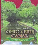
The Johnny Apple Seed of the Ohio & Erie Canal
Certain stories are subject to ALL RIGHTS RESERVED which will be acknowledged at the beginning of the story. No part of a specific story may be produced, stored in a retrieval system or transmitted in any form or by any means without written permission of the author except by a reviewer who may quote brief passages in a review to be printed in a newspaper, magazine or journal. Any stories which fall under the terms listed, are not to be used for cinematic purposes without permission.
The Johnny Apple Seed of the Ohio & Erie Canal
Sold in most book stores use this ISBN #1424128765
2,142 comments:
«Oldest ‹Older 801 – 1000 of 2142 Newer› Newest»982-The canal boat graveyard was situated dead smack in the middle of downtown Akron at the northern end of the Portage Summit. Akron had two basins to its credit which were the upper and lower. The lower basin was created with the coming of the P & O canal. The upper basin was a wide water section of the Ohio and Erie Canal. It extended south beyond Bowery St. ending at the guard lock. The lower basin was part of the Pennsylvania and Ohio Canal at its most western end. It sat at the low side level of lock one in Akron. From the O & E, it extended towards Main St. eastwardly. Its main body of water was south paralleling the upper basin. Today, it’s nonexistent and the only landmarks can be identified by the B.F.Goodrich complex, the Spaghetti Warehouse and YMCA that now occupy the former lower basin. The P & O canal tied into the lower basin and was used primarily as a holding pool for canal boats of both canal systems and a safe place to moor overnight as well. It was the lower basin which ended up as the canal boat graveyard and remained so for many years. How this came about stemmed from the failure of the P& O Canal. After its demise and years to follow, the abandoned canal boats in the Akron area were shoved into the lower basin where they had no more further use. For years on end, the canal boats lay half sunken and rotting. This became an eye sore and an embarrassment for those who were influential in Akron’s political arena. They had no idea what to do with all of them. The answer came when a mysterious fire consumed all of the remaining fleet moored in the lower basin. Although called an act of arson, there was no investigation or follow-up. No sooner had the fires been put out, the basin was being filled in. The land was then sold to B.F.Goodrich who increased his factory size, a relative of Nelson D.Rockerfeller. I have often heard that Summit Lake which sits only a few miles south of Akron on the mainline of the Ohio and Erie Canal, was the final resting place for scores of canal boats which were able to be towed from Akron to be sunk there. Canal boats were left to rot all over the canal from Cleveland to Portsmouth. We all know the stories of how they were deliberately sunk at Coshocton’s middle basin. I was told by a local resident of Muskingum County that the basins between Adams Mill and Dresden hold several sunken boats along with Nesmith Lake and the Portage Lakes. Cleveland had scores of old canal boat hulls just sitting abandoned and they were towed out onto Lake Erie to be sunk. Throughout the state these boats had be dealt with because they became a health hazard...
983-Hello canal enthusiast, did you know that in the early days of the canal here in Ohio, that a boat would have to wait at the lock until another was coming from the opposite direction to conserve water.
984-On the Miami and Erie Canal, Middletown had two canals, one was the mainline and the other was used as what?
985-Although the river changed its course in Massillon years after the canal went defunct, name the other canal towns which had river changes during the canal era on the Ohio and Erie Canal.
986-to 984
Middletown also had a hydraulic canal that provided water power to Middletowns many paper mills. It remained in use until the 1990's. Nearby communities in Hamilton & Miamisburg also had their own hydraulic canals. Hamiltons & Middletowns are still watered.
The Short-lived Warren County canal also junctioned with the Miami & Erie in Middletown.--W.A.Seed
987-to 985
I'll guess Peninsula, Chillicothe & maybe Clinton. Now a question for Trivia guy. Name a river on the Miami & Erie that had its route straightened during canal construction ?--W.A.Seed
988
987-I would guess the river made a substantial change near Toledo. The swift currents of the Maumee made it hazardous to navigate canal boats. The answer came when powers to be settled this on-going problem by cutting a channel to Toledo and Maumee, re-routing river traffic. Another guess might be when the deep cut was pushed through the St.Marys Moraine making a connection with the Auglaize River. By doing so, it re-routed a major waterway used as a feeder. Cincinnati had some extensive work done in the Mill Creek area to its north.
The river changes on the Ohio and Erie Canal were at Cleveland, Peninsula, Barberton, Clinton, Massillon, Chillicothe and Portsmouth.
989-
Trivia Guy,you are a gentleman & a scholar. I was referencing the course straightening of the St. Marys river within St. Marys when I posed that question. While the Maumee was used for a few miles of slackwater navigation at a few spots,it's actual course was not altered.The swift running currents were tamed by dams,much like that used in the Licking/Black Hand Gorge. The Mill Creek & its branches in Cincy paralelled the M& E & was crossed via agueduct twice but never had it's course changed until well after the canal era. In St.Marys,a wide loop of the St.Marys river was eliminated during canal construction so the canal wouldn't need to cross an expensive water wasteful aqueduct.
The Portsmouth alteration struck me after I'd answered your query. I was unaware of a Barberton re-route. Please elaborate on it when you get a chance.-- W.A.Seed
990- Mr. Seed, you are much too kind. Portsmouth initiated several course changes beginning by removing the vast delta at the confluence of the two rivers, then digging a more direct connection of the Scioto at the Ohio. Old maps clearly reveal the existence of the old river bed plus two former bends. Barberton’s section of the Tuscarawas River was much like the Missouri River which has miles of switchbacks. The Tuscarawas zigzagged all the way into Clinton. In order to establish the canal successfully, the river had to be straightened out in order to place the canal close by. By not doing so and leaving the bends as they were, a series of culverts and aqueducts would make several crossings, a costly endeavor. The old river bed is still very distinctly visible from Barberton to Clinton and can be gazed upon by driving down Van Buren Rd.
991- What do we have on the capture of John Hunt Morgan ?
992-Long ago, the north to south boundary of the United States was no more than 90 miles long, located here in Ohio, where was this border?
993 what was the greatist challenge when making the ohio and Erie canal?
994 to 993- That boundary would be the 80 miles from Bolivar to Cleveland. All the land west of the two rivers, those being the Tuscarawas and Cuyahoga, were given to the Indians as a result of the treaty of Fort McIntosh and later the Treaty of Greenville of 1795. It's hard to imagine that the western edge of our country was here in Ohio. When the treaties were written, they were carefully worded. In these treaties, the Cuyahoga and Tuscarawas Rivers were not ceded to the Indians. There was another national boundary. It ran from Fort Recovery south towards Brookville Indiana to the big river.
PART ONE OF TWO
995 In response to 991, the query was if I knew how or when John Hunt Morgan was captured. During July, 1863, Ohio was aroused again by Bragg’s command to Morgan, to raid Kentucky and capture Louisville. On the 3rd of July, he was in a position to invade Ohio, Indiana and Kentucky. He continued his depredation, bewildering the militia with his movements. His avowed intention was to burn Indianapolis and take Cincinnati alive. Morgan’s purposes were never clear. It was his audacious and sudden dashes here and there which gave him success. Before Cincinnati was aware, he was at Harrison the 13th of July. He expected to meet the forces of Burnside and Judah and to cut his way through. His plans here, as everywhere, were indefinable and he succeeded in deceiving everybody. While printers in Cincinnati were setting up reports as to his whereabouts, he was actually marching through the suburbs, near troops enough to devour them and yet not encountered by a single picket. They fed their horses within sight of Camp Dennison. At 4 o’clock that day, they were within 28 miles of Cincinnati – having marched more than 90 miles in 35 hours. The greatest chagrin was expressed, that Morgan had so easily eluded the great military forces. A sudden dash was made to follow him. There was a universal bolting of doors, barring of valuables, hiding of horses, etc…along the route of the mad cavalry man and his 2,000 mounted men. They plundered beyond all comparison. They made a principle of it. On the 14th of July, he was feeding his horses near Dennison. He reached the ford at Buffington Island on the evening of the 18th. He had encountered several little skirmishes but he had marched through at his own will. Mostly all the troops of Kentucky had been outwitted.
PART TWO OF TWO
995 – In response to 991. The Indiana forces have been laughed at and scorned. The 50,000 Ohio Militia has been as mere straws in his way. The intrepid band would soon be upon friendly soil, having a blackened trail behind them. But Judah was up and marching after him. The local militia in his advance began to impede the way. Near Pomeroy, a stand was made. Morgan found militia posted everywhere, but he succeeded in running the gauntlet, so far as to Chester. He should have hastened to cross the ford. Fortunately, he paused to breathe his horses and secure a guide. The hour and a half thus lost was his first mistake Morgan is known to have made in his military career. They reached Portland, and only a little earthwork guarded about 300 men, stood between him and safety. His men were exhausted, and he feared to lead them to a night attack upon a position he fully didn’t understand; he would not abandon his wagon train nor his wounded; he would save all or lose all. As Morgan was preparing the next morning, having found the earthworks deserted through the night, Judah came up. He repulsed the attack at first, capturing Judah’s adjutant general and ordering him to hold the force on his front in check. He was not able to joint his own company until it was in full retreat. Here, Lieutenant O’Neil of the Fifth Indiana, made an impulsive charge, the lines were reformed, and up to the Chester Rd. where Hobson’s gallant cavalry men, who had been galloping over three states to capture this very Morgan. And now, the tin-clad gunboats steamed up and open-fired on Morgan. The route was complete, but Morgan escaped with 1,200 men, 700 men were taken prisoner among them, Morgan’s brother, Colonel Ward, Duke and Huffman. The prisoners were brought to Cincinnati while the troops went after the fugitive Morgan and his renegade band. Morgan was surrounded by dangers; his men were exhausted, and were hunted like dogs. Skirmishes and thrilling escapes marked a series of methods to escape – his wonderful saga city absolutely brilliant to the very last – which was his capture on the 26th with 346 prisoners with 400 horses and arms. It may be added that after several months of confinement, Morgan and six prisoners, escaped on the 27th of November, 1863. Again, he assembled a large multitude and began raiding all over again. He again later was recaptured and spent time in the Ohio State Penitentiary before his release. This story was forwarded to me by an Ohio historian.
996-
Being from the Cincinnati metropolitan area, Morgans so-called confederate raid through Indiana & Ohio has been considered by local history buffs as nothing more noble than a looting expedition by a group of opportunisitic criminals, not real soldiers. Yes,their "raid" diverted troops from other military actions,but in the end accomplished nothing of importance.--W.A.Seed
997- I couldn't agree more with W.A.Seed. Morgan was a criminal and a bandit who fled in the dark of night. They were afraid to make a stand and fight it out like real soldiers do. We really shouldn't consider his tactics as early guerrilla warfare methods; they were cowards to say the least. Morgan should never be idolized but instead looked down on.
998- We had a great Indian fighter here in Ohio who hails from Prince William County, Virginia who fought alongside Daniel Boone and was thought of as being immortal by the Indians. We have a county seat named in his behalf. Who is this person?
999- to 998
I'll guess Simon Kenton, notable indian fighter & namesake to a northern Kentucky county.
To 997- Glad to see that Mr Maximovich & I agreed on something. Must be that great minds occasionally think alike-Just kidding--W.A.Seed
1000-
The seat of Hardin County named Kenton, was named in his honor.
Simon Kenton equaled Daniel Boone and this was proven in a shooting and axmen demonstration in Louisville, Kentucky. While each was impressed with the other’s abilities, both were well-known as great Indian fighters and played similar roles as frontiersmen throughout Kentucky, Michigan, Ohio and southeastern Indiana and the new frontier. After a bloody battle, as fate would have it, both Tecumseh and Kenton met as the only survivors on the battlefield in a standoff with neither of them striking the other. Instead, both warriors stood within feet of the other with tomahawk, ready to kill and stared into each other’s eyes, slowly backing away, never losing eye contact.
Kenton served as a scout against the Shawnee in 1774 in the conflict between Native Americans and European settlers, later labeled Dunmore’s war in 1777. He saved the life of his friend and fellow frontiersman, Daniel Boone at Boonesborough, Kentucky. The following year, Kenton was in turn rescued from torture and death by Simon Girty. During his capture, Kenton was taken to Chillicothe near Dayton where he was displayed and beaten near death. Barely alive, these beatings continued from village to village until Girty through an act of deception, rescued Kenton by convincing the Shawnee to let him have the pleasure of killing him rather than to have his warrior spirit roaming amidst them. With Kenton’s life hanging on a thread, Girty had taken him into Indiana where he eventually regained his strength. Kenton’s hatred intensified toward the Indians and again he went on a killing campaign. The Shawnee were convinced that Girty, who was a man of his word, had carried out the execution on Kenton. Girty betrayed his native brothers. Thought to be dead, Kenton reappeared, striking fear in the Indian nations of western Ohio who now feared him even more in spirit form. The Shawnee believed he could not be killed.
Simon Girty as a child was taken captive in Pennsylvania and adapted the Indian way of life. He could speak fluent Indian dialects and he was inducted into the Colonial Revolution against the militia and the Americans. Many have mixed feelings about his part in Colonel Crawford’s killing. Crawford was burned at the stake. Was Girty a participant or did he really plea for Crawford’s release to the point of threatening his own well-being? No one could really trust Girty because they weren’t sure where his loyalties lie. When Girty helped Kenton to safety, this changed the outlook of many who at first did not trust Girty. But after the burning of William Crawford years later, many deemed him a spy against the American forces.
1001- I read a previous posting where the contents make reference to Cleveland Ohio as being spelled Cleaveland. Can you verify that?
1002-Have you ever taken the time to research the Baltimore locks and the history of them?
1003
To 993-Certain sections of the Ohio and Erie Canal imposed far more backbreaking effort, interference and loss of time than anticipated not to mention an underestimation by the contractors who bid far too low and were unable to fulfill their obligations. Everyone has heard by now of the overwhelming amount of work and cost overruns to get through the deep cut section of the canal from Millersport going towards Baltimore, Ohio. We have another section very similar to the deep cut and that’s at Conesville where the canal leaves Rt.16 and follows State St. before it meets Township Rd. 483c. At this location, the canal sits deep in a ravine there. Just to examine this area, one can see the enormous amount of work performed. The southern end of Township Rd. 483c has numerous remains of former dockage and canal-related buildings. Each summit had an abundant water supply to keep the summits operational. Up north, we had the Portage Summit and in southern Ohio they had both the Old and New Reservoirs. Of the two, more planning was put into the construction process of the Portage Summit in comparison to Buckeye Lake. Both had dammed up reservoirs, but it was the Portage Summit which dammed up different streams of the Tuscarawas River creating several lakes and reservoirs - much more complex then the Buckeye Lake region. Talking about lakes, it was Summit Lake that put the construction at an absolute standstill when they decided to drain it down to standard canal level. By draining the lake, the wet shoreline was exposed – a shoreline of at least fifty yards wide of overgrown tamarack and roots and underwater plant life covering several miles. This caused an unforeseen deadly hazard. Thousands died as a result and the work stopped for some time. There was nothing easy about the digging of the Ohio and Erie or any canal here in Ohio or our neighboring states. Every aspect of this construction project, be it a lock, aqueduct or culvert, equated to a huge amount of work, and for thousands who succumbed during its construction – they would never know if it was ever completed. All of the above, although challenging, were not the greatest challenge. The workforce would be the greatest challenge to the completion of any canal construction. For many of them, they fell to sickness and disease and died. The greatest challenge wasn’t the staggering amount of digging or building. The greatest challenge was for the worker to stay alive through outbreaks of dysentery, cholera, blacktongue fever, the shakes (malaria), typhoid and even poison ivy that was inhaled through burning it. The canal was finished regardless of the loss of life. At the state house level, the loss was acceptable. The loss of life was basically unimportant, set on the back burner and no one really cared as long as the work was getting done. The whiskey was the catalyst which kept them working and on which they became dependant. The canal had to push forward at any cost. When the workers ran for their lives during epidemic outbreaks, as they fell one by one from killer diseases, the prisoners of Ohio were forced into the trenches to continue digging until they all died away. When the outbreaks would pass, the original diggers came back, but, usually with demands for more pay. One of the biggest challenges was to keep the men on the job.
1004-Looking at a Google view of the Summit Lake region distinctively outlines the former size of the body of water before its drainage. I can make out two service canals going east, being unfamiliar with Akron where are those channels going.
February 24, 2009 4:55 AM
1005
To 1004-Summit Lake was much larger then, but we really don’t know for sure of its former size. Google Earth gives us the opportunity to view areas from far above, and it alone can save a lot of investigation. There is no doubt that Summit Lake reached far to the south beyond Wilbeth Rd. The lake was drained reducing its level by 7 to 10 feet to match the level of the Ohio and Erie Canal. Even today, the former lake has leftover swamp and marshland that runs east of the former canal between Manchester Rd. and Main St. with Wilbeth Rd. to the north and Rt.224 to its west. This square area has hundreds of acres of wasteland and swamp that’s never been developed. I strongly feel that the swamps were the southern end of the lake. What we know of Summit Lake, it probably looks somewhat the same now as before it was drained down. The landscape around Summit Lake has steep hills (Kenmore) on its west and bluffs to the east. It’s evident that the lake lied further north as well and ended at high hills and bluffs as well. That alone kept the lake close to its original layout just a little thinner and not as deep.
The canals that you can see from Google Earth were service channels from the canal into Firestone where canal boats delivered coal. Those two channels were actually once a loop off of the canal that had docks and wharfs at Firestone. I was emailed earlier from an enthusiast who stated that the channels were water intakes and discharge channels used to cool the rubber within Firestone. That sounds convincing except there are designated intake channels into Firestone which are not canals. I went back in there and those channels are the standard canal width and were navigable by design. I can’t say whether Harvey Firestone shipped by canal, it’s possible. I’d be certain that raw materials were brought in by canal, that’s why Firestone built along the canal, it being a major transportation route and an adequate water supply for industrial usage. The swampy area just discussed holds many secrets; it has a few canal-width channels without explanation. We had someone post to this site last year who played in an old boat out in the swamps behind Main St. back in the 1950s. He thinks it was a canal boat. That could very well be true.
It’s hard to say if tires moved by canal boat after the tire operation went full swing by 1904. Around the same time, Firestone also created the “Ship by Truck” campaign, encouraging manufacturers to move their products to markets by truck. In fact, the very first coast-to-coast truck shipment of goods traveled on Firestone tires
1006- The Simon Kenton posting was fairly accurate, but as a wanna-be historian, I can always find debate. We have an island now covered by the Ohio River near the falls of Louisville, do we remember its name? Which Kentucky city referred to its population as villains?
1007-
1-Did you know that a counterfeiting operation operated on the most northern end of the Ohio & Erie Canal?
2-Which part of Akron along the canal was nicknamed the "Gore"?
1008
To 1001-Just after the Treaty of Greenville, General Moses Cleaveland led a surveying party deep into the Connecticut Western Reserve. His intentions were to lay aside land representing the Connecticut Land Company in hope to secure quality lands with private and wealthy speculators in mind. His surveys had limitations previously set by the statutes of the Greenville Treaty. The Cuyahoga River was the boundary dividing America from the Indian nations and the land to its west was under tribal ownership. The original surveyors plat list Cleveland as "Cleaveland" in honor of General Moses Cleaveland.
1009
To 1006-Corn Island is a now-vanished 7-acre island in the Ohio River, at head of the Falls of the Ohio, just north of Louisville, Kentucky. Heavy excavation of rock for cement was done in the 19th century, and the island was flooded by the construction of a dam in the 1920s. It now lies permanently underwater.
Corn Island was first surveyed in 1773 by Thomas Bullitt's party and called Dunmore's Island (after John Murray, 4th Earl of Dunmore, Crown Governor of Virginia). Surveying expeditions like this helped to provoke Dunmore's War the following year.
During the American Revolutionary War, the island was settled on May 27, 1778 by George Rogers Clark's militia and 60 civilian settlers, who remained behind when Clark's party departed on June 24. Clark established the farming colony on the island as a communication post to support his famous military campaign in the Illinois Country.[1]
The island was renamed Corn Island by Clark, presumably reflecting the early importance of farming. The agricultural name also might have helped further the ruse that it was intended purely as a farming settlement, and not a military post. The settlers remained long after Clark's campaign ended. They moved to the mainland the following year, establishing Louisville. Louisville traces its foundation in 1778 to the settlement on Corn Island. The island continued to be used for farming and hunting until it was submerged.
1010-Baltimore, Ohio’s lock 5 was a busy place to be during the canal era. Located at canal mile 196 in Fairfield County, its official name was actually called Dry Dock. Thought by some to be the busiest dry dock on the system - that is up for debate with the rather larger boat building and repair industries throughout Summit, Stark and Tuscarawas Counties that handled substantially more canal boat traffic. Lock 5 was the first of several locks in the Baltimore line-up ending in Basil’s Bibler lock number 8 on the far side of Baltimore. Lock 5 housed a double drydock facility directly west of the lock chamber with a general store which sat directly east with only a narrow towpath between the two. Both the store and dry dock were at about the halfway point of the lock chamber for reference. A feeder race entered just below lock 5 coming from the north as part of Fur creek. This run also connected with Short Level lock 4 and lock 3 Norris Mill further up the canal. Paw Paw Creek came down from the north and passed below the Toledo & Central Ohio RR and up the canal, crossed below it as well. At that point, there is a lot of stonework that was part of the abutments of the crossing lying in Paw Paw Creek. This lock can still be viewed by climbing down off Canal Road where the road bends sharply right beyond the railroad tracks into Baltimore and head west by slightly north. It’s north of the railroad. Another easier way to find these remains is to locate Lock St. which dead ends to the former site. Baltimore had a single dry dock located between locks 6 and 7 on the immediate other side of the Baltimore & Somerset Turnpike Rd 256. next to the bed and breakfast that’s now there. During the late canal era, the single dock was purchased only to be closed by the owner of the larger dry dock to eliminate competition. Business was so slow by then and the canal had already succumbed to a steady decline with the railways being established. Dry dock 5 was slowing down going into the 1880s with boats few and far between. Going into the last quarter of the 19th century, most canal boats were better than 50 years old and rotted away by a half a century of sitting in water. Along the entire length of the Ohio and Erie, there was never the ability to remove the boats for the winter months and dock them on dry land. That alone split the seams and the ice crushed the hulls; thus, severely weakening the whole craft.
I have been over this area a time or two. These observations recently backed up earlier findings from 2005. Going back in during this time of year gives a better and clearer view, but it’s still difficult to identify its layout. A hundred and twenty years of forest plant life has swallowed the past. The lock itself is the only really distinguishable site. Being so overwhelmed by growth, it became apparent that the only way to make good determinations of the land’s layout is to walk it and feel for it. This historical site also reveals the remains of some type of water run or creek that entered the basin at its most western point. I have pictures of this place from a hundred and twenty years ago and it was a bustling community with wide-open fields with manicured farms and businesses. Those pictures were during the decline of the southern end of the Ohio and Erie Canal; I can only imagine how it was during its hey-day. There were sawmills, icehouses and homes in the immediate vicinity of this lock. Lock 5 was once a busy business center with wharfs and docks lining its basin but all withered away when technology arrived, namely the trains. The railway brought so much more than the canal had ever offered; it brought communication into Baltimore, Ohio as well as the invention of the telegraph in 1843. Initially, the telegraph was situated at the train depot and in time at the post office and the law had their own. Baltimore then had the ability to contact the outside world directly without the long wait of the postal service or any word that trickled down the canal. Secondhand information became a thing of the past.
I will soon answer the request to cover the other locks 6, 7 and 8. Then, I’ll be giving an overview of the importance of Baltimore and the role it played during the canal era.
1011-While sitting in the doorway of his home on the western bank of the Cuyahoga River near Boston Bridge, a young man named James Brown was struck by a bolt of lightning during a violent electrical storm. His clothing was ripped clean from his body as he lay smoldering, alive but unconscious. After a lengthy recovery, he often boasted that no living man could throw him to the ground as quickly as the Lord almighty had done. He claimed that not a man alive could take him at fisticuffs as well. Many tried and his popularity eventually grew up and down the canal after its arrival. A small community began growing around Brown. He soon opened an inn and mercantile store in Boston Village. Brown was a sly, devilish type as well as a gentleman. Brown had a hidden enterprise buried deep in the hills of North Hampton Village. His general appearance portrayed an upstanding businessman of wealth with a multitude of different interests and who was either liked or disliked as an entrepreneur. It would seem as if overnight, Brown was the wealthiest man in northern Ohio. This unexpected wealth was a result of his primary operation tucked away in the hollers and rolling hills along the Cuyahoga River. His mercantile and inn was a cover-up for his primary operation which was engineering a well-oiled machine making counterfeit money. His moneymaking scheme grew immensely during the 1820s and no one stood in his way because he had the law on his payroll. His other forms of wealth were derived by the network of distilleries operating to full capacity near the canal locks of the Ohio Canal. Brown’s operations and taverns were a mere stone’s throw from the canal, usually off in the woods. These places were popular amidst the crewmen which included every illicit activity known to man including prostitution. Brown moved his goods from the canal’s edge and the Kettlewell and its neighboring locks where he had an interest there. His associates were Brother Daniel who was thought to be extremely handsome, popular with the ladies, was well-mannered and who dressed like a prince. His army of crooked soldiers included the local sheriff and deputies and in his ranks were some very prominent people including Sir William Latta of Bath, another man of unending wealth who looked the part of a king, always in the best wears imported from England and France. The other lieutenants were William G.Taylor of Cleveland; Abraham S.Holmes and Colonel William Ashley of Boston who were millionaires as a result of the James Brown enterprise. Other names were Jonathan D.Courcey and Thomas Johnson of Norton who became known with his operations at Johnsons Corners on Hudson Run, also a cover up, and Joshua King along with Joel Keeter of Portage County. These men were involved in the first known crime syndicate family within Ohio’s boundaries, all led by their leader, James Brown. Hidden away in the deep hills of North Hampton, their printing apparatus was being operated by an army of his workers. To give away this operation and whereabouts was certain death to the worker and his entire family. Brown was a pleasant man on the outside, but a ruthless killer who floated many bodies down the Cuyahoga and who also dotted the North Hampton hills with bodies of those who crossed him and killed any competition by gruesome means. Both brothers never made an appearance at the counterfeiting operation and left that up to the subordinates who worked below them - they never touched the bogus money themselves. They were clearly masterminds of the underworld ways of doing business. The North Hampton hills and gullies afforded ample protection and seclusion for this type of endeavor. Agents worked the farms and villages hoping to find and sell to these poor individuals, they being in the field or tavern. The sales pitch was irresistible and the agent filled their heads with the answer to all things. Prosperity they had always dreamed of was within grasp, and for meager pennies on the dollar, he could obtain perfect counterfeit exchange and it worked. One of the best ways for the enterprise to get rich was to rely on the stupidity and greed of others as mentioned above. For instance, one of his agents would take a man eager to be wealthy (usually a poor farmer who was scraping to get by) into a hideout blind-folded. Once there, were casks hidden below some straw or perhaps under a floor board which were filled with silver pieces. The agent offered it at 20 cents on the dollar on this one time chance only. The unsuspecting buyer was amazed by the perfect silver after digging out a handful for inspection. The buyer then swiftly handed his money over to the agent and off he went with his cask of money and new-found fortune. Once at home with the contents emptied, the buyer soon found further despair by learning that only a few pieces of silver were on top and the rest was just plain old stones and lead. Now the buyer is stuck with a barrel of heart break. Although angry, his hands were tied as he was breaking the law himself. He could not report this to the local authorities and had to absorb his loss. Spawn out of embarrassment, the farmer kept his ignorance bottled up inside. That alone allowed this scam to continue on. Those who attempted to get even, just simply vanished. The neighboring villages became flooded with counterfeit exchange, be it silver or banknotes. The banknotes on the other hand, were no more than a poorly counterfeited bill printed on paper that disintegrated when wet and the color soaked through the user’s pants. That situation in itself, became a laughing stock with many having red stains on there hands. This money became well-known as red money along the canal and was useless. James Brown’s operation was so powerful and feared, he was left alone. After a time, only the unsuspecting outsider fell prey for those in the nearby communities were well aware of these schemes, by then going into the 1830s. His whiskey operation outlived him and his brother by nearly a century. The hills along the canal and Northhampton boiled corn mash, making rot gut whiskey into the prohibition beginning in 1919 where they really started producing the brew. The money flowed in from Akron but mainly Cleveland. The whiskey was produced in large quantities back in the hills of North Hampton, then was floated on flat barges into the flats, the warehouse district of Cleveland. The 18th amendment had loop holes and they were exploited to their fullest. Whiskey was warehoused out on the lake just beyond the 3 mile limit considered a safe zone in Lake Erie on ships sitting off Cleveland. This was the biggest loop hole in the prohibition law and as in Chicago and New York, the brew was sitting at sea or ports within reach, only three miles away. This created a deadly situation for those who began transporting whiskey from Canada. The great lakes became a war zone during prohibition and Canadian ships were hijacked and boarded with many casualties, with bodies washing up on American shores as a result of piracy. The mobsters in New York and Chicago had great armed armadas watching their whiskey supplies. All that began slowing when the law was repealed by 1933 with the 21st amendment and eventually disappeared, but the distilleries were running at full capacity in the deep hills of North Hampton and through Ohio’s hilly and mountainous country as well as Kentucky and Tennessee. Cleveland mobsters destroyed state-owned liquor stores and the police dept. was in on the action - on the payroll. Trucks hauling legal alcohol were being burned and the drivers were murdered. Elliot Ness was then dispatched to Cleveland working under the government’s Alcohol Tax Unit and his job was to clear the hills of Ohio and the other states just mentioned. The project was called the “Moonshine Mountains”. Cleveland’s Mayor Harold Burton later hired Ness as the new City Law Director to clean up the corruption within the police dept. Ness had taken on more than he could handle. His own department unfolded a conspiracy against the new law director to destroy him and his reputation. Cleveland already had an established crime syndicate with long ties and deep pockets. They intentionally kept Ness busy with a string of murders and other matters which kept him from focusing on the real cause for being there which was to clean up the department and stay focused on the revenue issues. The Cleveland police department hung Ness out to dry by arresting him for driving intoxicated and accusing him of other law-breaking incidents. It was the mobsters of Cleveland with the hierarchy of the judicial system who put down Elliot Ness.
1012--Taverns were springing up along the canal. Young men, their arms made strong by the swinging of axes, left the clearing and the timber to follow the lure of the canal. The gentlemen in fortune in their fine linens and cambric’s sat in the taverns and invited the admiration of more prosaic men and women. Their pockets were full of bogus money made in the hills of North Hampton, and mingled with this was the currency of duped farmers.
I familiarize myself with our states history. James Brown, of North Hampton in the storyline of counterfeiting along the canal, hailed from Tallmadge, Ohio originally.
After studying posting 1011, its contents really tell what clearly happened to Elliot Ness. Mr. Ness, was among strangers in Cleveland, the corruption was too well established to be taken down.
1013- In regards to-1007 –In the specific area of North St., Summit St., Oak and Walnut Sts., and Quarry and Bowery and West Center Sts., they touched the northern limits of Akron at Center St., this had left a wedge shaped piece of neutral ground resembling a triangle.
A century ago, you would have heard the old timers refer to that part of downtown Akron as the “Gore”. Our dictionary claims this word to relate to a triangular piece of garment, but in the case where it's referring of Akron, it meant a piece of ground. This land was situated between Cascade Village and a hamlet called Akron.
1014- I recently received a posting from a member of an enthusiast group who had taken advantage of our nice weather and walked the last two most northern miles of the former Ohio and Erie Canal. The party was made up of five men and two women. They began their journey just off of Rockefeller Ave. where Central Furnace Dr. connects to Central Furnace Court. Ironically, Central Furnace Ct. was the former towpath of the Ohio and Erie Canal. This group who set out on a day of fun, adventure and discovery soon had a change of heart when passing by the oldest and most dangerous section of Cleveland. I nicknamed this section of the former canal bed which later was the Valley Railroad (Despair Alley). My personal experiences along this last couple of miles leading into the flats will remain within me an ugly picture of those who are less fortunate and will survive by any means at their disposal. Perhaps I should have relayed just how bad things had gotten that morning as I started out for Portsmouth. By doing so may have been enough warning for those who are thinking about trekking this ground to stay out. People live along those tracks who have nothing left, and according to the Cleveland Police Dept., generally are running from the law. The tracks are abandoned and have been without railroad policing for half a century and there are no access roads for police patrols. The police said that they keep out of there and would rather attempt to apprehend them in town as they slide into town after the sun goes down. They will usually find them digging in a dumpster behind some restaurant near the river or panhandling. These people live under the Nickel Plate Bridge and in and under abandoned buildings which are plentiful along the tracks that were in use a hundred years ago.
I was alone when I went through that early May morning just past 6am. The sun was just coming up and they saw me long before I did them. They were all standing around a smoldering barrel. It looked like a scene out of the New York gang-related movies where they surround you. I was certainly outnumbered and nervous beyond belief. This was the time of morning they were returning from their life of stealing and crime through the city of Cleveland. After some thought about the whole thing, it was like they were returning home from work and it was time to turn in and go to sleep. They were determined to rob me and the circle began to close in. That’s when I showed the use of force and it was then that they backed off. I could here them hollering and yelling things from below the trestle as bottles were being thrown and busting all around me. One man stood out who was up on a hillside with a club, swinging it violently, screaming obscenities. He was trying keep my attention while another tried getting me from behind by a sneak assault with a block. There is no doubt in my mind that killing me and stripping me of my belongings would not have bothered any of them. I recommend staying out of there. There is nothing to see that’s even remotely canal- related left to view. Akron has the same scenario around locks 2 & 3 where dozens are often lying about just waiting for the right opportunity to strike.
1015- Where is the most difficult place to trac the former canal bed on the O&E ?
1016
To 1015- One of the most difficult sections to track came to light when I was looking for the towpath in Fairfield County. I was soon at a standstill as I moved from Bibler Lock 8 in Basil heading towards Havensport and then on to Carroll. I was out there for three days trying to figure out where the towpath had gone. From Basil at canal mile 197 to Carroll at mile 205, it is about 8 miles. About a ¼ of this distance has somewhat of a distinguishable canal bed. The canal bed reaches close to Leonard Rd. NW which was the site of the old Leonard’s bridge. Anything beyond that county road is a puzzle of farm land that’s broken up into different crops with sections of the canal bed tucked away in the tree line that appears as fast as it disappears and then fades away the nearer you get to Havensport. Havensport is 2/3rds the distance to Carroll from Basil. Bader Rd. and Pleasantville Rds marks the area where the former canal bed leaves a slight impression in the earth where the slight scratch in the ground almost materializes into a canal bed and runs into Havensport paralleling Canal Drive there. After leaving Havensport, the canal vanishes until you relocate it again west of Coakley Rd. about a mile north of Carroll Eastern Rd. Carroll Eastern Rd. follows the former towpath into Carroll. I had a very difficult time tracing the towpath back in 2004. Once completed, I plotted the course for my walk that played out the following year.
1017-Carroll as with other southern canal towns, was a master at covering up the past history of the Ohio and Erie Canal. Carroll was the hub of activity as Akron was. It was the connection to another canal system. The same was for Bolivar, Ohio where the Sandy and Beaver connected Pa. In Carroll, the basin laid in the area between West Canal Rd., Lock St. and Mill St. Lock 9 had a saloon conveniently on the towpath directly next to the lock. A mill race existed from the lower end of lock 9 and powered a grist mill with its tail race reentering the canal below lock 10. A toll station was at the connection to the Hocking Canal and today to find a trace of any of it is nearly impossible. From the connection point of the Hocking Canal, it took a direct southerly course following the Carroll Southern Rd. where hardly a trace exists of the former canal. The Ohio and Erie Canal turned westerly and crossed Oberly Rd. then passed over Kistle Run where it gets totally confusing in the wooded area between Kistle Run and Rt.33. There is some block work lying around. Once across 33, the canal is barely distinguishable, heading a sharp northwesterly course until you reach Hummel Rd. where it’s in good shape all the way into Lockville up to Pickerington Rd.
1018
To 1017-
I'd nominate the canal prism (or lack of)between Lock 16,17 & Lock 18 (Creek) south of Lockville as one of the roughest to follow. I damn near broke my neck hiking through that terrain & it's only approx 1/3 mile.
I'll agree w/Mr.Maximovich that the short section between Lock 6 & 5 in Baltimore, & #8Biblers to the Walnut Creek aqueduct were unexpectedly confusing too.-- W.A.Seed
1018- It seems that diggging the canal from Cleveland to the Ohio River could have been by-passed in part by just using the main rivers for canal boat navigation.
1020 The logical reasoning behind canals was a necessity rather than making use of the nearby by rivers that are prone to current inconsistencies. River travel was repeatedly tried with a high rate of failure on the smaller internal rivers. Many canal systems incorporated the adjacent rivers for travel, by doing so they adopted the inherited problems that comes with them thus making passage difficult and inconsistent. Canals are more immune to weather conditions by manually controlling the intake needed to float a boat. Rivers are prone to rise and fall and dams weren’t guaranteed to hold in those days.
1021- As W.A. Seed has stated where he nearly broke his neck trying to track the canal in Lockville, I can believe it. After leaving Lock 16, Rover/Short Level by name at canal mile 207, only maybe at most a half a mile, separates you from the next lock, by name called Swimmer or Swimer. I guess that depends who you talk too. The canal bed disappears immediately once you leave the confines of the lock chamber 16 and its anybody’s guess where the canal bed is at. This part of the former canal is extremely hard to manage with the growth that has taken hold over the years. As I once stated in my book, you have to actually plow your way and it’s totally exhausting work by the day’s end. I would be certain that Mr. Seed’s vision was blocked by the vines and vegetation. It’s hard to walk and keep balance when branches, logs, and blocks are hidden from view and those who track as I do have landed flat on their face more than once. For those who wish to locate locks 17 & 18 in Lockville, here’s a good way to do so. If you have a compass and you’re at lock 16 – the one at the bend on Pickerington Rd., head out on a northwesterly course of 315° and you’ll soon enough find the canal bed or crosscut due west and you’ll end up in a soybean field. Once at the field, walk its edge and soon enough you will walk up on an easement in the tree line where you can cut to the right and enter another field. Walk into the easement and look right and there’s lock 17. Finding 18 will require the same maneuvers by walking the field’s edge quite a ways until you hit a northeasterly row of trees. Where these trees meet the edge of the field you’re walking along, lock 18 is to your right. Another way would be as you are leaving lock 17, stay on the canal bed and it will take you to it. Back in 2005, I found an old pair of boots in there and the rusted remains of some type of stove and hundreds of rusted cans, a lantern and some type of jug that is in my home today. Lock 18 sits at Walnut Creek. If you look around, you’ll see some old timbers still driven into the river’s bottom and across the waterway is the remains of the guard lock. The side you’re on has blocks lying below you that made up the western side, now in the water. Downstream was once the location of the Walnut Creek dam which backed up the water for the crossing at lock 18. To get a better look at the opposite side, just get back on Pickerington Rd and head straight north, then west on Benadum Rd., then straight south on Amanda Northern Rd. where it ends. There will be a home on the right near the site of the former guard lock. It’s on both sides of the road with only a course of block visible in their yard. On the creek, the lock’s in fairly good condition.
While in Lockville, we’ll backtrack a bit. Lock 15 named the Short Level /Fickle Mill has part of the chamber wall washed out by Hog Run that’s changed course over the years. The towpath was on the western side of the canal from lock 13 to lock 18 in the Lockville area. The towpath was on the opposite side from Havensport to lock 12 where a change bridge was located switching sides because the basins were east of the canal. The only way to Lockville’s other side was at the cross-over at each lock and the Pickerington Bridge at the great bend in the road. The former bridge sits in the water below in Walnut Creek in a perfect line as it fell near the newer bridge.
1022- I have three topics to discuss. (1) You have an aerial view of Newcomerstown at the time of the 1913 flood, how is that possible without aircraft then. (2) Mulnix Mills of Baltimore, would you say that your picture is totally accurate as to the locks former position? Lock 10 Creek outside of Lockville has some difference of opinions from researcher to researcher. I hold in front of me now a hand illustrated picture of the former layout of lock, dam and guard lock. This illustration has the dam upstream, is this correct?
1023
To 1022- About the aerial picture of Newcomerstown, well that had me a bit confused as well as the lack of aircraft then. Newcomerstown had a park perched high above town to its west and that’s where the pictures were taken. Just west of town, and barely beyond Buckhorn Creek, a huge bolder sits slightly north of Canal Rd. past the steel bridge. This huge rock was once part of the rock formations above town at this park. Supposedly up top is the carved face of an Indian. Through time, it split away and ended up where it rests now directly next to a home on Park hill Dr. There’s and old road leading up to the top that has remnants of an old stone wall built in the 1850s. Park Hill was its name and from it you could view the canal and countryside as far east as Port Washington and Gnadenhutten. Today, a water tower sits on top.
The lock location of lock 6, Mulnix Mills in Baltimore, is fairly close to where the water tower and transmission shop exists today as my pictures portray. I was given that location by the town’s canal historian. After a further hands-on review on Mulnix Mills, I feel as if the lock chamber was about 200 yards to the northeast along the eastern side of West Water St. The Mulnix Mills warehouses sat below the water tower. Today, a small water run connecting to Paw Paw Creek flows below W. Water St. marking where the end of the Baltimore Basin once existed. A smaller industrial basin was between the lock and warehouses and if present today would partially border W. Washington St. The basins both big and small, can be easily distinguished by the elevated ground still in the proximity. Along W. Water St. nearer to Paw Paw Creek are still some block remains about.
The Little Walnut Creek enters the Scioto River about 5 miles southwest of South Bloomfield west of SR.23. The water flows basically west by a southerly course into the big river. Anybody who knows Walnut Creek is quite aware that it moves in all directions with extreme “S” curves and switchbacks but ultimately heads southwest. I located the picture in question that was a hand drawn picture by a local canal historian and compared it with something slightly more official. The picture has the dam above the slackwater crossing when it should be below it. If you turn that picture upside down and flip the print, it would be more accurate.
1024- Canalwayman and would you be more explisit about Creek Lock number 18 and give a better synopsis by digging into the particulars of this crossing at walnut Creek. I have everything on hand by everyknown canal historian and I fail to see where a discrepancy exist in our Central Ohio authors publication. Should we have a look at your book instead.? That diagram it factual!
1025
To 1024- The dam at Walnut Creek near Lockville is south or downstream from Lock 18. I'm not familiar with the local historians diagram but I'm sure it was an honest mistake on his part. The remnants of this cut stone dam & its abutments are clearly visible a few 100 yards south of the slackwater crossing. The abutments of a covered bridge are just a short distance south of the dam ruins.
On a side note to 1024. Use a spell check & make sure you write in proper grammar b-4 composing your next angry blog entry.--W.A.Seed
1026-Canalwayman. There’s not a single publication without error. Redundancy in pointing out other’s typos or simple mishaps can get tiresome. As an avid reader on Ohio’s historical beginnings, it’s up to the individual to formulate his or her own opinions. Bashing this site is unproductive and leads into a gray area of misconception or doubt that spills over into confusion for some. The beauty of writing is that it creates self opinion and the right to express how you individually see things. Knowing all to well that everyone will not agree with your findings or of those who take a chance by putting their own thoughts out for the world to review is courageous. Why do we take the time to research so stringently and set aside time in our lives to record our historical beginnings? It’s a passion that you and others want to share with everyone who has the same interest. We depend on researchers to widen our knowledge and that is why they buy our books.
Author, historian
1027- I stand totally confused on the Creek lock and state dam ordeal being discussed here. I was always under the impression the state dam was below the slack water dam downstream of the crossing. My intentions are not to put author against author and I hold the highest respect for all of you. We have a well written publication that centers on life along the Ohio and Erie Canal from Buckeye Lake to Columbus. These words as follows shine a whole new light on the dam’s approximate location near Lockville’s lock 18. “The dam worked fairly well in slowing the creeks rushing water during spring freshets. The water would rush over the top of the dam and down into the slack water carrying all types of debris with it”. I think that indicates that perhaps another dam was in the immediate area and you researchers have thru neglect overlooked this substantial fact. This goes out to W.A.Seed, or excuse me is that Professor Seed, I don’t need to refresh my grammar and who’s displaying ignorance by saying (B4) rather than using (before) properly.
1028- Responding to listing 1027.
You are a very ignorant person whom is clearly mixed up emotionally. Your remittance to this site cannot stay true to course. You start off well then the ugliness appears soon enough exploiting a devious dark side. Have we no life except to harass those who bring something good and honest into our homes?
1029-I spent the afternoon yesterday in Lockville and the landscape yet reveals the past. From what I have gone over and over, only one dam existed near lock 18. I strongly feel as if an aqueduct was the method used originally and later came the slackwater pool to cross over the Little Walnut. I found two areas where it had wide abutments of better than 150 feet that separated them. One was the dam and the other was the covered bridge that carried “War Road” over the Little Walnut.
1031
I think I can speak for the majority of readers of this blog & say that the previous entry is unacceptable. If anyone has a disagreement with the subject matter, hash it out in a civil manner.
To Mr. Maximovich- Since you commuted down to Lockville,did you swing into Newark & check out the recently unearthed Lock 9? It's my understanding that it'll be reassembled.== Professor W.A.Seed
1032-There is always someone out there who can’t practice self-control. We have several who often watch this site and that type of language is uncalled for. I had better than 20 emails with people who were very displeased with the posting in question.
I think that Professor W.A. Seed has a great ring to it. I bypassed Newark by using the I77 south and I70 west route jumping off at Rt.158 into Baltimore. Next month, a couple of us are going back into the Black Hand and will make a point of gazing upon lock 9, Second Lockport. I made sure to get some good pictures of what was left of the former lock but paid the price by being consumed with poison ivy.
I was appalled by the earlier posting. Those without integrity have nothing!!
1033- We have a canal culvert here in Ohio that once carried the Miami and Erie Canal. It was converted into a roadway bridge. Do we know its whereabouts?
1034
T0 1033- I can think of at least 12 canal era culverts on the M&E that now serve as road bridges.
(1) in Butler,(2) in Paulding ,& another one in Defiance county sit under seldom used township roads. There are (8) stone arched culverts in Henry County that sit under heavily traveled US424 & US24. These are located between Independence & Providence/Grand Rapids. In Lucas county,the northbound lane of the Anthony Wayne trail utilizes aqueduct abutments at one site to take commuters into Toledo.--W.A.Seed
1035-
I have a correction to make to the previous entry. There are 3, possibly 4 stone arched culverts serving as road bridges in Defiance county. They are located under T-153, Cromley Road, and Canal Road by the landfill. A 4th possible is behind the Big Cheif (i think) grocery store. A modern concrete box extension from it runs under SR111. Its western porthole is stone.
The other correction is that US 424 in Henry county is actually SR-424.--- W.A.Seed
1036
To 1035 & 1034. That was quite a response and truly informative. The Oberhauser Creek Culvert on U.S. Highway 24 would have been sufficient. Nice work Professor.
We have only two of such on the Ohio & Erie system where the road uses a former culvert does anyone know the whereabouts?
1037
to 1036
I can think of 3 or 4 culverts on the O&E used that way. There's one just north of Akron (I think Yellow Creek). The Rocky Fork Culvert near Black Hand once had a road on top. Wilsons Run culvert in Omega. Ganderhook culvert below Jasper has a modern box culvert above it but the eastern stone arch can still be seen when the Scioto is low. The west side is buried.-- W.A.Seed
1037 to 1036- I think the areas where a culvert transposed as a road on the Ohio Canal would be limited to three places. Yellow Creek, Nimisila Creek and Frey's Culverts are most likely the candidates to complete the answer.
1038-Oldtown Creek Cult at mile 99, Buckhorn Creek Culvert at mile 120, Blue Ridge Culvert at mile 121, White Eyes Creek Culvert at mile 126, Paddy's Fork Culvert at mile 155, Wakatomika Creek Culvert at mile 156,Indian Creek Culvert at mile 262 some of these have been removed and a new roadway was built. Maybe this answer doesn't qualify.
1039-Responding to both 1037 and 1038. Of the two captions presented above, I believe that only two culverts fit the bill and they’re Yellow Creek and Blue Ridge culverts. Yellow Creek is now in use on Riverview Rd. in northern Ohio and Blue Ridge sit at the intersection of Oh. 36, and Cr. 751, to the northwest of Newcomerstown .
1039
To 1037-
I know Yellow Creek is still extant & qualifies. Nimisla is a corrugated steel pipe & I didn't think it dated to the canal era. Where is the Freys creek structure?
To 1038- I've personally verified that none of the culverts you've listed still exist except for the Indian Creek structure. Where was that sited near?
I did remember another (very small) stone culvert beneath a road. It's located in Coshocton county & is located below Township road 105.-- W.A.Seed
1040 Responding to 1037. Mr.Seed how would I locate this sight? I canvassed the area thoroughly and I never have run into this as you mentioned.
1041-Indian Creek Culvert lies on the bend of Three Locks Rd. north of the Tomlinson 41,42,43 lock site.
1042-
To 1040- The fellow I was exploring with a couple of April's ago said that this small culvert had been mentioned in a old CSO tour book. We drove slowly down T-105 until we saw water on both sides of the lane. It's a grassy area with easy,but wet access to both ends. The S.E.side is close to the road & very swampy. The N.W. side is a dood 30-40' from the road. Go when the weather has been rainfree for awhile.
We also looked for the Blue Ridge structure that day but found nothing (that looked canal era) near that intersection. W.A.Seed
1043
To 1041- I've stopped at every stream crossing on 3 Locks north of the locks & found nothing standing. Don't think the stone used in that area really held up very well.----W.A.Seed
1044-
The boaters were in a constant conflict over shipping rates and made a stand at Falls Mills in 1847, from it they found little relief. The coal mines on the Lancaster Lateral were running full capacity going into the 1850s, but the boaters were becoming reluctant to ship. The mine owners band together and formed an alliance and locked in rates. In retaliation, the boaters docked in Carroll Basin numbering in the dozens as the coals was sitting idle at the mines. Soon enough there was no-where else to stack the coal and the mines began to slow-down. Cleveland’s Mills quickly re-assigned their contracts to other mines and began buying coal along the mines in Tuscarawas County. Over one hundred boats lined the canal near Logan and they became desperate to ship the coal as the mines were to move it. But hard nose politics on both sides hurt both the coal shippers and haulers alike. The strike lasted over a month and the mines along the lateral ended up loosing much of the market up north. It was a no-win situation for all those who were involved. Some owners took the chance and loaded regardless, that resorted to violence; they were boarded and severely dealt with.
1045--A story that's inline with caption 1044 is that in the 1840s the boaters were occasionally perturbed by the steadfast established rates that did not conform to their request for better rates. From Lockville a boat owner operator whose name was Lewis Graig headed up the strike which inevitably was a big waist of time for both sides. There was a historic strike where the boats blocked all traffic coming and going on the Hocking Valley Canal at Logan. This strike lasted almost two months and the contracts were seized by central and southern Ohio mines mostly from Clinton to Canal Dover who began providing a lower grade coal to the northern foundries but, in abundance the price worked well for the shippers and boat haulers alike. The ease between both sides erupted again in 1852 when coal began arriving from Pennsylvania. In years prior the boats along our Ohio Canal lay moored often until the rates increased, it happened often throughout the Tuscarawas valley's coal mines. It was always a tumultuous situation over shipping rates and it all came to an abrupt end with the (B &O) Railroads arrival
1046- We visited Deep Lock Quarry in Summit County today and I'm puzzled as to how the boats got into the quarry.
1047 responding to 1046-Deep Lock Quarry was one of many quarries along the Ohio and Erie Canal that quarried the stones that built the foundations for our cities and towns. The quarries sat much higher in elevation than the canal. The stones were brought down to the loading dock and were loaded onto the boats by use of tongs, fulcrums and winches. The high side of the lock which was the Johnny Cake and Deep Lock level, had a substantial wide water section enabling the boats to be loaded and allowed passage in either direction. Today, to look at the canal immediately north of Deep Lock 28, the canal disappears and displays the leftovers of the aftermath of the great flood of 1913 where the Big Cuyahoga completely washed away the canal bed. Another area nearby which has the same similarities is just north of the Mustill Store Lock 15 where the river washed away the towpath for several hundred feet. The canal boats were never lifted into the quarry, if that answers your question.
1048-How did the canal boats manage to enter the South Rim quarry?
1049 On the south rim of the Licking River today yet has what was once an important quarry from which was basically used in the structures built within the Backhand Gorge. They didn't have to travel far to move the block stones into place. The moving was done by horse drawn wagons. The canal boat was unable to reach the confinements of the South Rim Quarry. A careful investigation gives a strong indication that a railway system operated on both the north and southern banks of the Licking River. Opposite the Blackhand ledge are thousands of carefully cut block stones placed well which make up the rip-rap to ward erosion near the Narrows.
1050-I wish to start off by saying that was a great presentation you gave last Friday at Tri-C University. We live in Maple Heights’. We are led to believe that our Great; Great Grandfather on my wife’s side worked a canal boat out of Clinton owned by the Lupberger Bros. He lived there a while then moved to Ohio City where he married a young Polish girl who died of cholera along with his oldest son. He was so distraught that he moved far from the canal to feel safe where he ended up settling in Maple Heights where we still live today. We're thinking about visiting Clinton this year. We would enjoy a short history lesson about Clinton, we’ll be watching for it.
1051- The Limabach brothers Martin, Jacob and Adam plied the Ohio and Erie Canal headquartered in Clinton. From what I learned today is that they owned three boats and a city block as well, calling it the Limabach block. It’s said that the foundations of the Clark House Hotel was built on the timbers of an abandoned canal boat that we don’t know the name of nor do we know the name of the Limabach boat. This is hearsay about the keel being a foundation. More than likely, the brothers employed a captain and crew to handle the shipping and canal affairs. They moved wheat, lumbar and aggregate in hefty amounts up and down the canal. They were known to ship oversize loads by wagon and by canal. The brothers established a freight service in the former village of Warwick that later changed its name to honor New York’s Governor Dewitt Clinton. Cholera ran rampant during the canal era and took life indiscriminately. The story about your great-great grandfather is a tragedy but with a good ending. Like many men of the canal era, they worked the canal and settled down here and there. In your particular situation, if his Polish wife would have lived, you probably wouldn’t be here today. Clinton is a small canal town that has removed most of its historic past for one reason or another. During Clinton’s hey-day, they held the self-acclaimed title of the wheat capital of Ohio for sometime. That unofficial title was moved down the canal about fifteen to twenty miles and was divided between Massillon and Navarre.
1052-In Barberton, do we know when Hudon Run and Wolf Creek busted through the towpath changing them in a more direct path to the Tuscarawas then bypassing the concrete aqueduct and basin?
1053--1052--February 1918 marks the year when the east bank of the Ohio and Erie Canal broke through near the Diamond Match operations in Barberton. After an unseasonable early year rain fell for several days the water rushed through a widening gap resuming its original path used before the Ohio and Erie Canal was put into use. The towpath bank was restored after a large workforce rescued the depleting water supply causing several factories to close until repaired. That break caused further concern for the Barberton industries that relied on canal water to go forth and dig many reservoirs in the region.
1054-How many proposed canals did we have here in Ohio?
1055 -Before the canals were developed they were all proposed canals, although a canal proposal never developed into no-more that that from Warren to Ashtabula connecting with the Penn & Ohio Canal. This proposal if carried out would have been the Pittsburgh canal.
1056-July 4, 1825 marked the beginning of the Ohio Canal project. Three years later on the same day an article was signed which eventually sealed the fate of the Ohio Canal. What was this and where did this take place?
1057-Independence Day marked the beginning of several canal projects and transportation routes in the early years of our state and country. To answer posting 1056, the event which unfolded three years to the day from the historic ground-breaking event of the Ohio and Erie Canal will follow. Three years to the day, July 4, 1828 is also a notable date for one of the earliest historical transportation routes here at home in Ohio. On Independence Day 1828, the Baltimore and Ohio Railroad made plans to run their tracks into every canal town parallel to the towpath. To bolster the great proposal, they made clear their plans for new routes reaching far from the confines of the canal systems throughout New York State and Pennsylvania, mostly targeting Ohio with its accelerated industries. July 4th marks the beginning of the Miami and Erie Canal and the start of the Ohio portion of the National Road. The Erie Canal of New York was also started on July 4th.
1058-About the Pittsburgh Canal from Warren to Ashtabula. That proposal surface often and was never acted upon. The proposal was on the table again in or about 1906 for its last round.
1059-
This entry is unrelated to any of the previous ones. Thought I would point out that Mr.Maximovichs Canal Stories home page contains a link to Google Book search. This site,with some patient searching,contains several Ohio Board of Public Works annual reports in their entirety, These are a goldmine of information to anyone interested in canal research. They are easily down-loadable & printable. The one covering 1909 is recomended because it covers the individual costs of replacing the various structures on both of the main-line canals.-- W.A.Seed
1060--Carl A Helsing has a story.I have more or less a "package" of local waterway stories of my own.I have lived inLake County,Indiana all my life and picked these up along the way.The first I recall was whenI was around 16 year's old inthe late 1950's.
There is a small lake just west of Crown Point,where I have lived for 60 of those year's since 1949.It's name is "Lake Seven".The family used to visit the people who ownwd the property on which the lake is located.During one visit,the old gentleman who was the land owner began to tell me that around year 1900 the Indian's used to paddle canoe's all the way from lakw Michigan down south to the Kanakakee River,about 30 mile's.
Lake seven was one of seven lake's in a "chain" which were then extant.The natural waterway and most of the other lake's dried up over the 60 or so year's to the late 50's.
The usual town site expansion's in the area gradually cut into the flow of te stream by various diversion's.
If you like "spook" stories,one I heard later many time's from other's is that person's who drowned in Cedar lake nearby would show up in Fancher Lake at Crown Point in the fairground's.This was due to an underground channel thought to exist between the two lake's.The distance between them is about 4 or 5 mile's.
The unfortunate story may well be true.One day,driving home along the north shore drive of Cedar Lake I saw emergency vehicle's at one location I knew well.My mother had taken me to a small beach there when I was a child.
When I got home my mother told me that a fellow and his son who had recently painted our house had both both drowned that day after tipping the boat.This took place in the early 60's.
Cedar Lake southwest of Crown Point is about one mile in length and of good width.An item I read several year's ago in a local history text is that in the 1930's Cedar Lake became filed with silt.In order to get the job of removing the silt accomplished,a "tractor" (dozer) from Texas was obtained.It was of great size and shipped up by train in piece's,then re-assembled by the lake.The lake was then drained by removing the dam at the south side and the work then done.
There is also an abandoned rail track along the swampy area close to the lake.I rail web site show's the old line.A story on that is that a locomotive once disappeared into the peat swamp when the track's failed.The locomotive was not retrieved,apparently being very difficult to locate and rwach in the thick,soupy mire.
In later year's,working in around the county I usedwhat is called Ridge road very often.On the south side of the 4 lane highway which is also designated U.S. route 6 there is a continuous "ridge" of about 30 to 50 feet in height which run's for 20 or more mile's virtualy unbroken.
This ridge line is about 4 mile's from the present lake shore.I have followed in many time's,going from south Chicago all the way to Michigan City to somewhat verify what appear's to be,and that is that Lake Michigan may well once have had it's shore located along the ridge.Geologic archaeology.Everything from the ridge to trhe lake shore is flat as a pancake.
With the great media "scare" these day's I have thought we might be seeing Gary under 50 feet of water if enough ice melt's and increases water source's to the lake's in Canada.
With the late spring's we have had for a few decade's around here,I think we are cooling off instead.So,no conclusion.It was warmer by far in the 50's
I have studied the Panama Canal on and off in the past.My dad used to tell stories about passing thru it as well as many other place's when working the ocean's when younger before coming to the Great Lake's for marine employment.
You have no doubt looked thru the canal web site.That is a case where the railroad's actually created the canal.Time consuming and rough work,laying a small section of track at a time to move the big shovel ahead just a bit.Then,working slowly,layer by layer.
The truth,as I see it,is that there never was any "competition",nor is there today.Neither between marine and rail,highway and rail,or even air.What it is may be a peculiar form of "evolution" on what is apparently our strange planet-??----
The canal's of the east anf Ohio.also Indiana,may be be peculiar incident's.The timing may have been bad.If it could be said that world "run's backward's"in some sense,the canal's should have been the last transport mode to be constructed.
If you look at my web site at http://sylent9blue-2.webs.com you will see where I concieve of the influence of a derelict U.F.O. "automaton" millenium's past having altered life on Earth thru the effect's radio data engineering.Maybe similar to Computer assisted Design,in effect.
One item that show's up often is the Great Storm of 1913 and it's effect's.It is in a 1940 publishing of Lore Of The lake's by Dana Thomas Bowen,which I have.A long list of ship's sunk on the lake's then is given,including some photo's.
Also,in my rail hobby text,Ghost Railroad's Of Indiana there are many photo's of rail flooding during the 1913 storm.So,real thing's do happen and may be honestly or correctly recorded,at least.
Illusion's and delusion's.I sometime's think the whole existance here might as well be that.
Machine's have not freed man of labor,neither bulldozer nor spacecraft,or anything else.somebody has to "build" the machine.That may include the ore from the mine for the metal,all the process's between,and all involved in building each process,and on and on endless
Therefore,no "worksaving" or labor saving device exist's,nor ever has.People build system's,and leave them behind as material evidence.
In search of the "Santa Claus" Machine which might do all for us.I have walked many a mile around here looking for "unknown's".I had an Indian friend back in the 70's who helped me to see some future event's.Never missed a detail,tho I have attempted to "alter" the less desirable one's.(like the individual's who talk of "time travel" and changing the future while in the past).Well,I experienced a "time warp"' of thought around Cedar Lake for some reason.That's where he lived.
The concept is probably part of a torturer's dream,since the actual effect tend's to remain as a continuum of delusion's.Like the Pluto myth where the guy is in water up to his chin.
Information on the Indiana canal's is lousy(Wabash-Erie,etc)I need to find the reason for that.Weather pattern's may have fooled the "project" here and it became of less worth here.Probably a lack of concentrated industry, in that time period at least,contributed to more complete abandonment.Lay of the land(lack of hill's of any great size) and water source's were also less.
The planet is not a "bowling ball" with absolute machine predictability,as round as it may be,but ony in the "theoretical" sphericity.
We had two double track railroad's thru Crown point until the early 1980's.the Erie-Lackawanna and the Pennsylvania.They both pulled up and gone.And I still need to figure out why the Cincinnatti subway was never finished.No rail laid.No car's purchased.And there is part of the old tunnel under the "loading dock" of a Zunbiel's company.Similar to a canal section in Akron you mentioned.
Akron--a-chronos-? of time ?--Dayton--A day-?----Youngstown---early and young--Check your Ohio calendar for a time warp---
So much for persistence of the train.Everyhing is a victim of time and change.Out west the Burlington northern-Santa Fe has still hauled 100,000,000 million ton's of coal in a year.Powder river Basin-Wyoming.Back in steam day's that much was moved in a year from the Appalachian's and West Virginia thru Ohio and so on.
What the old "Snake's" have moved since they started in the early 1800's may amount to the majority of material moved on the planet.They generaly supply shipping with their cargo,and even the material's to build the ship's.Lot's of work.
Just a "technical' fact.Maybe we are actually in the "Serpentine" Galaxy.----?
Pay no attention to my rambling's.It is all true but is a "story".Just don't forget your pick and shovel---I have much to discover yet.
Carl A. Helsing---"SKYTRANZASTRON"---U.F.O.--(and other)--Research-----
1061-Only four years separated two of the worst floods to hit Ohio, both of which caused severe canal damage. The first was the flood of 09 where the state officials wanted to close the canal at that given time. Just previously the canal went through a series of repairs re-fitting it northern end. Millions were spent from 04, to 08, to be nearly destroyed the following year. Just as the water played a role in the birth of the canal, so it played the in the death of the canal. In both 09, and 13, both years had record snowfalls followed by record rains early in the spring. The reservoirs quickly exceeded there limit and flowed into the Ohio Canal. The storm of 13, was the deciding factor that nailed the final nail on the coffins lid and closed every canal system throughout or country including the New York Barge Canal which survived the onslaught after minor repairs.
1062-A canal construction crew from Canal Fulton went by what name?
1063---1847 was a memorable year pertaining tragic flooding which inevitably destroyed several canal systems. Which Indiana canal system met its demise by the hand of Mother Nature when the flood waters busted through the canal banks? This system hadn’t lasted 20 years.
1064-Hey Canalwayman I have some information and pictures about the Beyer River Mill on the Ohio and Erie Canal, only one problem, there is no Beyer River anywhere in the state of Ohio. Could these pictures be incorrect?
1065- Responding to 1064. You won’t find a river by that name here in Ohio. A Beyer’s River Mills is more than likely what’s in question in posting 1064. To answer this takes us to the Lateral Canal of New Philadelphia where the mill sat on the south fork of the Lateral Canal that dropped into the Tuscarawas River as a mill race. Up to the mill house the canal was navigable. The eastern fork separated away heading due east along Mill Street eventually entering the Tuscarawas River below the Hilton Dam. The Hilton dam can still yet be viewed just to the north of the Mill St. Bridge. It’s my understanding that A. Beyer’s was the first of many to occupy that location during the life of the Lateral Canal. The mill still has remains lying back in along the river where hundreds of blocks are near the connection point to the river. While I was back in there a few years ago while the river was low, I took advantage of the low water situation and explored the opposite side. In doing so I and found an old brewery buried in the wooded area just across from New Philadelphia paralleling Front St. and Rt.250. Another interesting find is where Bluebell St. meets Front St. at the bend where a walk bridge is sunken there that once spanned the river. The mill sat in the low area of New Philadelphia called Bluebell Island which consisted of the land between the Lateral and the river. Interesting enough, I have an explanation of how this small piece of real estate was named Bluebell Island. Whether it be the actual facts or not we’ll never know for sure. As the story goes, a family came over from Scotland and the man’s wife who loved her native Scotland brought with her the seeds to one of Scotland’s many treasures and that would be the Bluebell Flower. While there, she lived in town but planted the seeds down along the marshy lowlands by the river and they thrived just like back home in Scotland. The entire region was covered with the flower giving the place its name.
1066 to 1063 The answer is the Whitewater canal.
1067 to 1062 The Mclaughlin Crew worked out of Canal Fulton. They were regular contractors for quick canal repair. They were headquartered at the dry dock.
1068
Our family has roots going back to Ireland and to the Ohio and Erie Canal as the story goes. Supposedly, are descendants had their passage paid in barter for digging the Ohio Canal. This was a common procedure during those times with so much of the labor force dying off from disease. Because of this ongoing problem, an ample work force was always in need. Our grandfather going back 4 generations worked the canal boat Charlotta plus several other boats before being hired to a state boat that maintained the integrity of the canal and its structures. He was a lock tender and did other canal-related duties. We understand that he was employed up until 1863 by the Canal Commission. That is the year the new owners took possession of the waterway, laying off the state force. He joined the war and was killed in Virginia within his first month on active duty. His sons survived him and after the war, they moved down into the Portsmouth proximity with our great-great x 2 grandmother and lived there for the duration of her life. Somewhere, someone broke loose from the gander and moved north into Chillicothe and we have been here ever since. I left out the part where my great xxx grandfather who worked the canal met his wife, which ultimately was the start of our family here in Ohio. She was working as a saloon girl in a place called the Buffalo Tract near Ohio City. From what I gather, it was in the confines of early Cleveland. She was around 14 when she was sold away by her father. Young and beautiful, she was scooped up and placed into an illicit way of life where a young girl who’s unprotected and vulnerable can end up being an unwilling part of. He was 21 years old and fell in love with her at first sight. He wanted to get involved with her, but she wasn’t able to comply as part of a brothel harem. Her owner tried to run him off repeatedly and nothing was working and eventually had him beat up almost to the point of death. The story of this beating spread like wildfire as the young boy barely held onto life. Stemming from that, that particular tavern was dubbed off limits by all canal boats and crew in retaliation. The canalers were angry by the actions taken towards this young boy for merely falling in love. The tavern’s main line of business was from canal activity generated from the canal boats and their crew. With this boycott in force, the tavern was quickly going under. To save his business and to re-make his image, the owner released the young girl. Once free, she sought out the injured boy and nursed him back to health. They were married soon after and had many sons. Where they lived then is unclear as to whether it was on land or boat. I wanted to share this story.
1069 to posting 1011-That's some great information there. I studied that posting to a degree and you're correct by mentioning that Ness was kept busy by a string of Murders. The killings were known as the Torso Murders of Kingsbury Run. I find it where your logic about the killings to keep Elliot Ness busy and of the heels of the moonshiners makes more sense than anything that's surfaced yet. I read the book and no-one has made the approach that you candidly portrayed. Nice work!
1070-The canal boat named the River Mills rotted away in the wooded area we know as Arizona Chemicals now. Now in my eighties, my memory still serves me quite well, well enough to remember the old tales of my father telling of playing in the hull of a boat capsized by the old mill house at sugar creek dam back in day.
1071--We visited the locks 26 & 27 at Roscoe Village and we were somewhat astonished by the little bit of information that's offered on that site. It was then revealed that it’s not a state park when we inquired about the lack of technical support. I was interested about the location of Camp Charming, the former home of Captain Pearl Nye. To my surprise no one could give a good answer. So I'm asking you or W.A.Seed who are both experts on the workings of the Ohio & Erie Canal to explain where the former home of Pearl Nye was located.
1072
To 1071- I don't claim to be an expert on the O&E but I can answer your question. From the many photos taken of of Camp Charming,it would appear to be located on the left side of the lower Lock 27 if you were approaching it from Roscoe village.
To 1063 & 1066. The Whitewater canal was devastated by floods in 1847 but still operated sporadically until its purchase by a Railroad company in 1865. Sections of this canal between Connorsville & Harrison Ohio were still utilized for Milling & hydraulic purposes well into the 20th century.-W.A.Seed
1073-I also do not hold the title of expert, but we're learning more about the canal daily. Camp Charming was as W.A.Seed has stated, at lock 27, which was southwest of where the former Walhonding Aqueduct once sat and was built at the approach into the lower basin.
1074--In August of 1901 President McKinley had an unexpected layover in Navarre when the railroad tracks were sabotaged on the Lake Erie Line into Canton where he and his party were on a return trip form an outing in the Zoar Valley. The train backed up several miles into the Wheeling & Lake Erie Station at Navarre where Secret Service men swarmed the town and cleared the streets. The local residents were asked to point out anyone who might be a stranger. Navarre was on lock-down during his brief Stay. President McKinley has had several death threats prior. Within weeks he was killed by an assailant.
1075 responding to 1074, the date was August 19, 1901. No-one can say for certain why the train carrying the presidential party was rolled back into Navarre. There was only one railway linking Canton to Navarre, that same line was used earlier in the day by the McKinley Party without incident traveling to Zoar. It could have very well been an act of sabotage which was the cause for the abrupt return to Navarre and the abundance of overwhelming security...
1076-Which railway bought out the Valley Railroad?
1077-I have a trivia for trivia guy. What year did the canal grave yard burn in Akron's lower basin?
1078-in response 1076 & 1077. The B&O Railroad purchased the Valley Railroad.
1910, was the year that the canal boat graveyard in Akron's holding basin was set ablaze. Ironically, all the boats weren't destroyed, only a few burned entirely. The remainder of the defunct fleet was smashed and was buried where they settled, covered by fill after the basin was drained. The upper and lower basins were downsizing towards the end of the canal era. By 1913, only a small section of the lower basin existed. The lower basin was deemed useless with the closing of the Penn & Ohio Canal. With the connection canal out of service, the discarded fleet was moved in. Soon after, the sawmill was closed and the whole lower basin became a stagnant pool filled with cat-tails, reeves and tall grass. All around both basins and the canal leading back to Summit Lake was lined with box homes and shanties. The open water was clogged by debris and floating junk and was a growing health concern. Both the lower and upper basins had a multiple of old canawlers living as hobos in converted canal boats. One of them was the canal boat "Cozy Corner". Up and down the canal from Lake Erie to Portsmouth, many a canal boat served as a home for the homeless and less fortunate. Summit Lake, Nesmith Lake and parts of the Portage Summit where the canal is full, may still hold many boats below its murky waters. The canal era was over, but the un-educated people of the canals way life stayed close hand to it, it the only life they had ever known. Many of the old hermits then who in their later stages of life, probably worked the Ohio & Erie as far back to the canals very beginnings and died nearby it.
1079-During the flood of 1913 were the dams blown in such a manner to save Akron with hardly a second thought of the destruction to their south?
1080, Responding to 1079. That’s really hard to know for sure whether any consideration to Akron’s neighbors to their south was even an option during desperate times. The way the storm and story played out all began on Sunday morning March 13, 1913 and continued all day and through the evening. Monday morning began with Middlebury being consumed from the raging waters of the usually mild and gentle Little Cuyahoga River which was ten feet out of its ordinary manner. The dam at Case Avenue had already exploded by the pressures applied to it. Goodyear Tire & Rubber was in trouble with the flooding to its lower levels. By noon Monday the Little Cuyahoga which was a mere stream of no more than twenty feet across had widened to a whopping one hundred feet destroying everything as it climbed the banks into the lower neighborhoods in the Little Cuyahoga Valley.
The Portage Lakes were filling at an alarming rate as the lower level cottages were being evacuated as the dams were beginning to show signs of giving away. Hundreds of seasonal cottages would soon be lost. When midnight came the dam on the East Reservoir broke through as the water quickly filled the lower reservoir called Long Lake. Long Lake is 36 inches above the canal level with only a towpath which separates the two. Soon enough the West Reservoir gave away as well and its water plundered down into Long Lake from twelve feet above and pushed through the towpaths with ease and began flooding the Ohio & Erie Canal. This called for immediate action because on both ends of the Portage Summit sat Barberton and Akron which would get the brunt force of every level of the Portage Lakes with its uncontrollable force unleashed coming their way.
The only sensible answer was to explode the retention dam at Manchester Road at the feeder to relieve the water from spilling at an alarming rate into the canal and sending its overflow to the south. The Tuscarawas River was already 15 feet above flood stage and when Clinton, Canal Fulton, Massillon and Navarre and several other towns all the way to Coshocton felt things couldn’t get any worse, the unsuspecting force of the Portage Lakes swarmed down on them. The waters continued down the Muskingum through Zanesville and to Marietta into the Ohio River.
To sum this story up rather than go all evening, the dam at Manchester Road was supposedly blown, this was witnessed by eye witness accounts who said that a loud explosion was at or near the Paddy Ryan’s Inn near the dam’s location. After the explosion the water rushed through for hours and according to those there, it sounded like a loud train bearing down. At daybreak the Portage Lakes were nearly emptied.
Wednesday the 26th brought the storm to an end. The river towns along any major rivers in the Midwest were hit the worse and that included canal-towns. Massillon heard the news that the Portage Lakes were exhausted to save Akron and stemming from that Massillon challenged Akron in the courtroom with very little being accomplished without solid proof. Massillon was burning up their money and dropped the suit. It’s known that the former chairman of the Waterways Commission situated in Akron telegraphed the state capital to get authorization to destroy the locks in Akron to save as much of town as possible. He was given executive authority to make any decision he felt necessary to ratify the situation using any means available.
Just by knowing the layout of the lakes on the Portage Summit, it would make sense to blow the dam at Manchester Road to relive the flooding at the summits north and southern ends by sending the water down stream rather than into the canal. If that happened, and we’ll never know for sure that it did, if so, it would have been out of desperation and whoever done this hadn’t really considered what would happen down the river or didn’t really care.
When the dam was blown at the Portage Lakes the threat to upper Akron and its industries diminished as the force was diverted, it saved B.F.Goodrich but all the businesses along the western side of the canal going down into the Cascade area of the lock system were already destroyed. If a decision was made to manually blow the dam at the lakes, they surely waited and procrastinated before doing it. It’s common knowledge that the dams at the locks on the upper staircase were blown by use of dynamite.
1081-Jeff,
My name is Rick Wigfield. I ran across your site and I was intrigued by your adventure of walking the entire length of the Ohio & Erie canal. I am contacting you in regards of the canal specifically in what they used to call Blakes Mills area south of New Philaldelphia. I grew up at the end of Blake Avenue where my parents currently reside. In the back yard has been a concrete slab that I was always told was part of the old canal. I thought little of it as a kid but recently I have been doing some historical research when I ran into your site. My parents were looking into eventually buidling a deck on their home and was told by a contractor that the concrete slabs according to the land survey that they extended under ground about 10 feet. My parents house was built in the 1930's and I take it that what ever it was was buried for a time until rain eroded and exposed these old pieces of concrete. I am messaging you really as both interested in what these structures are and maybe notify you of these possibly lost structures that maybe you did not know about. I will try to get pictures to see what you think. Thanks for listening and have a great day!
Rick Wigfield
Bolivar, Ohio
1082--The Ohio and Erie Canal ran nearer to Commercial Street rather than Blake. Depending on where on Blake the parents of the one who listed in posting 1081 live, they may have the loading dock of the Old Brewery that extended from Blake to Commercial Streets. The dockage and wharfs for the handling of material for New Philadelphia began at where 5th Street SW meets commercial then extended up 2 blocks to the west. If his parents lived along there, they have the original dockage of the old canal on their property.
1083- Responding to 1081. Blake’s mill originated at Sugar Creek near Dover at the confluence of the Tuscarawas River. Blake set his milling operation in motion long before the Ohio and Erie Canal came to life. When the canal arrived, the name Dover was changed to Canal Dover. After the name change, they were able to gain a post office of their own. A post office with the previous name of Dover was not possible because there were already several other towns named Dover established in Ohio. The nearest post office was in New Philadelphia and Dover disliked having to get their mail there as much as New Philadelphia residents wanted them coming there. Blake moved his operations into Goshen Township at the site of the Lockport lift lock number 13 where he used the water that passed through his millrace left of the lock chamber. Blake was also the sheriff among other things. Blake moved from Sugar Creek because Christian Deardorff who owned the property where his original mill sat at Sugar Creek Basin basically kept shutting off the water needed to turn his water wheel. Deardorff made a deal to sell all the water rights to the Canal Commission. By doing that, Walter M Blake was out of business because no water could pass through his water wheel with all of it being used for the canal...
The area between Commercial Street and Blake Avenue was a sort of an open farmers’ market with plenty of dockage to do the bidding for New Philadelphia. That presented a problem because it was across the river from Philly. This was all a part of Blakesfield. Blake was unhappy with the political arena in Philly and taxed them severely with fees and dues to use his docks. Blake Ave. once reached down to Ferry St. to the ferry crossing. That was the only link at one time to New Philadelphia and the canal in the old days before the makeshift bridges were finally built. When the construction of the bridges came, plenty of problems surfaced because the commerce of New Philadelphia was still compromised by having its dockage in Lockport. To top that off, both Lockport and New Philadelphia were locked in bitter conflict by a toll being imposed to those coming from Lockport and the ferry rates for freight was astronomical. New Philadelphia felt left out by having the canal pass right on by them. Word has it that the government of New Philly was quite upset by the whole ordeal after paying high bribes and lobbying extensively, only to loose out without a refund! New Philly was left behind and took the original plans submitted to the state and built their own canal called the Lateral. The state claimed the plans were no good. The original plans were one in the same as those that were eventually used. In the plans, they included the damming of the Tuscarawas River as they had done. This dam has remains yet today directly behind "Big Lots" on Blue Bell Ave. It was called the Baker Dam. The Lateral Canal came directly off the Tuscarawas River and the Canal boats used a linear slack water crossing entering off the Ohio and Erie Canal at Sugar Creek and plied the river to get to the lateral. They were able to re-enter the O & E again miles to the south beyond Schoenbrunn at the state dam area of the Trenton Feeder, the same proximity that the boats left the confines of the Trenton Feeder to access Uhrichsville. Schoenbrunn had dockage on the river which was used from the Ziesberger missionary days and later by canal boats that traversed the river after leaving the Lateral Canal heading towards Tuscarawas. The river was only used in one direction by the boats to enter the Lateral from Dover or the Trenton Feeder from the lateral. A return trip was done by use of the mainline canal. The entrance to Uhrichsville was Stillwater Creek which was groomed to accept canal boats; it flowed into the Tuscarawas River. It could only be accessed from the Trenton Feeder which was below the state dam south of Moose Island at a slack water crossing.
Your parents are living on a piece of history to say the least. Hopefully soon I can get down there to make an assessment.
1084 replying to 1083-I find the entire scenario to be "total hogwash"I have always understood the canal boats could navigate the Tuscarawas River from Dover to Coshocton. By doing so it was like the fast lane bypassing all towns and villages.
1085 to 1084-In various areas along are canal systems here and in other states the adjacent rivers were used often for canal travel. That wasn't usually the case on the Ohio and Erie Canal. The rivers were used as slackwater crossings in unique situations where using the river were a necessity to continue the canal at another point. On the Ohio and Erie Canal the Licking River was the passage between locks through the Black Hand Gorge an area where digging a canal was impossible. We used the rivers to cross gaining access to the other side on many occasions.
The Sandy and Beaver Canal was noted for using the rivers for canal usage probably more than any other system here at home in Ohio. To my knowledge, the canal boats never by-passed the canal by using the rivers instead on the O & E. If it were that cut and dried we would never had need for an internal canal system linking up Ohio. We did use the rivers in such cases as the Lateral Canal and Trenton and Uhrichsville where it made it easier to re-enter the mainline. Cleveland was another place where the boats were pulled up river into the Flats and across the Cuyahoga as well. There are other places as well where the rivers were incorporated.
1086---From the downtown dam in Columbus the Scioto was open water all the way to Portsmouth and in reality a canal was useless form the capitol to the Ohio River. Hig by, ran the river for 20 years before the canal was established taking produce throughout Ohio from his Plantation in Pike County. He used a shallow draft flat bottom boat that could float in the lowest water conditions.
1087 Listing 1086 is totally invalid. Several dams spanned the Scioto River to Portsmouth backing up the water for the canal. The Scioto is and always was an inconsistent river one day it could be raging and the next barely a trickle, bad for reliable travel.
1088-
Massillon Independent July 1880.
"A BRAVE ACT"
A LITTLE GIRL RESCUED FROM A WATERY GRAVE YESTERDAY.
About the hour of 10 O’clock yesterday morning, a little five years old girl named Reichard fell into the canal near the Main St. Bridge off of the canal boat E. Moore. She sank several times when she was rescued by Mr. Harmon Richardson. The water at this point is from four to five feet deep. The little girl had not lost consciousness, but was very sick and much overcome.
1089- How was the canal kept clean from floating trash and debris?
1090-
Dale McManas, 7 was saved from death Friday afternoon by Clarence Klein, of New Philadelphia, who jumped into the canal at Cherry St.NW, and grabbed the boy as he was going under the water for the third time. Klein, a construction foreman on a building being erected over the canal ay Cherry St. The youth who lives near the canal was seen playing on its banks. He suddenly struggled to reach the bank, but blinded by the water in his eyes his efforts only served to take him into the deeper water. A workman atop the building saw the boy bobbing up and down and called to Klein who was on the first floor. Klein immediately plunged into the canal for the lad and caught him going under for the third time. The boy was carried to the bank, still conscious, and the water was drained from his lungs. He was then taken to his home where he quickly recovered.
Massillon Independent, March 12, 1927.
1091 in response to 1089. The canal was always cluttered in town where everyone floated away any discards they no further use for. There was a stiff $5.00 fine for those who were caught dumping into the canal for the first offence and it graduated upwards from then on. Eventually the trash either sunk to its bottom or ended in Lake Erie or the Ohio River. This was an ongoing situation that had no real solutions. Everybody or business along our canal was as guilty as the next and although trying to be discrete about enacting on this bad habit most people used the cloak of night in doing so.
Here below is an article I picked up in a Massillon Paper dated August 5 1899 that had a solution to rid the canal of trash, but never the less pollute the major adjacent river that probably redeposit the trash into the canal all over again at the next feeder.
“CANAL IMPROVEMENTS”
A SLUICE BEING CONSTRUCTED SOUTH OF TREMONT STREET.
Mr. Washington Johnston of Akron, a member of the state board of public works, is in the city, the guest of his daughter, Mrs. Howard Lucas, on North Erie St. While here he is superintending the construction of a sluice at the waste –way in the canal, just south of Tremont St, which will prove of great benefit in keeping the bed of the canal clean. By fully opening the sluice gate a current will be created which will wash away all un-ordinary obstructions
Mr. Johnston says the Northern Division of the canal is in excellent condition, and boats carrying cargoes of from seventy five to eighty five tons more than the cargoes carried a few years earlier. The only really serious obstacle is the tall grass which has consumed the channel causing more resistance of the boats and pulling team tiring the out sooner. He cannot explain why the overgrowth has taken over the canal.
That’s one way to get rid of the trash!!!
1092- In response to the previous listing 1091. When the canal was leased it was then where the maintenance comes to a halt. One of the most important jobs was to keep the channel open and that was grass removal. We have photos of the canal being totally consumed by 1880 with tall grass. How could an official who's involved on the everyday workings of the canal be at all baffled with the concept of tall grass without proper care to the system?
1093 to 1083--The statement about Deardorf shutting down Walter Blake’s mill is correct. Deardorf, a shrewd business man opened the gates at Sugar Creek more that once stopping canal traffic in lue of back payment for water that was rendered. Deardorf got it in return his when a new spillway was devised near the Baker Dam which kept a constant supply of water in the canal off the Tuscarawas. The end result was Deardorf became more lenient when faced with the possibility of loosing his water contract. The Canal Commission owned the dam at Sugar Creek and threatened Deardorf to reroute his creek around the canal so it would not interfere with canal activity if he didn’t change his ways. Deardorf only owned the water coming down Sugar Creek. Deardorf was quiet from then on. This story is partly hearsay. Every bit of hearsay holds some truth!
1093
The same thing happened on the M&E canal during the lessee period of canal management. Rather than dredge or cut the weeds in the prism,the lessees decided that it was considerably cheaper to raise the banks of the canal & board up the weirs. In the Franklin-Miamsburg area of the canal. They even added layers of timbers to the tops of locks to keep the water from spilling over the banks. Needless to say,adjacent properties were still damaged as a result of these actions.
When the state resumed management of the canals in the mid 1870's it was forced to payoff these landowners & perform minimal maintenance on the canals.-W.A.Seed
1094-Deardorf not only owned the land prior to the canal arrival he owned about 300 yards upstream on Sugar Creek from its mouth at the Tuscarawas. Deardorf donated the land for canal usage in exchange for a lucrative water contract. Deardorf was no match for the state who was growing tired of his antics by running the canal dry deliberately for slow payment. The state jumped in and reconstructed the entire area of the dam at Sugar Creek and the state then took over the responsibilities of regulating its spillway and the access to the river passage for Lateral usage where at that point a toll was collected. The state controlled all activity at Sugar Creek Basin. No one has ever touched on this before, a slackwater crossing operated near downtown Dover to reach the confines of East Dover which was a leading industrial manufacturing location which was on the opposite side of the river away from the Ohio and Erie Canal. The same opening on the canal was used to lower the boats into the Tuscarawas to float the river towards the entrance of the Lateral canal.
1095-Walter M. Blake hung John Funston at a public execution in Public Square here in New Philadelphia the same day the ceremonies were unfolding opening the Ohio and Erie Canal July 4, 1825.
I believe Blake was already milling beforehand to the canals arrival. During the construction of the canal the first bridge to span the Tuscarawas was built by Christian Deardorff taking five years finally was completed in 1825. Deardorff was in bitter battle with Blake and built two more toll bridges and would toll those coming from Lockport. Blake also a smart business man bought the land where the ferries would best serve both sides of the river, which infuriated Deardorff. Every bridge attempt failed for more than a century until 1937 when the massive Dover Dam was built by the Muskingum Watershed Conservancy District.
Deardorff once erected grist and saw mill on Sugar Creek, about half a mile from its mouth, and on the site of the present salt works. Except an old horse mill at Gnadenhutten, this was the first mill in Tuscarawas County. It was visited by the settlers in the valley for many miles, and proved quite a convenience to them. The mill remained in operation until, at the construction of the Ohio Canal; a dam was built across the mouth of Sugar Creek, to form a feeder for the canal, thereby destroying the water power of the mill upstream. As a recompense for this loss, the State granted to Deardorff & Slingluff a perpetual lease of water power on the canal, and, in consequence of the rights thus obtained, Mr. Deardorff erected the Dover Mills, afterward known as the Cascade Mills. Deardorff on many occasions tried strong arming his opposition and was known to open the gates to the Tuscarawas River breaking continuity in canal travel. Only hearsay, but Deardorff purchased certain sections along Sugar Creek to find what he called squatters in his words on his land. What he called squatters was a man who was given that land for his service in the Continental Army. So called squatters were dealt with severely even to the point of perhaps even death.
Deardorff as many had done bought up land certificates which were given to soldiers for war service. After time these bonds were up for sale if not acted upon by a specific date by the serviceman and were sold for as low as one dollar in auction. The bonds could be bought on signature and had as long as five years to pay in full by those without immediate funds with 10% down. After purchase, many land agents and entrepreneurs re- sold these deeds and became very wealthy. The hot spots were along the rivers and especially at the rapids where mills were more than likely erected.
Christian Deardorff lived from 1781 to 1851and died much disliked.
1096---Ohio was named the give away land. Its whole being was payment for war crimes against settlers by the British Army and compensation to soldiers. The biggest land holders was the Congress Lands being followed by the Connecticut Western Reserve and the Virginia Military Lands, United States Military District Refugee Tract, Ohio Company Purchase, Donation Tract, Seven ranges, Symmes Purchase, Fire Lands, French Tract and a place named the Area Between the Miami’s. No other state had this type of wide range ownership in our countries history.
1097-- Ohio was the first state and a good example of our own arm forces turning on its people. Many early settlers made their way to Ohio before its statehood and set up living. Years before we had this ridiculous division of land mass many New Englanders made Ohio territory their homes by clearing land and fighting the Indians to hold what they made their own. Continental Congress never recognized these individuals for there efforts and their length of stay accounted for nothing. From Washington was sent to Ohio a Congressional Proclamation for their removal. This bill was designed to remove squatters and re-establish Ohio fresh and new, for orderly settlement. The soldiers swarmed into Ohio and took lives and began clearing them out, a good reminder to some, duplicating the same actions imposed on many of those years prior by the British in colonial times. Col. Joshua Harmer stationed at Fort Pitt carried out this Congressional order and began exterminating those who were steadfast to stay. Harmar was met with a huge petition numbering in the thousands of Ohioan’s who at least wanted to harvest what they planted. This was led up by John Nixon and William Hoagland, Charles and Edward Watson who represented the people. For those who didn't comply who stayed were burned out and killed indiscriminately with permission given by Congress to carry out vigorous executions at will without legal reprisal. Many settlers were in Ohio land long before the land act of 1784, was set in motion by Congress. That’s when it was a wide open territory for the taking. In another time and place soldiers were enacted again the people at the Ohio and Michigan line, a place known as the Michigan Survey where a ten mile stretch was claimed by both sides. The soldiers were non Ohioan’ who carried out the orders that mostly were from New England. The settlers living there was already familiar with the militaries tactics taken against the people years before clearing Ohio of squatters and took aim, In a bloody conflict they people were able to hold of the army for weeks fighting for what was theirs. Congress stepped in and stopped it before became a massacre against the people with more troops on the way. Congress was embarrassed and offered the Michigan settlers the Michigan Peninsula for payment and even moved those who were willing to go. During the fighting, the people on both sides come together forming a militia that held of the Continental Army.
1098-Washington sent word to Fort Pitt to remove the Ohio squatters by force, death if need be. Harmar set fire to homestead and cabins by the hundreds and killed man, wife and entire families who tried to protect their homes. Most settlers were illiterate and were unable to read the proclamation posted to the door giving them only three days to vacate. It was killing of enormous proportions against Americans.
1099-- Responding to 1093; about the tall grass within the canal prism. The M&E done just as he had claimed and even drained the canal in places during the winter months and set the grass ablaze which worked for merely a month or two come spring and it sprouted up just as before. Raising the depth caused flooding to react sooner when the rains fell with the towpath naturally closer to flood stage. By elevating canal level that alone creating unsightly flooding conditions more often than previously by hurting fields causing washouts and destroying quality farmland.
1100-The canal played an important role in the development of a well known billionaire, who was he?
1101-in regards to 1100, probably one of the greatest impacts on Ohio and Cleveland especially was made by a quiet shipping clerk on the canal who began working in 1855 by the firm of Hewitt & Tuttle who had their operation in the warehouse district in the flats. This young man showed great ambition and skills and was always dabbling in ways to enhance his employer’s wealth. In return after his ideas falling on deaf ears opened his own shipping management company. He was approached by a few Oklahoma wildcats oilmen and began moving their products abroad from his meager headquarters in Cleveland. John D.Rockerfeller saw this great potential and began buying stock and eventually took over midwestern oil companies then refineries and finally opened Standard Oil in the flats where he then headquartered his operations before moving his corporation into Chicago and New York. Standard Oil began as an Ohio partnership formed by John D. Rockefeller, his brother William Rockefeller, Henry Flagler, chemist Samuel Andrews, and a silent partner Stephen V. Harkness. Rockefeller kept his stock and as gasoline grew in importance, his wealth soared and he became the world's richest man and first American billionaire, and is often regarded as the richest person in history.
1102-Can you give some insight on the Muskingum water improvement?
Ken.
1103- Was the Sandy and Beaver ever a competitive canal system?
Merle
1104 to 1102
To canalize the Muskingum River was solely funded by the state and was completed in 1841, its usage was constantly in jeopardy from poor designs and a very unpredictable river. To gain access a side cut was cut off the Ohio and Erie Canal near the halfway point on the Adams Mills, Webbsport level. Dresden Junction was borne from the Muskingum Navigational waterway connection that never took hold, closed for repair more than open. The canalized river stretched from Dresden Junction to Marietta some 90 miles with a lock every nine miles. The locks were built designed a bit differently than those on the canal. They had short skirting and the width was 36 feet by a length of 180 to accommodate river boats or steam boats. Breaks were so often at its dams often leaving boats mudlarked for long periods. Its untrust became well known. The the river was off limits to a number of navigational companies who couldn't afford such a loss by having lost precious time or even a boat on several accounts. The Muskingum improvement never paid for itself and was the biggest blunder of all canal systems here at home.
1105 to 1103. The Sandy and Beaver Canal was never competitive and was just too late in the canal era to be effective. It was undoubtedly one of the biggest fiascos in our states transportation history. Stating in Bolivar it crossed Ohio heading east to the Ohio River. The story is only one boat made the complete journey, in doing so the contractor was able to collect his pay.
1106 Did the canal planners use any already known indian routes when making the canal?
1107--The Indians were here long before we were. The Indians here in Ohio moved primarily along the rivers basically their livelihood depended on them. They had established trails up and down the rivers and we have roads named after known Indian trails. Portage Path and Portage Trail, Mingo Trail, Treaty Line and we could go on all day coming up with names.
To cross over the land portage as some called it the hump to enter the Tuscarawas Valley Ohio surveyors quickly found that they weren't there first. The Portage Summit was the narrowest point along and above the Cuyahoga’s. Each end of the summit eventually supported a canal town, to the north was Akron and the southern point was named New Portage. This land portage was just less than ten miles in length. The portage was well known to be neutral territory a place where the different tribes put the hatred aside as the warriors carried their canoes on a narrow foot path of no more than 2 feet wide
This small trail ended up as the famous Portage Path. We know it today as the stretch of ground between Long Lake on the Portage Lakes and the intersection of Merriman Road and Portage Trail. The Portage Trail come from the northeast and dropped over the rapids of Cuyahoga Falls, by-passing the raging river where the Indians crossed the big river at the Cuyahoga’s great bend at Signal Tree on their up way to the land portage by having to cross the Little Cuyahoga as well climbing the northeastern ridge entering the area we know as Akron today.
1108-Hey Canalwayman we love this site, it covers so many out of the way historical things we as a whole never knew of or fully understood. Maybe you can be of some help to a long burning question that I haven't yet been satisfied with anyone answer to date.
Where was Tuscarora??
1109 to 1108
THE Tuscarawas Valley in the last century, before its occupation by white men, was visited and crossed by hunters and traders perhaps as frequently as any other portion of Ohio. One of the principal trails from the western Indian country to Fort Pitt and the frontier American settlements was up this valley, and was often traversed by both hostile and friendly bands of savages. Captives were hurriedly dragged from their devastated homes through its rich and varied scenery, to more remote Indian villages. The territory of Ohio was claimed by both England and France, and the agents and traders of each, visited the various Indian settlements, intent on forming alliances and compacts of treaty, or for the purpose of trafficking with the natives. In 1750, Christopher Gist, a land surveyor, explored the wilds of Ohio, in behalf' of the Ohio Company, that contemplated extensive purchases of land in the wilderness. Gist reached the Tuscarawas River, or Elk Eye Creek, as it was then known, on the 5th of December, 1750, probably at a point in what is now the southern part of Stark County. In his journal he speaks of the land as broken, and the bottoms on this stream as rather narrow. Passing down the river to a Wyandot village near the present Coshocton, he found George Croghan, an English agent and trader, and also several other white traders. Traders doubtless frequented the Indian villages in the present territory of Tuscarawas County at this time. Heckewelder mentions Thomas Calhoun as a trader near Tuscarora, the site of Bolivar, in 1761.
1110-Along the banks of the Tuscarawas River near the Ohio and Erie Canal a revolt unfolded in 1898 which was the end of a collective communal commonwealth. This event nicknamed the "bloodless revolution” happened where?
1111
to 1110--The breakup of the Zoarolites Society of the Separatist was coined the bloodless revolution in the year of 1898. Many unanswered questions will always loom about the lifestyles within the Separatist compound. In 1817, Bimeler who changed his name to Baumeler for some unknown reason arrived in Tuscarawas County, apparently running from something. Joseph Baumeler found the biblical answer he was searching for on the fast moving rapids below Bolivar. That ended his quest for his land of the Zoarolites far from Germany as in Sodom and Gomorrah in the Old Testament. Baumeler, a staunch believer in the bible, compared himself to Lott who God led to a safe place safe from the burning destruction of many corrupt cities along the Dead Sea. His wife was turned into a pillar of salt for disobeying God’s word not to look back. Lott hid away in a cave and had relations with his own daughters as the bible claims and Lott could see no wrong in doing so. Baumeler believed in the ways of Lott and under his leadership dissolved families and slept with the women of the commune at will. This was the reason for so much discontent among the society especially the men. In 1835, Baumeler built an extravagant home in Zoar and lived there with many women he considered his wives. The home later became a home for the elderly after the disbandment and eventually became the Museum of Zoar and the Society of the Separatist...
Zoar exploded with industry and hotels went up as well as taverns and saloons which were the beginning of the end when the women began leaving at will and were un-responsive to the rules of the society. Many young girls who were still kept as breeders left, ran away then married outsiders and moved on and disappeared into a normal lifestyle. An interesting fact which filtered out during the early days was that the elders took multiple wives as much as fifty years younger than themselves. The dream of a young man of the society would be to work hard and someday acquire a young wife. The boys and girls were kept away from each others sight for fear they may become attracted to each other. The society was sexually motivated and that was soon to change, the times were catching up and women soon found out they held rights outside the confines of the compound and were treated with respect, not harsh rule, and fell in love with boys their own age. When the women began leaving, the men soon followed and it was that, that ended the Society of the Separatist. The society had their own law system and dealt with internal problems in harsh ways. Women who tried to escape were locked up away from people until they were brainwashed and became compliant. Young men who fell in love were banished or shunned for years on end and seldom ever returned. Baumler’s worst nightmare came when the Ohio and Erie Canal was destined to run through Zoar. Baumeler refused to let outsiders dig for fear of exposing the women to outsiders and from that fear alone, the men, women and children picked up pick and shovel and went to work day and night to complete that task. Baumeler had a certain amount of time to complete his section and if not done in that given time the regular diggers would arrive and finish the job. By the scores, the young men and women began leaving their suppressed way of life when the boats began arriving into Zoar.
Many stories leaked out about the life and times during Baumeler’s reign from the ones who walked away after a revolt in 1898. Only the ones who stayed were eligible for a division of assets. Mostly those who left could hardly care if they received anything from the society. Their great reward was to be free from a fanatical cult.
Religious cults----a mother said...
1112-The Amish even yet today carry on Baumeler’s ways. They as Baumeler wish to cut their own rules and live as a communal society immune from outside law and interference. Often enough young Amish girls give birth to their sons and daughters sired by their own fathers. As a hospital worker near Amish country we see this regularly. The Amish reap the benefits with tax leniency and they never have too worry about loosing a son at war. The Amish have no social security number and never were drafted to fight in any of our several wars to date. They don't believe in killing and it’s not in the beliefs of the Amish to take a mans life. It's not my beliefs either, but my sons fought in the wars protecting life here at home for all of us. The Mormons and many German cults have always and still practice polygamy. Baumeler was no different. Why in cases like Brigham Young and Baumeler were they wandering through the wilderness looking for places far from the mainstream? Why, so they could practice what the normal civilization would never comply too. Young who was a part of the Quorum of the Twelve Apostles, he felt as if his action were sanctioned from god himself and shared the same thirst that Baumeler had by searching for the land of Zoar in his own way by dragging a multitude west through the desert ending at Salt Lake that mimicked the Dead Sea. He also had many wives and the elders within who were close to him shared the bountiful youth of the younger ladies of his flock. Polygamy still carries on today in the Mormon religion today but is less spoken about. The Old Testament tells many of stories of man having several wives and it’s that they practiced and construed for their own gratification.
May 17, 2009 5:10 AM
Anonymous said...
1113
Canalwayman- Love your site. I'm from the Warren area and I was curious if you knew of any canal structures west of Kent. A friend and I have tried to trace the Pennsylvania and Ohio canal back to its junction in Akron with little success. It seems to veer in and out from the railroad. Your feed back would be very much appreciated.
May 17, 2009 3:01 PM
Anonymous said...
1114--When did Ohio get interested in interior navigation? Was It George Washington who designed the canal systems? May 17, 2009 5:40 PM
Pennsylvania and Ohio Canal lock placement and towpath help///Jeff Maximovich//Canalwayman said...
1115 to 1113. I hope that this will help you find or get an idea for the actual path of the Penn & Ohio Canal, as follows: LOCK STRUCTURES
PENNSYLVANIA & OHIO CANAL
The Canal Company's report for 1838 states that there were 54
locks on the main line of this canal. Dudley Weaver's notes,
now stored at Kent State University, state that there were 53
locks on this canal. He also said there were 16 locks between the
summit and Akron. We are using 16 here in this study and we are
able to justify the existance of only 53.
The 1838 report, on page 13 lists locks, 22, 23, 24, 15 beyond
Warren. Don picked a 'site' for a lock at the end of McClintock
Road just before the canal entered Portage County. So if we
maintain that lock #23 & #24 existed in Portage County,additional
research will be required on that portion of the canal to find
those locksites.
(From the 1857 Canal Company's Report)
Division 1 - From Akron to Campbellsport (24 miles)
Division 2 - From Campbellsport to Warren (23 miles)
Division 3 - From Warren to Kimball's Lock (20 miles)?
Division 4 - From Kimball's Dam to Junction (16 miles)?
83 miles
DIVISION No.1:
Lock #16. Lane mentions a 'descending' lock (going north) just
south of Mill Street in Akron as the last (western-most) lock
on the P & O Canal. The 'marked-up' 1828 survey map refers to
this lock as Lock #15.
???
Lock #15. There were seven locks (descending going south) to
the east of present Home Avenue in east Akron. The first of
these, according to a map in a booklet, OLD FORGE, C.R. Quine,
1950, was located some 700 feet north of North Street.
Lock #14. There were seven locks to the east of present Home
Avenue in east Akron. The second of these, according to a map
in a booklet, OLD FORGE, C.R. Quine, 1950, was some 600 feet
north-east of the first lock, just at the point where Camp Brook
turned south.
Lock #13. There were seven locks to the east of present (1996)
Home Avenue in East Akron. The third of these, according to
a map in a booklet, OLD FORGE, C.R. Quine, 1950, was some 250
feet north-east of the second lock, just beyond the point where
Camp Brook turned south.
Lock #12. There were seven locks to the east of present (1996)
Home Avenue in East Akron. The fourth of these, according to
a map in a booklet, OLD FORGE, C.R. Quine, 1950, was some 300
feet north-east of the third lock.
Lock #11. There were seven locks to the east of present (1996)
Home Avenue in East Akron. The fifth of these, according to
a map in a booklet, OLD FORGE, C.R. Quine, 1950, was some 300
feet north of the fourth lock, about midway between North Street
and Home Avenue.
Lock #10. There were seven locks to the east of present (1996)
Home Avenue in East Akron, running generally in a south-to-north
direction. The sixth of these, according to a map in a booklet,
OLD FORGE, C.R. Quine, 1950, was some 650 feet north-west of
the fifth lock.
Lock #9. There were seven locks to the east of present (1996)
Home Avenue in East Akron, running generally in a south to north
direction. The seventh of these, according to a map in a booklet,
OLD FORGE, C.R. Quine, 1950, was some 1,000 feet south-east
of the present intersection of Tallmadge Ave and Home Avenue.
Lock #8. There were two locks to the west of present (1996)
Home Avenue in East Akron, running generally in a south to north
direction. The first of these, according to a map in a booklet,
OLD FORGE, C.R. Quine, 1950, was just to the west of Home Avenue
about 50 feet north of present Tallmadge Avenue.
Lock #7. There were two locks to the west of present (1996)
Home Avenue in East Akron, running generally in a south to north
direction. The second of these, according to a map in a booklet,
OLD FORGE, C.R. Quine, 1950, was approximately 500 yards
north-east of Home Avenue.
The canal continued on this "Nine Mile Level", through Monroe
Falls, passing into Portage County.
GUARD LOCK #6. According to many old Atlas Maps of the city
of Kent, Ohio, the canal exited slack-water just below the
current (1996) route #59 bridge. Several photos of the lock
taken after the canal was abandoned show this lock. It was
undoubtedly a guard lock, but some accounts also say it had
an eight foot lift. (Dudley Weaver's Notes now at Kent State
University state that Engineer Dodge's notes call for a 12
foot lift). If it were a pure guard lock, standard convention
would dictate that it not be counted with the lift locks. If
it did have a designed lift, standard convention would have
dictated that it be counted.
Lock #5. "A Ride on a Canal Boat" by Charlotte, Morton, Weaver,
1853, mentions the impressive "Upper Lock at Franklin (Kent)".
Other accounts mention that it had a lift of 19 feet! The lock
was apparently located at the head of Lock Street (1996) in
Kent where the canal entered slack-water through the village.
The canal company report for 1857 also mentions that the "upper
lock at Franklin needs new gates and considerable other work."
Lock #4. "A Ride on a Canal Boat" by Charlotte, Morton, Weaver.
1853, mentions Lock #4 or Breakneck Lock. Dudley Weaver, one-time
President of the Portage County Historical Society, in a 1975
letter to T.K. Woods, identified the site of this lock as just
at the point where the Breakneck Creek slackwater pool was
exited, "about a mile south of present route #59 along County
Highway #85". According to a letter from Brad Bolton to Terry
Woods dated January 02, 1997, this was a guardlock from the
slackwater pool into the canal channel and "was about 50 yards
south of route #59 at Breakneck." The 1857 Atlas map of this
area indicates that a lock was at the lower end of this
slackwater pool. Technically, this would have been a guardlock.
Lock #3. The 1857 map of Portage County indicates that there
was a lock (outlet lock) at the upper end of the slackwater
pool in Breakneck Creek. A letter from Brad Bolton to Terry
Woods dated January 2, 1997, states, "it (the lock) also provided
water power for the Gillette and Austen Powder Mill". Since
water power was provided at this lock, we can assume that it
was also a lift lock.
Lock#2.? Dudley Weaver, former President of the Portage County
Historical Society, stated in letters to T.K. Woods in 1975
that there were 16 locks on the western division of this canal.
If that is the case, then we need one more than we have
identified so far. Its location, or existence, is so far unknown.
Lock #1. A letter from Dudley Weaver to Terry Woods dated May
19, 1975 states that, "Lock #1 on the western division of the
Pennsylvania & Ohio Canal was located one mile west of the center
of the Summit level" That same letter contains a sketch showing
that the center of the summit level was at the point where
the South Feeder and Cuyahoga Feeders entered the canal.
Lock #1. A letter from Dudley Weaver to Terry Woods dated May
19, 1975 states that "Lock #1 on the eastern division of the
Pennsylvania & Ohio Canal was located 1 1/2 miles east of the
center of the summit level. That same letter contains a sketch
showing that the center of the summit level was at the point
where the South Feeder and Cuyahoga Feeders entered the canal.
Lock #2. The canal company's report for 1857 mentions that,
"Lock No. 1 to 9 inclusive east of the summit require new cribs
and gates." An 1857 map of Ravenna Township shows two locks
west of current C.H. 31 and north of current Lake Avenue. We
assume that the western-most of these two locks is lock #1 and
the other is lock #2.
Lock #3. The canal company's report for 1857 mentions that,
"Lock No 1 to 9 inclusive east of the summit require new cribs
and gates." An 1857 map of Ravenna Township shows a lock a
hundred yards or so east of current C.H. 31. This was possibly
Lock #3.
Lock #4. The canal company's report for 1857 mentions that,
"Lock No. 1 to 9 inclusive east of the summit require new cribs
and gates." Personal field work in the spring of 1992 indicated
six or seven lock sites in close proximity to each other between
current C.H. 31 and State Route #14. Lock #4 was probably within
this 'staircase of locks'.
Lock #5. The canal company's report for 1857 mentions that,
"Lock No 1 to 9 inclusive east of the summit require cribs and
gates." Personal field work in the spring of 1992 indicated
six or seven lock sites in close proximity to each other between
current C.H. 31 and State Route #14. Lock #5 was probably within
this 'staircase of locks'.
Lock #6. The canal company's report for 1857 mentions that "Lock
No 1 to 9 inclusive east of the summit require cribs and gates."
Personal field work in the spring of 1992 indicated six or seven
lock sites in close proximity to each other between current
C.H. 31 & State Route #14. Lock #6 was probably within this
'staircase of locks'.
Lock #7. The canal company's report for 1857 mentions that "Lock
No. 1 to 9 inclusive east of the summit require cribs and gates."
Personal field work in the spring of 1992 indicated six or seven
lock sites in close proximity to each other between current
C.H. 31 & State Route #14. Lock #7 was probably within this
'staircase of locks'.
Lock #8. The canal company's report for 1857 mentions that "Lock
#1 to 9 inclusive east of the summit requires cribs and gates,"
Personal field work in the spring of 1992 indicated six or seven
lock sites in close proximity to each other between C.H. 31
& State Route #14. Lock #8 was probably within this 'staircase
of locks'.
Lock #9. The canal company's report for 1857 mentions that "Lock
No. 1 to 9 inclusive east of the summit requires cribs and
gates." Personal field work in the spring of 1992 indicated
six or seven lock sites in close proximity to each other between
C.H. #31 & State Route #14. Lock #9 was possibly within this
'staircase of locks'.
Lock #10. A photograph from the collection of the Pennsylvania
Historical & Museum Collection shows a lock, supposedly
photographed in the 1870's, labeled "Lock #10", near
Campbellsport". Both Don Danko and Brad Bolton have indentified
a site below present-day Campbellsport as that of Lock #10.
DIVISION No. 2:
Lock #11.?? The Canal Company's report for 1855 mentions required
repairs on Locks #10 through #13. We have yet to locate the
exact site of Lock #11, but the terrain would suggest it was
located somewhere between Cambellsport and Newport (Wayland).
Lock #12. The Canal Company's Report to the Ohio State
Legislature for 1855 states that, "the lock at Newport, one
side of which was rebuilt last spring, needs the other side
rebuilt." That same Company report mentions required repairs
on Locks #10 through #13. We are presently assuming that the
lock at Newport (Wayland) was #12.
Lock #13. A letter (including photographs and other data)
from Jeff Bader to Terry Woods dated June 3, 1998 indicates
that there was a lock in Section 25, Paris Township of Portage
County (about 3/4 of a mile south-west of the later RR crossing
of the Mahoning River). We are assuming this lock was #13. I
talked with a Bob Tickner on the phone on November 30, 2000.
Bob now owns the "Paris Farm" and confirms the general location
of this lock.
Lock #14. A map of Paris Township, from the 1874 Portage County
Atlas, shows that the "Old Pennsylvania & Ohio Canal" entered
a slackwater pool of the Mahoning River in section #20 a couple
of hundred yards south-west of current (1997) Newton Falls Road.
A letter (including photographs and other data) from Jeff Bader
indicates there are remains of a lock about 413' south-west
of the old RR crossing of the Mahoning River. We are assuming
that this lock was an outlet lock into the river's slackwater
pool and that it is #14.
Lock #15. A map of Paris Township, from the 1874 Portage County
Atlas, shows that the "Old Pennsylvania & Ohio Canal" exited
a slackwater pool of the Mahoning River in section #20 just
50 yards or so north-east of current (1997) Newton Falls Road
in the current (1997) town of McClintocksburg (old Harrisport).
There was also a mill here. There was probably a guardlock here
as the canal exited slackwater and entered the canal channel
proper, though since it appears that a mill used waterpower
generated by the fall in the canal, we can assume that this
was also a lift lock. We continue to use the east west numbersing
system primarily because we think this lock, as a guard lock,
would be tied into the previous numbers. We are presently calling
it Lock #15.
The canal passed into Trumbull County shortly after this point.
Lock #22. Quimby's 1850 Survey Map of Trumbull County shows
a lock, designated Lock #22, just beyond the junction of Lock
& Canal Streets in Newton Falls.It indicates that an east to west
numbering system was being employed at this point.
Lock #21.? The Canal Company's Report to the State Legislature
for 1855 states that, "Doud's Lock below Newton Falls which
is too narrow, one wall will have to be taken up and rebuilt."
We place Doud's lock here, somewhere between Locks #20 and #22.
Lock #20. Quimby's 1850 Survey Map of Warren, Ohio shows a lock,
designated Lock #20 on the map, at the intersection of Market
(Tod Avenue on current maps) & Canal Streets (Current Route
#422 or the Railroad).
Lock #19. Quimby's 1850 Survey Map of Warren, Ohio shows a lock,
designated Lock #19, one block east of the intersection of Market
(Tod Avenue on current maps) & Canal Streets (current Route
#422 or the Railroad).
Lock #18. Quimby's 1850 Survey Map of Warren, Ohio shows a lock,
designate Lock #18 on the map,1 1/2 blocks east of the
intersection of Market (Tod Avenue on current maps) & Canal
Streets (current Route #422 or the Railroad).
Lock #17. Ron Reid, in 1981, drew a map of the five locks west
of the Mahoning River in Warren, Ohio. This map was based upon
an 1868 map transcribed in 1905. Lock #17 in this map was about
two blocks east of the intersection of Market (Tod Avenue on
current maps) & Canal Streets (current Route #422 or the
Railroad).
Lock #16. Ron Reid, in 1981, drew a map of the five locks west
of the Mahoning River in Warren, Ohio. This map was based upon
an 1868 map transcribed in 1905. Lock #16 in this map was just
east of the Mahoning River and acted as an outlet lock into
the slackwater pool.
Lock #15. An 1850 hand-drawn map of Warren Ohio supplied by
Wendal Lauth in 1992 indicates the canal crossed the Mahoning
River just west of the center of Warren, turned south and passed
through a Guard Lock. This lock is numbered Lock #15 in the
above mentioned map and on Ron Reid's 1981 map.
DIVISION No.3:
Lock #14.?? We are tentatively placing a lock in this general
location. The exact location of this lock is presently unknown.
Lock #13. The Canal Company's Report to the Legislature for
the year 1856 mentions $400.00 in repairs on the wooden lock
at the head of Slack-water on the division that contains the
lock at Girad. From an 1850 map of Weatherfield Township supplied
by Wendal Lauth in 1992, it would appear that this lock lies
in the south-east corner of section 7 in this township. The
Canal Company's report for 1838 mentions work being done "from
the state line to Lock #13 near Warren". We are tentatively
placing that lock here.
The canal then stayed in the slackwater of the Mahoning River
through Niles into Girard.
Lock #12. An 1850 Survey Map supplied by Wendal Louth in 1992
shows an unnumbered Guardlock at a dam across the Mahoning River
at the foot of Liberty Street in Girad.
The canal crossed into Mahoning County after passing through
Girard, though what is now Mahoning County was part of Trumbull
County when the canal was constructed. The 1856 list of canal
'stops', mentions Liberty, two miles below Girard. This would
place Liberty just inside the current Trumbull County border
in the township of Liberty
Lock #11.?? We are tentatively placing a lock in this general
area. The exact location of this lock is presently unknown.
Lock #10. An old Atlas Map (possibly 1850) shows an unnumbered
lock just west of West Street above R.R. @ left bank of Mahoning
River in Youngstown. Reid's article on the canal in Youngstown
mentions that this lock was adjacent to the old Pennsylvania
R.R. (Penn Central in the 1975 Street Map) Station.
Lock #9. "A Heritage to Share", by Howard C. Ally, The
Bicentennial History of Youngstown and Mahoning County, Ohio-
1975, pg 59 states, "there were two locks in the village limits,
one near the Hamilton Furnace (Center Street area in modern
Youngstown) a second near the lower Union plant of the Carnege
Steel Company (in the Salt Springs Area). The second is what
we here term Lock #10. The first is what we here call Lock #9.
Ron Reid, in a 1982 map of the old Haselton area (drawn from
an 1873 map of the Lawrence R.R. Company) also shows this lock.
Ron calls this lock, Lock No. 9.
Lock #8. (Kimball's Lock) The 1857 Canal Company Report mentions
that Division Three runs to Kimball's Lock. A 1982 map of the
area drawn by Ron Reid from an 1873 map at Lowellville, Ohio,
shows a lock a bit west of the current Route 616 bridge crossing.
This lock site is on section 23 of Coitsville Township. The
1874 Atlas states that this land belonged to Phillip Kimmel.
(is Kimball's Lock a poorly spelled version of Kimmel?)
DIVISION 4:
Lock #7. The 1855 Canal Company Report mentions that "one of
the locks at Slabtown is settling and needs new cribs." Ron
Reid's 1982 map referred to above shows two locks relatively
close together about two miles above Lowell. A nearby statement
in the 1855 report mentions Crab Creek Culvert which is in
current Mahoning County, making us believe Slabtown was in the
same general area. Since this is the only spot in the area we
know of that had two locks close together, we'll assume this
is the spot referred to.
Lock #6. There had to be an outlet lock into the Mahoning River
slackwater pool that ended at Lowell. Reid's 1982 map shows
the second of the two locks mentioned above being an outlet
lock into the Mahoning. A note on this map mentions that the
canal "entered slackwater in Mahoning River, for 2 miles to
Lowellville".
LOCK #5. An 1850 Survey Map supplied by Wendal Lauth in 1992
shows a Guardlock, designated Lock #5 on the map, in Lowell
(now Lowellville) at Third Street & left bank of river.
PENNSYLVANIA STATE LINE:
Lock #4.? The 1838 canal company's report states that there
were four locks within Pennsylvania so there has to be a Lock
#4 somewhere. We can account for the general locations of locks
#1, #2 and #3 within Pennsylvania so we will asume that lock
#4 was between Edenburgh and the state line.
Lock #3. An old Atlas map of Mahoning & Union Townships for
Laurence County Pennsylvania shows a lock on the Crosscut Canal
in section 1805 (west of Edenburgh). There was also a Grist
Mill here and the landowner's name on the plat is S. Harvard.
We have accounted for the general locations of the first two
locks within Pennsylvania so we will assume that this lock at
Edenburgh was lock #3.
Lock #2.? The Canal Company's Report for 1838 calls for four
locks within Pennsylvania so there has to be a lock #2 someplace.
The 1855 Canal Company's report calls for needed repairs to
"lock #2 west of Junction", so we will assume its location was
betweem Junction and Edenburgh.
Lock #1. The Canal Company's report for the year 1838 mentions
the contract for the aqueduct across the Shenango River and
Lock #1. Standard engineering practice would place the lock
between the Aqueduct and the junction with the Beaver Division
of the Pennsylvania Canal. According to the History of Lawrence
County Pennsylvania, 1887, James Rainey built a grist mill on the
'Cross Cut' Canal in 1852 (we assume at the lock). Rainey later
built a dam across the Shenango in 1873 and erected a new mill.
May 17, 2009 5:45 PM
«Oldest ‹Older 801 – 944 of 944 Newer› Newest»
Post a Comment
Newer Post Home
Subscribe to: Post Comments (Atom)
1116- A year ago, I set out to re-explore the P&O Canal with high hopes of finding several lock sites and miles of canal ditch. Following the detailed lock placement that I just posted in the prior listing, I was unable to come up with a whole lot of luck in the Akron area or on its entire length. The connection where the Crosby Mill Race is still intact where it met the P&O. A treasure like no other sits at Arlington and Home Avenue behind the Ken Tool Co. An original aqueduct that was used by the P&O to cross the Little Cuyahoga still stands today. It’s a double arched structure with 15 feet of railroad stone resting on top, added on to make it reach the proper height matching the railway above. Up north slightly and about 50 yards north of Eastwood St. just beyond the tool company are the remains of a lock which sat in there once. There's a long stretch of canal bed from Howe Ave going south that parallels route 8 and also in Munroe falls heading east from the tracks at Rt. 91. Along S. River Rd at the bend is a small feeder and another aqueduct or more than likely a culvert with rail above it which measures 60 feet through its tunnel giving adequate room for a canal above and a towpath. In Kent, the Plum Creek Aqueduct can be viewed at the Cuyahoga River and the Plum creek confluence. To see this site, follow Plum Creek near Middlebury and Mogadore Rd. westward. Don't get confused at Plum Creek because what you see from the road is not the aqueduct, it's the 3rd creek crossing in about two hundred yards. The lock in downtown Kent down on the river at the falls can be seen from above and you can venture down into it. Another place in Kent has many block stones lying around the bottom of Lock St. I have walked the entire length of the P&O to date and in many places the river was used as the canal as in Newton Falls for instance and various places along the Mahoning River. I followed the canal through Niles which is a real mess and took hundreds of pages of notes about the sites that are left to view which aren't many. I hope to re-do the P&O again within the next couple of years with the new and better knowledge that I have now. By doing so, I’ll be able to do much better this time around. Last year, a lock was uncovered on Forge St in Akron but it got no recognition and the block stones are stacked in plain site. The canal still runs below the Rt. 8 Bridge that spans the Little Cuyahoga valley below that separates downtown from North hill. Glenwood Ave is north of the bridge and Perkins is to the south of it. Brady Lakes is somewhat confusing, but it all makes sense when it’s figured out. Good luck on your research whoever you are and let me know how things go. A funny thing, I was raised on North Hill in Akron so we as kids found everything to play in and ways to get into trouble. I can remember along the railroad tracks just to the north of Bettes Corners which is where Tallmadge Avenue meets Home Ave., was a lake split in half by an earthen path. We played there for years in the summer. We floated out on huge timbers we nailed together and in the winter we skated on it. Looking back now, it’s obvious that it was a basin. Today directly below the bridge at the intersection sits a huge push beam for the Whalen gates. This long piece of lumber still has the cuts in it dating back to when it was hewed out. Three years ago exploring near Newton Falls, I stumbled across some huge timbers in the Mahoning which made me think they where from a boat of some type. The clock is running out on canal relics such as boat parts and other things. I found a rudder on the Ohio and Erie Canal wedged up against what’s left of the feeder dam that’s beyond lock 21 on the northern Portage Staircase and carried it out of there weighing a good 200 pounds from being water-logged. You never know what you’ll stumble onto!!!!
1117 Hi! I live in rural Ravenna and have always had an interest in the Pennsylvania Canal which came through. Ravenna was once the seat of Portage County reaching as far as Barberton butting up to Wayne County and included Akron before Summit County was established. Summit County was the last county that was formed in Ohio Anyhow, I used the great information you recently posted on several locations on the P&0 and went out and done well with locating different things. I love this site and you are quite the explorer and it’s all good.
1118-Canalwayman, have you ever stumbled across the dry-dock which still can be found between locks two and three in Clinton Ohio. This sits west of the low side of lock two.
1119 responding to 1118. I'm a active canal explorer who ran across that a few yews back and it really did resemble a dry dock. Looking in the water you can certainly see that some timbers still line the walls of it and there was a dry dock at the bottom and west of lock two. Long ago, a small channel was cut up through there to load the canal boats who were hauling coal from a Roagues Hollow location.
1120-In 1822, Governor Brown finally succeded in getting a commission to appoint to study the posibilities and problems of canal here in Ohio. Six thousand dollars were set aside for such a survey and James Gettes from New York was just the man who could complete this task. Gettes made well known by his survey work done on the Erie Canal of New York.
1121-Before the canals here in Ohio were formed the farmers near rivers large enough to make way to the Ohio or were near Lake Erie did well in comparison to the more interior farmer who depended on a more local commerce to survive. But for the ones who were able to float their products into the Crescent City and to New Orleans they were faced with severely fluctuating pricing after finding out the farmers whom live in Missouri and along the Mississippi harvested within the same time frame as we here at home causing an abundance of product. No sooner than the farmer arrived in New Orleans the weather back home was changing and soon the rivers froze over creating obstacles for a return trip. On a general scale of things it was a waste of time by the time they found their way back in the spring. With the canal open brought prosperity by having the ability to warehouse many products and answering to the call of need and not being exploited by low pricing and an erratic market. The warehouses set the price and the buyers or the middle-man who were once in charge lost that position and had to pay. By having several internal canal systems, Ohio could enjoy prosperity and a better way of life.
1122-to 1115 and 1116
Thanks for your input.My friend and I intend to follow your step by step directions. I'll let you know if we uncover any as yet un-rediscovered stone structures on the P and O.-- Canal trekker
1123-Hey Canalwayman following postings 1115 & 1116 subject the Pennsylvania and Ohio Canal we went out and mildly explored some Akron sites. Without hesitation and doubt whatsoever that is certainly a push beam lying near the tracks at Bettes Corners across from the old shoe company. Behind the KENTOOL manufacturing Co. along the old towpath trail, that could hardly be anything but an aqueduct. Following the creek going eastward reveals many block stones lining its banks. We plan to continue and use the information in listing 1115 to continue our research of the old P & O. We purchased your book finding it riveting. Using the instructions navigating through Ohio to access the towpath and locks was so exciting and totally accurate. Thank you for the fortitude and dedication that you clearly demonstrated in the course of writing your book.
1124 responding to 1114--It was George Washington who first envisioned an inland waterway linking Lake Erie with the Ohio River. He was so excited by its possibilities he sent a letter to Virginias governor and the House of Burgesses before the start of the Revolutionary war. He made a strong suggestion that this accomplishment could be maneuvered with good surveying and adequate funding. The House of Burgesses and the governor didn't share his ambition and laid the idea aside. Decades later a Cincinnati judge named Ethan Allen Brown was going over some transcripts made by George Washington himself, he took a great interest in the possibilities of an internal navigation route to connect Lake Erie to the Ohio River. In 1818 Judge Brown, while running for the Ohio Governors seat shocked his opposition by using a canal construction proposal for his platform to be elected, it moved him into the governor’s mansion, and it worked well... Brown, soon put the wheels into motion on the canal project as he said he would and seven years later the Ohio and Erie Canal was put into action on the Licking Summit on July 4, 1825.
1125
After the canal was deemed navigational and the boats began moving both Ohio’s vast amount of raw materials and farm products alike that found their borders of commerce drastically expanded with the new transportation route. Millions of years ago, the glaciers moved across Ohio leaving huge veins of bituminous coal near the surface. With the canal working, Ohio exploded with the need for a metal making industry and the coal eventually replaced wood in the blast furnaces from Cleveland to Portsmouth. Coal enabled a better product and made the process swifter by developing nearly twice the heat when used with coke. An estimated 100.000 tons of wood was displaced while digging the Ohio and Erie and in our other canal systems throughout Ohio which was stacked and piled in unsightly heaps. This wood was often near the towpath making it easy to chop, stack and load onto boats for points north and south. In 1835, two million bushels of wheat moved on the Ohio and Erie Canal with salt pork from Chillicothe moving a million barrels as well. Toll rates varied from two tenth of a cent to a whole cent per mile per ton. Produce was slightly higher because of the special handling and its hurry to make market before spoiling, sending the price as high as 1.5 cent per ton. Gun powder was 10cents per to, per mile. Coal averaged 7 tenths per cent, on the mile. Our product were bacon, corn, flour, whiskey, lumbar, lard, iron, lard and common merchandise. Moving people was the least lucrative of all canals commerce. A packet could never create the revenue of a freighter.
1126-- I read the review made by the president of the American Canal Society and it wasn't too bad. Regardless to what's been done or said, your name is a household name amidst the canawlers society. Without doubt you have reawakened the research community and stemming from your extensive investigations we now have more sites to gaze at which you have located. I disagree with this, where he said you have a negative attitude towards organized research groups as a whole; it’s more the other way around if anything at all. They disliked you simply because you found all of their mistakes. Mr. Woods has a good book out now that contradicts the earlier publishing of Mr. Jack Gieck in so many ways. I know that since your book has surfaced that many mistakes have been relooked at in other books. You awakened them all with single handed achievements and doing so without their help makes them look bad. Did you ever request any information from them before setting out??
1127- responding to 1126- I did ask for certain information beforehand and I was told to use the "Canal Bible" for any of my needs. The Canal Bible was a great publication by Jack Gieck covering the life and times of the canals here in Ohio. It wasn’t too long that I began finding things which didn't add up and checked his information against fact. I had to question that and from then on the troubles began. Any help that I requested fell on deaf ears and that's too bad because it’s different with me. When people contact me which is often, I'm overjoyed to be of help. That review from the President of the American Canal Society or whatever he's the head of, wasn't too bad. Both he and I have had several transmissions by email and he's one who wants to get to the facts although he made mention that only on an occasion or two had he visited sites on the Ohio and Erie Canal. Being from Massachusetts, he is no authority by any means on our canal system. By comparison to me, at this point, I have spent the last five years out there on it and will continue to do so until I'm unable. That in itself makes me a bit more savvy about what's in my backyard. I have a couple of correction areas in my first publication which have been addressed here on this web-site which is far better than the book as far as an information source.
1128 I wish to make a powerful statement and in doing so compare Jeff Maximovich to Jack Gieck. To start off Mr.Gieck hasn't a kind word to say about Jeff. Gieck tried to discredit Maximovich years ago which started a full blown dislike for him and his work. Go to Maximovich's book and examine the bibliography and you’ll find none. Go to the publication of the Photo Album of the Ohio and Erie Canal 1825 to 1913 and examine the names in its Biblio, you'll find 23 of the most well known canal historians ever assembled. Some where former American Canal Society Presidents and many of the other held high positions with the CSO. The bottom line is simple, Jeff out witted them and found sites that they had any idea of their whereabouts. We should be grateful that Jeff stood up to them and has all along pointed out correction, both his own and the most relied on publication by Gieck. By comparison, Gieck's book should have been nothing less than accurate perfection. For its contents it's loaded with incorrect information by comparison. Jeff should be given more credit than he's gotten to date.
1129-I feel the same as the individual who posted 1128. There is no doubt that Jeff Maximovich has made more discoveries than those 23 put together, who in my opinion resemble spinning tops without direction bouncing off one another. There was a conspiracy to discredit Canalwayman but it backfired when he had to defend himself bringing to light others mistakes. Jeff Maximovich was given negative reviews by those who now are aware of Geicks mishaps and chose to ignore them as if they do not exist. I have learned far more from this website that’s touched in areas that were un-heard of, or explored until Maximovich showed up and began educating us about them.
1130 - I wish to say from the 23 who are in the Photo Album book 1825 to 1913 bibliographies, some of them have deceased. But I have run into a few of the live ones who are so full of themselves its sickening. On nearly every encounter they want to argue about stupid things of no importance. T. W. is part of that list and I find him to be pretty dedicated and knowledgeable. I can't understand how some of those inaccuracies got by him. Some of the others are just plain fools and idiots by their actions.
This website will eventually and hopefully cover the life and times of those who plied the Ohio & Erie Canal and how things worked then.
Now let’s get on to something of real importance. Would someone post a question or something to change this subject matter?
1131-All that stuff about discrediting your work is un-called for. I live in Navarre and no-one yet can explain the canal workings at Craig Pittman Memorial Park.
Reninger
1132-I would like to jump in and give the story on the cement structure at Craig Pittman road side park. Whether it’s true or not, is debatable. If someone has another take on it please give your story. As a life long member of this small community, I had always been interested in our history. This website has some great, accurate often really good reading about Navarre.
Long before the Ohio Canal passed through Navarre there were need for mills & industrial enterprises. The Tuscarawas wasn’t an option with the smooth flowing river which was prone to flood. There is a stream coming from the northeast with many tributaries out beyond Folh Rd. with ample enough water to run several milling operations if dammed. It was incorporated to fill the need.
In order to use a rather larger stream as the Tuscarawas River, a set of water falls would be necessary with a substantial drop in elevation in order to work as in Zoar, or span a dam from bank to bank. A slaughter house was set up where the stream runs below Folh Rd. towards the river. At the river as it stands today, two walls are visible which may resemble a lock chamber, except much to narrow. This place mentioned is located at the Craig Pittman Park at the towpath cross over bridge. In or about 1810, Charles Wellman built a mill at that site, an undershot water wheel operated between those two walls. Looking east from that location beyond the hi-way we have another walk bridge which was the reserve pool opening, his home sat at that spot.
When the canal route was planned, Wellman was told he had to go and he sold the land and moved on. A local entrepreneur bought the mill site and moved it along with the slaughter house to the site of lock 6 where they operated for years. Through time the wood milling operation was sold to a wood planer. Two or maybe three businesses were running out of Navarre at the locks mill-race and tumble. All simultaneously shared its hydraulic power with another meat processing company. The stream at Pittman Park never connected to the canal but ran below rather than tying in for fear of aggregate deposits clogging the floor of the canal prism stopping canal traffic...
That’s my story!
Red
1134Were packet boats designated for passengers only?
1135- When looking for lost lock sites are there certain characteristics which made them stand out if nothing else at all is present to go by?
1136- I live in
New philadelphia and have taken interest in the Ohio & Erie Canal, my question is, if the canal connected with Wainwright , where are the locks?
1137-Wainwright never enjoyed a direct connection with the O & E. There were no locks to climb to its slightly higher elevation above the mainline of the canal. Wainwright had its starts by cutting coal that sits near the grounds surface and transporting the coal to docks at Moravian Church Rd SE and State RT 416 where today many block stones which made the lower foundations still exist.
1138-I found these and they are quite educational.
Buffer beam.
A beam placed across the head of a lock as a protection to the lock gates.
Capstan.
A cleated cylinder (called a barrel) revolving around a spindle built on a wall and operated by electricity. A rope fastened to a barge can be thrown around the capstan for the purpose of towing a barge into a lock.
Controller box.
A steel box located on a lock wall containing switches for the control of the lock machinery.
Dam.
A structure built across a watercourse to confine and keep back flowing water. (A) A fixed dam is a permanent structure without movable parts. (B) A movable dam is one which can be set up or thrown down as desired.
Feed culverts.
Hollow spaces, or tunnels, within lock walls through which water for filling, or “feeding” a lock and for emptying it is conducted.
Land line.
That part of a canal which is an artificial channel¾not in a river or lake.
Lateral canals.
Branch canals leading into the main channels.
Lockage.
The passage of a boat or boats through a lock. The raising or lowering of a boat or boats from one water-level to another water-level.
Mitre gates.
Two gates which swing together into the form of a wide letter V.
Spillway.
A passageway for surplus water from a canal or reservoir.
Summit level.
The highest level or elevation reached.
Siphon lock.
A lock in which the water for filling and emptying is controlled by an application of the siphon principle, as distinguished from a lock filled and emptied by water controlled by valves.
Tide water level.
The level affected by the flow of the tide. (In the Hudson River the tide reaches as far as Troy.)
Tons capacity.
The carrying content of a boat state in town.
Waste weir.
An overflow, or weir, for the escape of surplus water form a canal or reservoir.
1139- we live in Columbus and are interested in the O&E and the Columbus Feeder. We gave up trying to track the feeder, that was useless. Lockbourne has some remnants going towards Shadeville and a few impressions here and there. A question, I was doing some reading where a horse pool fence broke through, and the boat had to wait out several hours before getting off again. What's a horse pool?
1140 Hey canalwayman I know your one for finding state hstoric signs all screwed up. Have you yet stumbled across the historic marker in the Portage lakes at S Turkeyfoot and Portage Lakes Dr. below the clocktower? What a mess!!!
1141- Guess I need to check this site more frequently. After reading entries # 1126 through 1130 I felt it necessary to defend Jack G's bible. Who among us hasn't used it to trace or research the remnants of Ohios canal system? Certainly it has its flaws-mostly misattributions on photos. For the most part,at least for me,it served its purpose. No book written,including Mr.Maximovich's (I apologize for the overly harsh review) or TKW's are or can be perfect. Now we can go back to the subject change --W.A.Seed
1142- Lately this site has focused on bad information and apparently we have alot of it out there. I took the time and went down and read the historic marker in the Portage Lakes. As mentioned in posting 1140, it's totally incorrect. This sign has the Portage Lakes Region and Coventry listed formerly as the first county established here in Ohio, and on top of that, naming it Washington County mentioning Jefferson County and an enormous amount of bad information. Marietta is the seat of Washington County formed about 1788 marking it the first county. Coventry was originally part of Portage County established in 1807 then was split into parts of Stark, Summit and wayne Counties in or about 1840.
1143-Mule pool was an idea brought to life on New York’s Erie Canal. As in New York and Ohio the idea was good but it never worked too well. In the early days of the canal era the boats were lucky to have a team to pull the towpath and stemming from that they, the boat owners all chipped in and bought into the idea of mule pooling. These were to be kept at changing stations that were to be fed and on stand-by for use. These mules were to be fed and rested and were suppose to be in a numerical line-up and the boat who just dropped a team took the next in line that were supposedly rested fed and raring to go. This had its problems when the mules were distributed on appearance by passing a more worn down looking team. Some boat captains would leave behind their personal team and pick up refreshened mules only to return and find their own mules gone to points unknown. To say the least this idea never worked well. Mule stud farms sprang up all over Ohio at farms along the towpath and it was a lucrative business for a while. The average cost of a good mule was about $100 and the boat owners were unable to afford this expenditure and bought the animal on payment or the barter system played in well. Once the mules were purchased most buyers bought both a male and female and made offspring. When the mule trade opened along the canal only male mules were for sale by the breeders, but through time and competition the female mules began to sell but the price was double the male. At the changing stations were rather large stables and a doctor was always nearby to check the condition of the state owned mules and were looking for sickness in the animals and in doing so had to put several of them down.
I have a story about the Cutlers changing station where a boat owner dropped off his worn team to pick up fresh mules to return to find out his personal mules had contracted Cholera and were buried behind the station on a hillside. The owner was very distraught over this because his mules were fine when they were left to be cared for. The owner purchased two mules and put this unfortunate incident behind him. A month later while passing Canal Fulton the boat captain was alarmed when his two dead mules seen him and begin crying out from recognition and were stammering around making a big ruckus. The boat lay too, and confronted the other boat captain about the mules to find out that he innocently bought the two mules at Cutlers Station. The captain who thought he lost the two animals somehow acquired them and headed directly to Cutlers Station where he shot and killed the manager of the livery there.
1144 Responding to 1135. There are characteristics which any explorer begins to learn and relies on them to guide him or her through. In my case when a lock was gone with out a trace along a main through affair or a county road, it only makes sense that the road was either named Canal Road, Towpath or River Road. In nearly every case the road was formerly a towpath. Where a towpath passes by a lock chamber it either raises of lowers depending on if you were climbing or descending. So naturally they roads that are there yet today do the same. I’ll give a good example of that. Looking for Adams Mills lock 28 was found by doing just that, looking at the layout of the road.
I would like to say that starting in June; I’ll be redoing the Ohio and Erie Canal starting in Cleveland heading for Portsmouth. This cannot be done in consecutive days, but I’m going to devote two days a week to re-document the canal. In doing so I’ll list the many up-dates which have transpired over the last couple of years. This documentation will be down to business and posted here on this website weekly. Anyone who would care to join in at different stages throughout the state and would enjoy a night out along the towpath you’re welcome to meet me anywhere along the way. To do so, email me at canalwayman@yahoo.com for a detailed schedule of when and where to meet me.
1145- Pooling was common during the beginning of the canals here in Ohio. No one could afford to have a team. I would like to express my opinion on posting 1143. Studding the mules became a popular business and some of the stronger animals which performed well were often sired out for a hefty price. a mule was a hybrid of a female ass and a male horse, usually very stubborn. A more subtle version was a combination of a mare and a jackass. Often enough having a male and female mule was the cause for a good laugh when they got the itch for the other, they didn’t care who was watching. If this act played out, the boat was stuck dead in the water until they split apart, usually the female was removed. Nothing could be more embarrassing that two mules hitching up in front of a loaded packet boat, the laughter could be heard for miles. I heard a funny story about a female mule in season that was put way up front of a three line up pulling team. She was trying to escape the persistence of the perky mules to her rear and all three ran wide open for miles never growing tired as the packet was moving at a high rate of speed. The mules wouldn’t listen to commands and the boat was approaching the Frenchtown locks and slammed into the lock busting off the lower doors with a full lock chamber causing all sorts of difficulties holding up canal travel for days. When a female was in season, they were removed from service. They female in season were let off at a farm or store and were to be picked up after her session has passed. Putting her onboard was a guarantee the boat stood still with her catching the attention of the males who were so taken by her scent they just stared at the boats. With a female is in season the males won’t eat, drink or even pull. Generally the team was all male or all female. Word has it the female mules worked better and followed commands…………
1146
To 1144- Jeff, you must have a death wish in wanting to hike that canal in June/July again. We're the same age & after experiencing near death in a soybean field while canawling in 90+ temperatures last summer I reached the rational decision that this interest is better pursued in the fall or winter. That being said, I'll keep an eye on your progress as you head south. Might even join you for a day once you've reached Ross county since neither of us has been to the Stoney Creek Aqueduct site.----W.A.Seed
1146-Hey Canalwayman, could you give the path of the canal through Clevelands steel mills before the river was changed ??
1147-Mr.Seed, I have really given this some thought and I won’t push it. I'll just sort of ease along at a comfortable pace. This week I'll do Cuyahoga County and then start into Summit the following week. I do appreciate your concern and we’ll have some idea when I'll make it into Ross County. I think we would have a great time of it if we ever do meet. Last year while I was out on the Sandy, I was in tall grass and tripped over a hidden log and fell. I was trying to cover my face to avoid having it bludgeoned by a stick and barely made it out of there. Later that evening I was in the emergency ward in so much pain from that fall. I know about getting old, I feel it daily. What happened in the soybean field?
1148-June 2, 2009 I'm soon leaving the house heading towards Cleveland. My objective is to retrace my former steps done in 2005, and look for the original site of the Cleveland weigh lock and lock 42 before they were moved with the coming of the Valley Railroad in the late 1870s. As I head south, I won't be using the new trail that's been recently completed but I'll stay on a true course of the canal.
1149
To 1147- I know all about feeling middle aged. I may have exagerated the "near death"part a little. Had a severe case of dehydration in the soybean field. I'm ashamed to say that only 5-6 miles were hiked that day-total !! The last mile was a slow & dizzy one. It's a sure sign that after consuming a gallon of water that day & not peeing even once that you may want to skip that last hike on the agenda !-W.A.Seed
1150- When I set out on my first walk back in 2005, I had already experienced dehydration from earlier explorations which can weaken you to a point of dizziness and other symptoms. Taking that in mind is the reason I went ahead and left food and water stashes at designated points to avoid that from re-occurring.
1151-August 23, 1899. Hi Jeff, I have an interesting canal story to share. The Canal Boat Col. Jarvis is sunk. Captain Roan says she is better under water than afloat. It is a very dull season on the canal. There are many boats for sale on this division, and there will be more if traffic does not soon take a turn for the better. Boat captain George Roan has sunk his boat, the Colonel Jarvis near the Walnut St. docks, and he has no expectation of doing any work this Fall. “I never saw it so dull” remarked he, yesterday. “There is really nothing doing. I did everything I could to stir up a little business but it didn’t go. It was not doing the barge any good to be living there idle, so I put her under water.” There is some chance of improvement towards Fall. The Hess Coal Company intends to run a fleet of five or more boats between Massillon and Navarre later in the year, when the demand for coal becomes great. The coal is to be stacked north of Main St. in a yard that is to have a 10 foot fence. At present, the coal is unloaded at the Canal St. docks, where there is no building or fence of any sort. It is an easy matter to drive to the pile and load a few hundred pounds on a wagon and the temptation has proved too strong for some people. Tons of coal have been stolen during the past several months. Ex-mayor McKisson’s boat, which lay in Massillon for several weeks has again gone north. The Rosalie is now in dry dock, the hull being repaired and recaulked by John Fry. As soon as it is again afloat, the W.L. Stewart, recently purchased by the Hess Coal Company, will be sent in for repairs. The St. Helena, in its day, one of the best boats that ever floated on the canal, is now lying north of town without a captain. It is to be sold next week. The stonework on the waste way south of the Tremont St. bridge has been completed, and men will shortly be put to work finishing other parts. This waste way will be one of the best-built and most modern on the canal.
1152---Part 1-Canal walk the northern end//Canalwayman said...
June 2, 2009 10 a.m. As I made my way towards Cleveland, I crossed the Ohio and Erie Canal here and there and I couldn’t help but get consumed by the amount of labor that was involved. Today was going to be a short jaunt from the Cuyahoga River to Kingsbury Run. Being alone, I buried a bicycle in the bushes at Kingsbury Run then proceeded into the flats and parked near Merwin St. Once I made it down the former canal bed to my designated point, I then returned by bike. Today’s walk was about three miles, leaving three hundred and five to go. I wish to say that some of what I relay on this site is solely my opinion, but for the biggest part, I’ll try to uncover the facts. Other areas may fall under speculation when facts are cloudy. Any information that I post is open for friendly debate.
I looked across the Cuyahoga at the most northern end of the canal that’s marked by the gigantic Bascule Bridge that linked the Valley Railroad with the other side. A bascule bridge is a moveable bridge with a counterweight that continuously balances the span, or "leaf," throughout the entire upward swing in providing clearance for boat traffic. Bascule is a French term for seesaw and balance, and bascule bridges operate along the same principle. They are the most common type of movable bridge in existence because they open quickly and require relatively little energy to operate. The opposite side now named Sycamore St. was the part of the canal which serviced the western side of the flats. To do the same on the eastern side, the boats were pulled along the wharfs. Lock 44 is gone without a trace but in its place is a partial dilapidated structure that protrudes into the river that was the supports for the bascule bridge. Lock 44 was a rather large lock with a much wider area between the walls to handle a lake ship, sloop or a schooner of considerably more girth than a canal boat. Behind the lock was a basin which divided both locks 44 and 43. The basin was primarily north of the canal going towards town. Looking around today, the canal is still watered for a couple of feet near West St. and Columbus Rd. Along Columbus Rd., it appears that wooden bumpers are at the eastern end of the parking lot below the Superior Bridge. In my opinion, lock 43 sat between the location of 44 and Columbus Rd. A railroad track which vanishes into what is left of the canal marks the canal bed in that area. Back during the early canal era this particular place was also known as Settlers Landing. Settlers’ Landing was a place where one could board a canal boat for the interior or disembark from a lake boat or canal boat after a long passage. Settlers’ Landing once was bustling with traffic coming from Western New York with those who booked passage on a lake ship from Buffalo. Most of the canal workers and their families who could afford passage entered Cleveland at that point. Most of the diggers who previously worked the Erie Canal walked the distance from New York, anxious for employment in Ohio.
1153---Part 2-Canal walk northern end canalwayman said...
Moving slightly northeast I walked across the Columbus St. Bridge and the former canal bed is now occupied by Sherwin Williams. Sherwin Williams built their industry in the 1860s along the towpath just to the northeast of lock 43, and to gain access to pass through there getting permission to see the President. Although three years ago, I was granted access to the grounds by the company superintendant who gave me a guided tour of the grounds. I was shown many exclusive pictures of the operation during the canal days. On these grounds sat five docking bays which were accessible by the river. The docks were originally building docks for Cleveland’s vast boat building operations that began during the revolutionary war while building frigates to fight the British. Being up river assured they were out of range of the British batteries. After the war, the docks were converted to dry docks and later enlarged again to handle the massive lake ships that were built there. In the later years when electricity was invented the Electric Light and Brush Co. sat between the newly established railway and the river on the Sherwin property. After the new outlet was re-established up river, the Steel mills brought the railway up into the rail yard that sat between Sherwin Williams and the river where at least ten sets of tracks that were packed with ore cars awaiting to be loaded to cross the Great Lakes.
On this outing I stuck to Canal Street and by passed the paint company and dropped down the ramp onto the railroad tracks which were once the canal bed. Interesting enough, the tracks from there back to Kingsbury Run are partially submerged in places. The reasoning is quite simple, the canal bed was filled in to lay railroad tracks, they never considered the clay which lines the canal bed holds water, and we’ll see this often as we head south. I made the turn south and to my left leaving the flats and there are several factories and warehouses one being the (Wholesale Merchandise Exchange) which once bordered the towpath, that now border the abandoned tracks along with several old buildings. I found this area just a little bit confusing because Canal Road was separating away from the tracks and took a more southerly course where it met the Cuyahoga River at the junction of W.3rd St. which is good distance from the railroad. The mainline that I was walking on went off and paralleled Broadway Ave, so they weren’t the tracks that were laid in the canal bed.... At the factories there are three or four sets of tracks that weren’t related to the canal bed at all, but a single set of tracks dropped directly south away from the multitude of tracks and then ended up near the Cuyahoga River close to the junction of the two streets I just mentioned. I feel strongly that’s the real course of the Ohio and Erie Canal in that area was staying close to Canal Rd...Moving towards the new lock 42 will be posted this weekend.
June 5, 2009 7:07 PM
1154—Part 3-Canal walk lock 42 area//canalwayman said...
Near West 3rd and Canal Roads the former towpath and railroad took a northeasterly course towards the refinery tanks that was once part of the Sohio refineries owned by Rockefeller then turns south passing the limestone piles next to a street called Central Furnace Ct. that once continued on to Kingsbury Run. Central Furnace Dr. Spurs off of Central Furnace Ct. running into Rockefeller Drive which ends at the abandoned Rockefeller Bridge. Going the other direction will put you on Independence Rd that parallels the former Ohio and Erie Canal. Staying on the former canal bed leads down to an area once called Gasselli Chemical Company which has a very toxic aroma to it that gives me an instant migraine headache that last for days. Kingsbury Run still has plenty of wooden pilings lining its northern end, once a dock. There’s a tunnel coming from the east that enters Kingsbury Run that is so poisonous smelling my eyes burned getting near it. My plans were to enter the tunnel once but I was sickened by it. Kingsbury Run had one of the largest shanty towns along the canal and it survived into the 1940s when it was mysteriously burned to the ground that happened in Barberton also. This area was the target for a string of murders called the Torso Murders that a book was written about. Elliot Ness was assigned to the Cleveland area to put a stop to bootlegging around Cleveland and Northhampton. Ness was promoted to Chief Investigator of the Prohibition Bureau for Chicago and in 1934 for Ohio. Following the end of Prohibition in 1933, he was assigned as an alcohol tax agent in the "Moonshine Mountains" of southern Ohio, Kentucky and Tennessee, and in 1934, he was transferred to Cleveland. In December 1935, Cleveland mayor Harold Burton hired him as the city's Safety Director, which put him in charge of both the police and fire departments. He headed a campaign to clean out police corruption, and to modernize the fire department. Ness was closing in on the bootleggers and to throw a wrench in the gears of investigating those who were involved, the mob set up a string of murders which in turn kept Elliot Ness real busy elsewhere trying to solve them leaving the bootleggers alone.
Later information handed over to me shows the inlet at Kingsbury Run as a dry dock cut off the Cuyahoga River. That all makes good sense, because I was there 4 years ago when a ship was pulled from its deep waters and was cut up for scrap. From what I understand, that the dry dock was un-expectantly flooded in the early spring floods of 1913 that destroyed the Ohio and Erie Canal. I was told that a boat had rested in there ever since then, trapped below the water of the Cuyahoga. The water was about 40 to 60 feet in depth the crane operator had claimed.
1155- Part -4-lock 42 Cleveland paper mill //canalwayman said...
This next piece is up for debate, but I’m nearly certain of my find concerning lock 42, not the outlet lock, but the first of the two lock 42s. Information has lock 42 at the foot of Dille St. If we were talking about the second of the two, it was north of the foot of Dille St. as was the second placement of the weigh lock after the railroad took the canal bed. After the take over, the River Lock marked the most northern lock, known as the 3 mile lock after the canal was sold to the Valley Railroad who sold out to the B&O. RR. The original outlet was lock 44 under the Old Superior St. Viaduct in the flats. The original lock 42 was north of the new outlet lock, as was the weigh lock. The weigh lock was near West 3rd St. and Canal Rd, as was lock 42, both in close proximity to the river as a detailed map shows it. Today if one was looking for this area, a good reference point would be that I-90. is directly over head at W3rd and Canal St. that was the former locations before the change? A while ago, while combing through the archives in the Louis Stokes Library and history department years ago, I dug out a detailed map having the original lock 42 placement in 1860, that’s before the change. Following the map, I retraced the previous area that I once claimed to be the lock itself to its former placement and I can substantiate it to within a couple of feet. When I was locating the outlet lock years ago, I misread the map which put me slightly off, that happens. Without any doubt, I can comfortably claim the new outlet lock 42, was at the Cuyahoga River ship turn around triangle at its furthest northeastern position and the weigh lock was within a hundred yards to its south both near Independence Rd, close to Dille St... A reference point on the opposite side of the river would be Houston St... That was 150 yards more north. Back in the canal era, the Cleveland Paper Mill set directly next to the towpath on the western side of the canal with lock 42 facing it. A long strip of land was in the middle of the canal with the weigh lock on the eastern side east of lock 42. The canal by-pass was on the other side of the long strip. Today only a hint remains of the past.
A piece of history about the paper mill: Younglove arrived in Cleveland in 1836, in 1837 joining Edward P. Wetmore in establishing a book and stationery store. In 1838, Younglove bought his partner's share, beginning a job-printing and publishing business in addition to selling books and paper. He sold his book business in 1852. Younglove brought several steam-powered machines to Cleveland. In Aug. 1845 he set up a steam-powered printing press in the offices of the Cleveland Herald, using it to print the city's papers and his publishing. In 1848, Younglove and John Hoyt established Cleveland Paper Mill, the first paper mill west of the Alleghenies powered by steam. They later merged their company with Lake Erie Paper Co. forming Cleveland Paper Co., of which Younglove was president until he sold his interest in 1867.
I was out there quite sometime going over things and I’m comfortable with my findings. When things were finally figured out on my end, I grabbed my bike and made it back to my truck a few miles away. I hope this is almost understandable to the normal reader, where I would expect seasoned canal researchers to fully understand all of it. I have several great maps collected over the years which back me up which are printed in Philadelphia. Deciphering them was another story. I’ll pick this up again next week at Dille St and give a detailed description of the former path of the canal before the steel mills changed the river all the way to Harvard Ave...
1156- Canalwayman, I have two points to touch on. First of all, it may seem as if you're writing another passage of the O & E Canal in its entirety. Not to be smug, but where are all the homeless as you mentioned in the Johnny Appleseed publication? Did they hear of your coming and vanish to save themselves from the “Wrath of Canalwayman”? The next point is; where all the sand stone blocks that formerly made up the canal locks which you claim are heaped up in the flats? I went looking and haven’t had good fortune as you have finding these things. Strangely enough, I have been on this canal for 40 years and counting. How can it be that you un-cover so much; when myself and many other true blue canal historians seem to be blinded or we’re just plain blind to what’s obviously right in front of us and you’re not??
1157
Responding 1156. This coming week I’ll be going into the steel mills at Dille Street, and if you have 40 years and more doing canal research behind you, then obviously you must be at retirement age so meet me there. Email me at canalwayman@yahoo.com and make arrangements to do so. Please escort me through the next 300 miles of grueling research, just so get things get published right. Anything that you proof and approve of will have your blessing and name attached to it.
Now about being full of crap, maybe you should take a good look at yourself, and to your obvious state of inefficiency as a good researcher. If you’re unable to find that so called heap of block stones, than that’s a problem that you’ll just have to correct without my help. I was just out there a month ago, where fellow researchers and I combed the area and the heap was still right there. As a matter of fact we found some really fascinating things near the river and hundreds of other block stones, and even a few near 3rd and Canal Road.
I find it hard to believe that hard work and effort leaves me without answers. What’s the odds of everything just being plain wrong that I do. I’ll put my knowledge to the test with anyone out there who’s willing. You must have missed a few of my speeches where so much crap was thrown at me, but, I knew the answers, that didn’t sit well with some.
If I were you, I would sit back and say, man, I realize that I wasted 40 good years of my life out there retracing the former canal bed because and can’t find anything!! My opinion of you is as follows: “You’re pretty clueless, as much as you are arrogant. Good luck finding the heap”.
1158- Cleveland yellow cab taxi sits in the wiegh lock and lock 42s first position
1159-June 11th, 2009. Near Dille St. I again began picking up the former canal trail in the steel mills of Cleveland. This can be confusing. After a week in the area, the trail is still somewhat foggy but initially I feel that my course is as close to accurate as anyone else’s work to date. Moving about the mills, I noticed that there are still mountains of block stones which once may have been former structures on the Ohio and Erie Canal. They are bridge abutments and retaining walls and the chances are these blocks were parts of locks and spillways etc. After the railways took over the canal bed in the 1870s, a new location was in need for a new northern terminus. A new weigh lock to collect toll at the canal’s busiest point was also reconstructed in the area of the Cleveland mills near Dille St. Tolls were collected from boats coming and going north and south. By going to Google Earth and using these coordinates, anyone can locate the former placement of the outlet lock 42, and then the coordinates for the weigh lock will follow. River Lock 42 is 41°28’39.34”N ---81°40’10.01”W. In very close proximity to it was the weigh lock at a slightly southern location from the River Lock. Its position was 41°28’38.91”N----81°40’08.67”W and both were close to each other. Nowadays, Independence Rd. follows the railroad tracks formerly named Canal Road for a ways before it climbs the hill and eventually connects to Washington Blvd. Before the hill, an unnamed road, formerly Canal Road, splits from Independence Rd. at the Y ending at Campbell Rd. Canal Road was directly next to the river, including the canal and towpath. In this area just mentioned, the river’s course was pretty much the same following its natural course but it was widened and dredged much deeper to the lake. Along the sides, metal and concrete shoring was added on when straightening the river. The Cuyahoga’s course was changed through necessity to service the mills and to compensate the large ore-carrying lake and ocean-going vessels. These ships were so large they needed the assistance of tugs to carefully nudge them into place. PART 1
1159- Part 2
PART 2
To accommodate the mills and the ships alike, the river was relocated and extensive frontage was added on with plenty of dockage and wharfs. A great bend was added onto the river going west and was dug to a minimum of 60 feet so heavy boats with deep drafts would clear the bottom with only a few feet to spare. All the bends were extensively widened in order to make turns with ease for freighters up to 900 feet in length and the river was widened up to Lake Erie. The original course near the lake before its change was the use of the old river bed that once extended to the site of the marina at Edgewater Park as we know today. Back down river at the mills, the original Cuyahoga River before the change was a mere 10 feet deep, maybe 40 feet wide if that, and its path was more of a 45° angle from these readings 41°27’53.28”N---81°40’19.72”W at its northern reading and where it met the original course to the south was near the Harvard Dennison Bridge and the rail below it. Interestingly enough, just north of Harvard Rd shows where the old shoring can be found that was another course of the Cuyahoga River that’s now on dry land. The Ohio and Erie Canal was filled in and the mills now occupy its former location. Harvard Ave. marks the area of lock 41, namely the Rathbun’s 5 mile lock. This initial area was the home of the old Austin Powder Works gun powder facility and a steel cross- over bridge was erected about two hundred yards south of Harvard Ave. The Lock was named after the property owners who were at that spot before the canal arrived in the 1820s. The info sign at lock 41 is incorrect claiming that the canal went underground. That statement is untrue. I made my way further south researching the former canal and that will be posted soon. During my research through the mills, I was accompanied by a few good names and had the liberty of having some great information at our disposal. With all of that at hand, it was still a tiring investigation by the time it was wrapped up. This concludes the first five miles of the re-investigation of the former Ohio & Erie Canal.
1160-I commend your efforts. The mills have always been off limits to research but never the less the canal prism throughout the mills housed no substantial canal related structures. Two miles separated locks 41 & 42. The canal bed ran along the low lands below the eastern bluff which followed the course you laid out. For safety reasons the mills were and have remained off limits because of the unpredictable rail movements and the holding cars which contain molten steel radiating a substantial amount of heat. Danger looms within such a busy complex. Of course you're aware of the connector which has been implemented to by-pass the steel mills. Those who are commissioned to oversee, approve and place the information signs should be relived from those duties for lack of accuracy displayed all too often at historical sites. Lock 41 has misleading information as you suggested. Further more the lock structure used to sit dead smack across Harvard Avenue with its chamber low side resting below the earthen slope that displays where the ground drops off to a lower elevation. This ground drop is only a couple of feet beyond a cable that’s placed there at Harvard..
1161-I thought the canal crossed over the Cuyahoga River and the walking trail is the rim of the canal bed north of Harvard Ave.
1162
To 1159
Glad to see that you're re-investigating the O&E at a more moderate pace this time. I've personally not seen any of it north of the still existing Lock 40location.
Look forward to reading of any new revelations as you continue your hike south.---W.A.Seed
1162- Responding 1161- The last crossing of the Cuyahoga River was at the terminus Sloop lock 44 to gain access to the western side of the warehouse district we know of as the flats. Pryor to that, the only other Cuyahoga River crossing was in Peninsula by bridging the river by way of an aqueduct connecting with lock 29. The new connector path has no correlation with the towpath or leads to it heading north of Harvard Avenue.
1163 Would the word slack water crossing apply at lock 44 to pass into the flats? Was there a recieving dock on the otherside or a guard lock of some type?
1164- Which automobile company had its starts before the Civil War and grew by re-copying the famous Conestoga Wagon and building war wagons?
1165 to 1164 The answer would be Studebaker, who built them in Ashland Ohio and Southbend Indiana.
1166 to 1163- Looking across the Cuyahoga River today would be a different view than what you would have seen during the canal era. Back then the Cuyahoga River was a considerably smaller river and shallow river by today’s comparison. The river back then has yet been groomed for large ships. The mills arrival was the catalyst to deepen and widen the river. The draft on a lake schooner or sloop ship of the day back in the 1820s was around 10 feet. With the channel being shallow a canal boat could leave lock 44 and move to the western bank through use of boatsman and push poles they could navigate their way across the river to re-enter the canal portion of the opposite side into flats. If it were a slack-water crossing, it would have been navigated in the same manor where danger is not an issue. In some instances the canal boats were moved from guard lock to guard lock at larger streams by use of ropes being pulled by the crew hand over hand and where danger could be present, for example the Big Walnut Creek crossing at Lockbourne was an area where that might be done. In such a place the uses of guide ropes where placed in the area so the boat would rest against them as a barrier from slamming into a dam or bridge abutments which could cause damage to the dam, any structures or the boat.
In the area of lock 44 known to be northern most lock of the Ohio and Erie Canal, I would doubt if there would be a need for an entrance lock or guard on the opposite western bank. I could see possibly a set of block stones at the approach to ward off erosion to say the least. Today on the western side of the river only a small piece of the northern tip of the canal exists, now a marina. Back in its day, this channel connected to the shipping lanes and then opens water. A landmark is Sycamore Street which was filled in late in the 19th century. It was formerly known as the most northern end of the Ohio and Erie Canal. Today marks the 40th anniversary when the Cuyahoga River was set ablaze burning out of control.
1167-The Conestoga Wagon more or less hails from Pennsylvania and Virginia. Its construction being traced back to a standard wagon design that moved America across the plains and the Great Appalachian wagon Road... The wagons beginnings were first built by the Germans abroad and its technology was introduced in America in the Conestoga Valley of Pennsylvania by the Mennonites around 1750. In colonial times the Conestoga wagon was popular for migration southward through the Appalachian Valley. Studebaker re-introduced the design around 1852 and made great improvements using Ohio oak trees which were superior to the Pennsylvania pines formerly used. Studebaker also case hardened the axles and used a balsam type wheel bearing and invented the jack used in changing wheels. Before the Studebaker design and the wagons were refitted and modernized the average wagon could carry about 8.000 lbs, afterwards with the stronger wheels and axles and hardened oak planks, the payload almost doubled. Another advantage with the Studebaker Conestoga wagon was, its inability to catch of fire. The oak was very fire resistant and could also defend those behind them using it as a shield if fired upon. The wood was nearly impenetrable to small arms. The Army and Calvary liked and took favor to its nearly indestructible framework. The U.S.Army in return ordered thousand from the Ashland Ohio Facility who built them during the Civil War. Today these wagons can still be found intact. Studebaker can boast it was the first of all the auto makers established in the USA. Among their production lines were wheel Barrows and farm implements. Sadly they shut their operations in or about 1963.
1168- Studebaker built the Automobile in South bend Indiana and the wagon industry spanned from Pennsylvania to Illinois with many companies building them. The wagon never acquired a patent. Studebaker himself brought the wagon building technology from his home in Pennsylvania into Ohio and Indiana.
1169- I recently posted an extensive piece reguarding the life and times within the (Society of the Separatist) and it was removed on this site. These stories were handed down through a man who lived it to tell. Is there a problem with it?
1170- I read all four postings which involved your great grandfather and the Society of the Separatist. I feel reluctant to keep them posted without some type of real proof that he indeed was a member. My email is canalwayman@yahoo.com and by phone I can be reached @ 330-413-2696 to talk this over. We live in close proximity to each other and meeting would be no problem. I really cannot or will not use your posting without proof. Your listing has some strong statements and if you're who you claim to be, then with some editing we'll put it back on. Thank You and I hope to hear from you soon.
Jeff Maximovich.
1171 ---I have given this some thought and the chances of descendants of the Society of the Separatist are highly probable within Stark, Tuscarawas and Coshocton Counties. I read the listings and they were inline retrospectively to that unique era in our states history. Re-list them please.
1172-Zoar part 1 said...
We are of German descent of the Society of the Separatist living in Goshen Township with strong roots here in Tuscarawas County. Having ties to the real facts about life within the separatist way of life, it was destined to disband. Baumeler and his beliefs were caught in a time of change where his colonization and communal acts and immoral ways of life were no longer permitted. Although in his mind he thought of himself as a righteous man defending his flock, he was a misguided man who had the ability to devilishly turn the pages of the Bible to work in his favor.
They were starting out as the flock who found their way to the land of Zoar along the Muskingum. Going back several generations, our grandfather worked the millhouse on the Muskingum then later referred to as the Tuscarawas River. His sons maintained the arboretum living lives in a questionable governed community. Joseph Baumeler (first spelling Bimeler) before he mysteriously felt the need to change his identity, ruled his flock by means of an iron fist. He focused his search for a place far from those who may again persecute him because of his beliefs and lifestyles as he had endured in Württemberg, Germany. Fearing for his life sent him searching for a land uninterrupted by criticism and with him, he took many of his followers. His search ended when he found his newly formed settlement, naming it Zoar. Convinced this place along the rapids was safe from outsiders and far from the mainstream of civilization, it was a place where they would finally feel safe from corruption and influence, calling it home. Within a few short years, what he thought was a safe haven ended up just the opposite, being right in the thick of things when the Ohio Canal’s surveyors showed up. Baumeler in fear that similar reprisals in Europe would unfold again, fought stringently and pleaded with the land surveyors to find an alternate path for the Ohio Canal. As fate would have it, there were no other options for the coming canal except to follow the Muskingum River. After a decision was made at a state level determining its course, the men soon followed, arriving with pick and shovel in hand. Baumeler prayed for a miracle, something that would change the tide of events that had unfolded. Baumeler had hopes that this newly proposed waterway would just go away with recent events then which unfolded through the Tuscarawas Valley by heavy unseasonal rains. After the destruction caused by severe flooding, he thought the state would reconsider that proposed route. Baumeler was let down when the plans moved forward without delay. The entire region was decimated in the spring of 1824. Baumler who presented himself as a link to God, dealt harshly with disobedience by not allowing the unruly ways of outside life beyond the commune to take hold for fear that if it took a foothold, it would spread like a wildfire. With threats looming from the outside world, the Zoarolites quickly made a new order, gave themselves a new name and those who were part of his fold had to swear an allegiance to uphold this new way of life, calling themselves the Society of the Separatist. The name clearly states they intend to be separated and segregated from outside influence. To avoid outside interference from the unruly diggers, Baumeler put his fold to work and dug out their section of the canal, in return paying off a huge debt owed for the land.
1173-part 2.Zoar part 2 said...
Soon after completion of the canal, the fold was weakening with the influence coming and going on the canal. Baumeler recognized this apparent discontent with some members and offered them the opportunity to leave. By then, most of those who wished to leave had already heard the horror stories of the outside world conjured up by Baumeler and from fear stayed. Others wanted to go and decided that they would take a chance at life outside the confines. Baumeler had another stronghold for those who tried to gather their families and leave peacefully. There sons and daughters were not permitted to leave or were brainwashed into staying. These actions by Baumeler backfired when the head of families who were denied their offspring went to the county sheriff for assistance. Baumeler was forced to turn over the young who were under age and they were put into the hands of their parents. Joseph who was desperate, seeing change on the new horizon, gathered his flock and began filling their heads with lies and made-up stories about disease. Baumeler always included the imminent wrath of God which would come down on those who mingled with outsiders. Disease did arrive in 1834 just as Baumeler had predicted. He used it to bolster his strength. Many of his followers were then convinced he was the messiah. Cholera arrived by canal boat brought from Cleveland and with it came death to many. Baumeler who portrayed himself as a man of God, offered help but this help had limitations. Any help offered was carried out outside the confines of the society to those unfortunate souls who had fallen sick or were dying. The elderly men and woman of the fold whose usefulness was up, gave help to the dying and in return died themselves giving help. Baumeler kept the afflicted far from the society. Un-expectantly, the disease took hold and killed within the society and spread rapidly, killing as many as forty. The disease arrival was none too soon for Baumeler. Its arrival was to be construed as being sent straight by God himself. He referred to this affliction as equal to the destruction at Sodom and Gomorrah. By his predictions alone, his people thought he was a vision.
Those who were previously weakened in faith then bowed down to him. His predictions demonically were unfolding as he said they would.
Our great-greatgrandfather lived as part of the society and was there when it folded near the end of the 19th century. The Separatist way of life struggled for 20 years before the decision was passed to disband as the only alternative to survive. He was known to be a strict man with strange ways embedded in his persona by being a part of the separatist group. He was only a boy when Baumeler died, but from a keen memory had remembered seeing and hearing him. He recalled certain aspects about his boyhood days and one that stuck out was the division of the sexes. He never had spoken a single word to a young lady until he was old enough to work in a mixed population and even then, contact was limited to conversations without any eye contact with a woman which was strictly forbidden. Any mixing of the young boys and girls would result in punishment by Baumeler or elders who delivered discipline, all done in God’s name. The boys as were the girls were segregated by age and stayed in dormitories away from their parents. The young girls were groomed for marriage at a young age. Baumeler had as many as 10 wives during his life - all young ladies. He was living his life in the Old Testament. He often praised the biblical character Lot who had sexual relations with his own offspring in a cave above the Dead Sea. Baumeler never recognized the New Testament, for if he had, it would have changed his lifestyle.
June 21, 2009 10:00 AM
1174-Responding to 1173. Baumeler done some marvelous things here in Ohio, regardless, his lifestyle was questionable. He played an important part in the advancement on the Ohio & Erie Canal by milling its lumbar needs. The sawing capabilities in Zoar made it a leader here in Ohio as having the most powerful vertical twin blades with a horizontal planer something that was unheard of in this country. He was a master of his trade and an influential businessman who ran a tight operation. Baumeler never had to make payroll and his products were grown on his land, thus making him wealthy. He cleared hundreds of acres and replanted new growth. His followers each had a place in society and his empire was expanding in the Zoar Valley. Baumeler built his sawhouse for the purpose of building his community and it was never intended to be used as the center of his economical fortune. His handy work can be found throughout Zoar for those who take the time too look. History points in the direction that Baumeler had an eye for the younger women which were totally acceptable by the biblical teachings of the Old Testament. Having several wives was the reason he was chased out of Europe. Baumeler was planning to setup his commune in Pennsylvania before events took place causing his coming into Ohio. He picked up and moved quickly from there being recognized by German immigrants who knew of him and his background and he headed west. During his life, Baumeler wanted Ohio to excuse his actions and radical religious beliefs. He wanted Zoar to be a sovereign community free from the laws of the state. Ohio failed to recognize him or the society as any different from the states general population and he had to follow the laws as they were intended to be carried out.
1175-Baumeler and Jim Jones thought much alike and both fled to be left alone from the ridicule of an established society. They were unable to conform to the righteous order of things. Both worked with the bible as supports and used it for their goals.
1176.Happy 4th of July to everyone.
Have you ever wondered what happened to the 56 men
who signed the Declaration of Independence ?
Five signers were captured by the British as traitors,
and tortured before they died.
Twelve had their homes ransacked and burned.
Two lost their sons serving in the Revolutionary Army;
another had two sons captured.
Nine of the 56 fought and died from wounds or
hardships of the Revolutionary War.
They signed and they pledged their lives, their fortunes,
and their sacred honor.
What kind of men were they?
Twenty-four were lawyers and jurists.
Eleven were merchants,
nine were farmers and large plantation owners;
men of means, well educated,
but they signed the Declaration of Independence
knowing full well that the penalty would be death if
they were captured.
Carter Braxton of Virginia, a wealthy planter and
trader, saw his ships swept from the seas by the
British Navy. He sold his home and properties to
pay his debts, and died in rags.
Thomas McKeam was so hounded by the British
that he was forced to move his family almost constantly.
He served in the Congress without pay, and his family
was kept in hiding. His possessions were taken from him,
and poverty was his reward
Vandals or soldiers looted the properties of Dillery, Hall, Clymer,
Walton, Gwinnett, Heyward, Ruttledge, and Middleton.
At the battle of Yorktown , Thomas Nelson, Jr, noted that
the British General Cornwallis had taken over the Nelson
home for his headquarters. He quietly urged General
George Washington to open fire. The home was destroyed,
and Nelson died bankrupt.
Francis Lewis had his home and properties destroyed.
The enemy jailed his wife, and she died within a few months.
John Hart was driven from his wife's bedside as she was dying.
Their 13 children fled for their lives. His fields and his gristmill
were laid to waste. For more than a year he lived in forests
and caves, returning home to find his wife dead and his
children vanished.
So, take a few minutes while enjoying your 4th of July holiday and
silently thank these patriots. It's not much to ask for the price they paid.
Remember: freedom is never free!
Post a Comment