Thank you for posting your stories here on my blog. I'm certain we will all enjoy reading each others adventures along the canal.
Jeff Maximovich
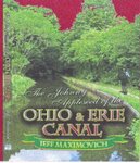
The Johnny Apple Seed of the Ohio & Erie Canal
Certain stories are subject to ALL RIGHTS RESERVED which will be acknowledged at the beginning of the story. No part of a specific story may be produced, stored in a retrieval system or transmitted in any form or by any means without written permission of the author except by a reviewer who may quote brief passages in a review to be printed in a newspaper, magazine or journal. Any stories which fall under the terms listed, are not to be used for cinematic purposes without permission.
The Johnny Apple Seed of the Ohio & Erie Canal
Sold in most book stores use this ISBN #1424128765
2,142 comments:
«Oldest ‹Older 1601 – 1800 of 2142 Newer› Newest»1706-Hey canalwayman, did the Circleville Aqueduct cross the Scioto River north to south or east to west?
1707
1706-State Route 23 and 204 run up & down the state north and south. The Scioto River is running parallel. State Route 22 crosses the rivereast to west 200 yards upstream and would been parallel with the former Circleville Aqueduct. Sorry Canalwayman, I had to take this one. I cant believe a member of the ACS couldn't know this answer.
1708 to 1706 Is that a trivia question or what. 1707 covered it as well as anyone could with an excellent explanation. Common sense tells all, if there's a river crossing on the Scioto below Columbus it's east to west. Why could you even consider something else.
1709 1708 The river took a sharp bend in that section making the crossing north to south. Ohio's Canal Era 1825 through 1913 published by Mr. Gieck on pages 112 & 113 says otherwise. Your flimsy book by comparison is laughable!
1710-1709 Have you ever followed that river by foot, probably not so? If you had, you would know the river takes a good bend heading due south of the former aqueduct for quite a piece. Now, about my flimsy book, it may be small in size but by comparison, you don’t have to lug around that other heavy publication that’s filled with inaccuracies by comparison. I read those pages long ago, and they are incorrect along with a huge number of other mishaps. I have nothing against Mr. Gieck, he seems really nice. But I’m not going to let the mistakes in his book that are wrong make my stuff that’s correct, look wrong to get along.. Look at the bibliography, its loaded with so many big names who want to be authorities on these canal systems and others, losers’. With all of their accumulated knowledge it’s scary, why haven’t they found these things, they have, but never thought the general public or someone like me would point them out. Man, they put out this big publication and it sells well. My book isn’t aloud to be sold along the canal because some assholes over at the university of Akron in the marketing dept in charge of what sells at the Mustill Store and other places says it has mistakes and the general public cannot assume the information is accurate. My book went in front of a review board made up by members of the diversified canal associations who said it’s totally inaccurate. The same guys who are listed in J.Gs Biblio, I’m sure. Imagine that! I have over 40 mistakes secured derived from the other book that can be proven, I ask them if they wanted to see them just to be fair, they weren’t interested in knowing any of it, they declined at least 10 request of mine to prove my point in fairness. That says a lot for the idiots who accumulated the information which was compiled into that book. Something else, I gave TKW a whole lot of good information for his book that he didn’t have nor had a clue about; he never gave me recognition for any of it. All the sudden, Oh. ! I knew about that, I was there years ago. Yea Right! There will only be one name in my next book as far as the Bibliography goes,, my own!
1711- You have quite a negative attitude towards the others who share the same passion as you do why?
Where or how and did all this develop?
1712- Years ago TKW met me at the Massillon Library and with him was the book in question and he asked me to point out the mistakes or if I knew of any. This was stemming from a phone conversation we had where the accuracy issues came up concerning that book.
In Massillon, I told him that I can find about 40 areas that just don’t fit; he placed the book down and asked me to point them out. I wasn't going to do so because he was getting all heated up, heated up to the point where he was practically out of hand. The Librarian asked us either to leave or settle down. It wasn't good. I ask him the, if you knew of these things, then why haven’t you done anything about then. His reply was that the general public isn't aware of these things and we should leave it that way. I got up and walked away knowing in my head that the trouble has just began.
Now boy's, there is your leader, you should be proud! That’s where it all began!
1713--I believe every thing that Jeff said in the above posting. Those fellows had known for quite some time the book was weighted down with inaccuracies. There was an enormous amount of effort that poured into outlining this publication. Within them, those who compiled its structure are the responsible parties who were directly involved in putting together its photos and its information. They thought they had gotten it right down to the finest details. The incorrect information stems from their blind eagerness and willingness to trust there fellow friends and constituents by honoring their investigational findings without reproach. The Bibliography is no less than big names and authors, professors, scholars, teachers, and those who have held important positions and office. Not to mention, several names headed up many of our canal societies. This doesn't sit well that they had the audacity to claim themselves as experts, which they aren't. The Interim Director at the University of Akron who hovers over the marketing and sales, especially the Mustill Store made a negative claim against you’re behalf saying that you are very arrogant and clueless about canal facts. It’s my opinion; you're a breath of fresh air, one who shows willingness and eager to do battle with the whole damn group. Good job for all the efforts you put forth. None of them, repeat none, has walked the canal in its entirety nor ever will, because if they do this making news followed up with a big blow out they’ll have to stand inline behind you or at the least make mention of you. They do not want to highlight you at all.
1714-I never wanted to do battle with any of them. I also never wanted to join them either or groups. This whole ordeal is about a canal system which died off over a hundred years ago really makes no sense. But just like the others, I have a strong magnetic draw which keeps me going towards it. When I was a boy, I played in the locks down along Cuyahoga St. I can go forth and say that I actually walked through the entire staircase of locks before Akron tore them out and built over top them. I can remember so many details about them. This dislike of each other was brought forth by one man, one man who set my feelings (cold) towards the whole other side. He has lied and among other things went public discrediting me. Just for the record, It’s not W.A.Seed or Astronurse, or Canaldog for all that, I really enjoy those guys and I feel as if their knowledge level surpasses my own in certain areas. I still get very bitter about these happenings from the past. Maybe I should lean towards more getting over it. It’s hard when the one in question swipes your work! I’ll admit that I’m not the most technical source of information about the canal, but I covered it on foot.
1715 Jeff until you walked the canal in its full length more than 125 years separate you and the last person who walked ahead of you driving mules. The last time the canal was actually open from Portsmouth up to Cleveland was the mid to late 1800s, after that the lower section from Circleville down to the Ohio River was washed out having several feeder and dam failures. That must have been full of excitement for you!.
1716-Jeff I don't think you give yourself enough credit for whats stored in your head. I feel as if you can go toe to toe with any of them. Woods in a man without a single concern for his fellow researcher, who is always taking credit for the others hard work. Woods had very limited knowledge of our southern half. it was you Jeff that figured out where the Howard's lock 47 really was located. On our 1988 tour we looked extensively for that site. For years lock 47 was thought to be untouchable as far location.
1718-The Americas Byway signs have caught the attention of one of our representatives who agrees that its poor wording. His next step is to see how it’s funded whether it be state of part of a Federal expansion fund.
There was a time when the CSO really meant something, its goal was to keep the history alive about our states canalways as a whole. Today, the canal societies, plural, have figured out how to extract funds on all levels and it became a financial way of life for too many. They should just ditch the canal projects and work on our walking trails, quit using this historic aspect to gain funding in the name of the Ohio and Erie Canal and our other canals of just as great importance. When lock 12 on the northern slope of the Portage Summit was rebuilt, they took away the character of its former self by creating a monstrosity that doesn't follow the original shape of its former self. If that's all the respect the people who write the checks to the construction companies have for our canals history, then please, don't do anymore lock restoration, it’s embarrassing to Ohio. What really is bothersome is the fact that here at home we have had a forgotten thoroughfare namely the Buckeye Trail, a formerly documented Indian and war trails. These are just as, or more important than our towpaths. And remember the canals here at home undoubtedly followed the Buckeye Trails as a guide line.
1719- The repair work at lock 12 was done adequately and only cost $255.000 dollars.
1720- The entire walking path project south of North Street and on up was a whopping $1.200.000
1720-was there ever a plan to build a central canal system here in Ohio?
1721-The cost of the walk over bridges up north and our corridor pathway construction project has already toppled over $100.000.000
1722 I've noticed that you haven't updated your calender page in quite a long time. Do you still give talks?
1723-Canalwayman 3rd canal proposal said...
In addition to the Ohio and Erie Canal on the states eastern and central parts of the state there were some within the Ohio legislation who strongly felt as if the Miami and Erie Canal running the western division weren’t enough to get the job done. Others disagreed but the plan to dig another canal coming straight down the state to connect with the Ohio and Erie was laid too rest. The course was as follows: It would begin on the western side of the Sandusky River at Lake Erie in Sandusky County passing south through Wyandot County paralleling the waters of the Upper Sandusky continuing into Marion County where it was met by the waters of the Scioto and was planned to enter Columbus where it would jump into the Columbus Feeder and tie to the Ohio and Erie canal at Lockbourne.
October 27, 2010 4:59 AM
Lock 12 at Akron is rediculous said...
1724- Looking at the expenditures, that almost sickens me. Whether those numbers are accurate or not, even a 1/4 of the overall cost would be totally out of hand. What's changed over the years, the biggest money vacuum this state has ever known was our canal systems and it still derives revenue from this dead horse. We spend more of our nation’s capital on useless projects and the former canals are a prime example. Are we to just sit back and pipe millions into a piece that only reflects on its nostalgic value? For the kind of money we're dealing with on this level at least get the darn things working again. I’d bet my grandchildren that we have some individuals in the higher hierarchy in our state house and further more in the more prevalent canal societies who are gaining weight. The contractors always show gratitude rather than give a fair price it’s hiked to line pockets. I agree that the construction at lock 12 in Akron is hideous.
October 27, 2010 5:14 AM
1725 to 1719- Why, would that be listed under a repair. You only repair things to re-use them again. That is the poorest representation reconstruction of a lock known to mankind on planet earth.
Back at the turn of the 20th Century using limited resources and equipment the one’s who rebuilt our canal at least made them locks look accurate by design!!
1726-Hey would someone please list to this site how much has been spent to date on the Corridor project or at least lead us to where these numbers can be reviewed. What do the people of Oho have to gain except for have their pockets being emptied some more?
1727 Ah!Where's OHO in response to 1726
1728- Name our shortest and busiest canal here at home. A hint, someone very famous was borne there.
1729-1728 Answer Milan/Thomas Edison
1730- What does Valley City, Ohio have in common with the O&E Canal?
1731 to 1730 Valley Junction is now called Zoarville. This place was where Sr.212 meets Rt.800 and was once a mainline railroad connection to destinations in all directions. This is why Valley Junction shares a similarity with the Ohio and Erie Canal and is quite simple. Both places had the tracks of the Valley Railroad placed there. Another is, both places are the beginning and the end of the short railway. I'm not certain but right off the top of my head, I believe this short line was about 75 miles long. Its basically was a coal run to fulfill the hungry needs of Cleveland’s steel mills bringing up top grade coal from Tuscarawas County. The Valley Railroad is the same railroad running along Towpath St. in Zoar and crosses I-77 next to the new towpath walk over bridge. The railway heads in a northwest direction leaving Zoarville to Navarre where it turns due north. On its northern trek it passed through Massillon, Canal Fulton and every town and village where the Ohio and Erie Canal went all the into Cleveland.
1732-1731 and 1730
Valley City is a small northeastern village located in Liverpool Township. I resorted to wikipedia and cannot find any kind of canal connection. However it is somewhat famous for it's leaping frog festival.
1733 Valley City is located just east of Franks Corners on Route 303. Valley city has nothing in common with any of our canal systems except for being in the same state!
1734---The Valley railroad must have had bad karma because it followed suit of the Ohio and Erie Canal and only lasted 20 years.
1735-The Valley Railroad was destined too doom itself. I say that because one of its major stockholders was the city of Cleveland that like anything they get involved in has corruption. Cleveland stockholders mismanaged the bonds and squandered its capital blaming economic times for its failure.
1736- What type of bridge construction was Waverly's Kilgore Bridge. Do we have any history on this? anyone!!
1737-A great picture of this bridge is self explanatory and can be found by looking up the Kilgore Bridge and drop down the page on yahoo.
1738- I dug around through my notes and have a couple of details surrounding the Kilgore Bridge of Waverly of Pike County. The bridge throughout its life had a sagging problem because of its original abutments were so far apart which allowed for a towpath to pass below. Its span was causing the bridge to fold in at the center. To remedy this problem the abutments were moved closer together actually out into the canal prism to strengthen the structure and the deck was only about 25 feet total. The bridge was a covered bridge with a loading door at its center to drop what ever needs to be placed on board a waiting canal boat. This bridge crossed the canal on Waverly's northern end where Cherry St. connects with Sr.335. There was a small basin inside the city limits. The bridge was named after the farmers whose land the bridge was built upon. Their home once sat on the high bank at the end of the field overlooking the bridge. The Kilgore’s also operated a small mercantile store in the area of the bridge seasonally offering baked goods, whisky, tobacco and other needs. The bridge was blown over in 1908 and never resurrected again. The Kilgore Bridge was on the very outskirts of Waverly but within its limits. It was a policy that any bridges crossing the canal in town weren't to have trap doors, they presented a safety hazard. The kids would leap through the trap doors into the water and a couple of them drowned. Just up the canal another bridge which was built much better and had its span over 60 feet was at the Barger Farm and it had twin trap doors to service two boats at once during the busy season. The Kilgore Bridge was a bottleneck because they built it into the canal where the Barger Bridge area was easier to negotiate and boats could pass. After 1880 there wasn't much going on at the bridges or in Waverly that was canal related. The Scioto Valley Railroad was running strongly and had a depot and yard in Waverly accompanied by Springfield Jackson and Pomeroy Railroad that was laid a bit later. Both of them eventually became part of the Norfolk and Western and the Detroit, Toledo and Ironton Railroad.
1739 Was the Miami and Erie Canal Americas Byway as well
1740-1739--Of course it was and I'm awaiting the same signs to appear on the P&O and the Sandy byway!
1741 - Which stone quarry supplied the stone which made up the Ohio State Penitentiary that moved only by canal?
1742 to 1738- As a Pike County Historian i can't recall hearing of any drownings in the Ohio and Erie Canal down around Waverly. A name would be nice , something which can be at least checked out for validity. Sorry, i just can't imagine someone living is a northern county so being up-pid -dy on our local history.
1743 Where on a canal boat was the guard plate located?
1744-The guard plate extended from the keel out past the rudder to prevent tow lines from being caught between the rudder and boat. This was a precaution made from necessity because crossing a sunken line of an on-coming boat could be jammed if the other boat was to anxious to wait until the boat had clearly passed.
1745 -1742- Maybe you're too stupid to known your local history! People drowned all over who lived on or near the canal. Usually being small children who fell in.
1746-1745 and 1742
Canal drowning victims consisted of mainly small children as 1745 stated and drunken adults. There are numerous archived newspaper accounts to back that up if one does a little research.
1746 TO 1742-In 1839 the towns blacksmith in Waverly known as (NIP) Miller pulled two children from lock 44. It was a boy and girl, the girl never made it. The two children were of the last name of Heibel, the boys name was Adam and the girl was Rachel.
1747 We met on an outing doing railroad investigations last year. I just now looked over this sight and its very busy. One would need a month to examine its contents. Tell the story involving the game warden who tried to disarm you in the deep woods trecking the Sandy and Beaver.
1748-1747 what happened is I was in one of our counties doing canal exploration. Being that I'm not a hunter, I have no clue whatsoever about which season is which. For personal protection purposes only, I had a side arm and was out doing my normal routine along the Sandy. Where I was headed took me pretty far off the beaten path. Casually looking about only paying attention to my surroundings a officer got the drop and snuck in on me and after a brief and bitter conversation he told me to hand over my weapon. I asked him, why in the hell would I wanna do that, I'm not hunting. He asked me again to un-holster your weapon and hand it to me, Now! I'm not asking you again. (I said)This gun is for personal protection and I have no intentions of just handing it to you, how do I know you're really who you pretend to be. He un-snapped his holster, and I did my own and we stayed in a neutral position at a stand off. He again said I'm counting to three at that point hand it over. I said, I will, but not until you either get someone else up here and really prove who you are, or else we will have problems. (I said) I am not handing some stranger my gun, two miles from anywhere and get shot for being stupid. I suggested that he call for back up and we start making our way to the main road at that point the gun will be surrendered. He made a call and when we made it to the road, I handed it over. There were a couple of officers at that point. The gun was returned to me right away. This was a good lesson for the officer, not everyone is out there hunting and I had the right to carry a gun for my protection against a bear, any predator and someone posing as an officer. I was in the right of way without any doubt. My biggest mistake was being in the woods during (Deer Hunting Season0. But then again why should that keep me at bay when I feel that I had important work to do. I had no intentions of handing it to him and he knew it. Let’s say for sake of argument he was an imposter dressed as a game warden and I handed him my gun. I would be shot and killed.
1749 If i was in the same situation, I would have reacted in the same manner towards the game warden. I do hunt; they can really be a handful. The officer by experiences should have known that you weren't hunting; at least did he give you an ample opportunity to offer him a credible explanation. You would have been a fool to give up your protection in a place where your life may have been at risk. During season all about the woods you can hear guns going off, too kill you wouldn't have drawn to much attention. Our law enforcement agency in every corner to a large degree has been consumed by corruption. What if he wasn't an officer, anyone can buy uniforms these days and pretend to be whatever and had taken your life. I would much rather break the law and face the consequences then get blown away by a stranger. You got Grit!
1750 I find it strange that they will shoot and kill a human for shooting a dear out of season or for not being licensed, huh, strange!
1751 Always something good on this site. There's a big empty section in everyone's publication about anything between Sugar Creek basin and New Philadelphia. Your book at least covers the minimum demographics explaining the hair pin turn on the canal etc, etc. Please explain in detail the canal and Stoney Creek. Were they one in the same for a jaunt?
1752-1751
Please reference an instance when a Ohio park ranger shot someone for hunting out of season or without a license in the past 50 years. They haven't. If you wish to explore Ohio's canal system you should be aware of the hunting seasons. I learned that the hard way too. If you choose to explore it with a side arm in your belt and you don't have a hunting permit, obviously the state ranger might think you are either a poacher or a pot grower checking on his harvest.
1752 to 1751-That is a really interesting place and you’re right, no-one ever gets into deep detail about it. First of all, I know that that region hasn’t been looked over to well because I have made a couple of errors in my work and no-one has caught them as of yet. These are understandable with the new hi-way coming covering things up and the gravel plant at the Rt.39 exit off I-77. What I thought was the old canal running next to and on the west of Stone Creek Rd. was actually a railroad bed. The high fill which was once the railroad meets Stone Creek Rd. next to the driveway of the Tuscarawas Auto Recycling. If you align yourself with the former railroad and look south it looks as if the towpath begins just beyond Crooked Creek where actually an old train trestle crosses over it. That’s the path I walked doing my canal adventure, I actually walked about a mile too far and 100 yards west of where I should have been.
After you leave Sugar Creek, you’ll soon be leaving the basin in your wake. But there is still yet the long and barely visible remains of the dam which extends south about 150 yards and ends at a block house of some sort. This dam faced the east and held the water to the west in a triangular shaped basin. A dam once spanned the creek behind you, it was part of this long great wall and it’s piled up along the side there next to the water. Several things went on there on the island between the spillway and the creek. A great mill operated there and it was the original Blake’s Mill. There was an outlet close by so the canal boats could leave the confines of the Ohio and Erie Canal to navigate the Tuscarawas River. The river was raised by the Baker Dam so the canal boats could enter the Lateral Canal to service New Philadelphia. The basin area was certainly a feeder for the Ohio and Erie Canal going south. Finally there was a sluice gate which regulated the basin and a spillway next to where the water wheel sat.
The Ohio and Erie Canal never crossed Stone Creek Rd and stayed between it and Hi-way 77. As you’re getting off at Rt.39 you are directly next to it. As you are getting on I-77 from 39 going south, look down, that’s the former canal bed and it goes quite away south then turns directly east where it once met Stone Creek. Where it turned east can only be identified by using the power station as a land mark but the interstate covers all evidence, except for what’s across the road. Now over on the other side is quite interesting.
The canal never doubled with Stone Creek, but did cross over it at a dam. There are yet the remains of a slack water dam on Stone Creek and a canal approach going up to it. The evidence is right there for the explorer who wants to see for themselves. Over on the side the canal only had to build one bank because the hillside was the other. Where the hillside merged with Stone Creek there sat the dam and the inlet or outlet to the Ohio and Erie Canal. Without hesitation I say that Stone Creek was a feeder without question. Where the canal began passed the dam going towards New Philadelphia sat a building that has its foundations still there. The building was the home of the dam keeper, the one who regulated its flow into the canal, or over the dam. The canal bed is in part still there. About 100 yards north of the dam is Stone Creek Culvert. The canal didn’t pass over it, but east of it, it was part of the roadway that led to the dam. The canal hugged the base of the mountain where Rt.250 exits -77 and 250 in part was built into the canal bed. The canal ran to the north of Commercial Ave in South New Philadelphia for its biggest part. Called Blakesfield then. The best and most fascinating thing I found that day was a preserved section of the Former Ohio and Erie Canal displayed in a front yard on Commercial Ave, filled with water in all its glory. I hope this helps you find your way around. Be careful, the thorns are atrocious back in there.
1753-Just because I had an uncomfortable incident with a game warden doesn't mean that I had lost respect for any of them. If one would check the state wide records it reflects that there have been several game wardens shot and killed by poachers. My only problem lies where such a bad attitude on his behalf surfaced and I felt threatened to the point I was afraid to surrender my gun to him. He wouldn't listen to reason and his ears were closed to anything I said. More than once I was told to shut up and don't talk unless I tell you too. That doesn't work well with any buddy. I do respect the laws of our state and will continue too. It was an unfortunate day for us both.
1754
1752 I admire your self worth to recognized your mistakes and straighten them out. Most people wouldn't do that. It's true there doesn't seem to be to much said on that section of the O&E Canal. Sounds as if you covered your tracks real good. Now that you outlined some landmarks, we'll run on down tomorrow and have a good look around.
1755--- I'm legal to carry a weapon. It's the middle of deer hunting season. I don't hunt. I would like to enter the woods. I wish to be armed. Why should I buy a hunting license to enter without a hassle?
1756- That's the chance you take answering posting 1755. Certainly all hunters aren't prepped through finishing school and are known for politeness. The game warden is fully trianed to approach the suspects without detection and win by the element of surprise. Just like anywhere else we can have those who get carried away with their duties. I do hunt and follow this site and research our canal systems. I haven't yet carried out on the towpath. By doing so would attract attention so I choose to not. If I was going into unknown territory, I would. The area on the Ohio and Erie Canal below New Philadelphia has been a mystery and has gone unanswered for ever with a acceptable scenario. I had looked for a canal crossing at Crooked Run and can identify with the old trestle you had mentioned. Based on that I knew your explanation is probably accurate without traces of any stone work at Crooked Run. Stone work even which has fallen is direct evidence of a former crossing being a culvert. We have not a single culvert listed back in there in our annual reports. I'm going out this morning to re-investigate this great find of your and will post my findings this evening. Where is the best place to park besides the side of the Interstate?
1757 to 1756 the best and easiest way to get back in there is actually simple. I wish it was that easy years ago walking back and forth and up and down for hours. You can park at Crooked Run Rd. at Stone Creek Rd and follow the stream, where high boots. You'll go no further than a 1/4 mile in where it meets Stone Creek. Once at Stone Creek turn north and soon enough you can evaluate your own findings. Another place to park would be at the Dennison Bridge. To find this, it’s the first road to the left beyond Crooked Run Rd. Once you arrive at that point, stay on the eastern side of the creek you'll go about 1/4 than there is where the canal connected to a slack water and crossed there.
1758 We located the dam on Stone Creek and thoroughly investigated its immediate surroundings. We found an old oil lamp where the building was Scattered. So happens we ran into another couple who shares our interest about the canal who read your directions yesterday.
This is a great find and to see that small section of canal on Commercial was a touching experience that someone cared so much to preserve such a tiny piece of history.
1759= I read the book and was pulled into the paranormal experiences. Do you think that a spirit hitchhiked a ride with you?
1760-I had some strange happenings and they were not of the normal everyday events. I’ve been ridiculed and thought to be a big story teller for talking of such things in my book. There was plenty to talk about; I didn’t have to go there to fill the pages. I already had in my possession dozens of actual canal stories which could have taken up space instead. I’m convinced that I had a spirit get in my Dodge truck and go back home to Canton with me. Too say it was evil might be incorrect, but it was jealous in a way because it acted up when Laura and I would get close. This all started in the Black hand Gorge doing my walk and investigating. I ran in the path of an older looking man on several occasions that looked as if he was dressed to fit the early 1800s. I found it disturbing because I passed him by and ran into him deep in the woods again. I watched him stare at me from atop Black Hand Rock he never responded to my callings. I climbed the rock and he wasn’t there. I never did see him after a couple of times he never returned. I feel as if he was trying to scare me from the area, maybe for good reason. I did find a body which was placed in a large lawn and leaf bag in the woods just east of Toboso. I made the reports of this and to my surprise it was still in there a couple years later. I made another report of it. The entire region reeked so badly with the rotting odor it was sickening to me. This area along the Licking River just settled down from the worst flood recorded in years and the place was decimated and looked as though a bomb went off resembling pictures if Hiroshima in Japan. Hillsides were broken loose and landslides were all over, perhaps the violent water opened some graves, I was told by a spiritualist and they were disturbed. I never really believed these things until events unfolded in front of me through the following months. I have a story which outlines a war that took place within the gorge because the Indians who lived in there for centuries were being forced out. The gorge was their home and they stood their ground and from that they were massacred by the troops which came up from Chillicothe and other nearby camps. The Ohio and Erie Canal was coming through and there were occasions when the diggers were being killed by flying arrows and became such a hazard the work stopped. The state sent in a delegation to work out something pleasing to both sides without any gratification and then the only other thing to do was to exterminate them and they done just that. Many soldiers and Indian warriors were buried in those woods, we as explorers have probably walked by thousands of grave sites, not having a single clue either. I was told of an Indian Burial site by a man who claimed to be in tune with the after life. He told me that I slept on sacred ground one evening and too never go back there again. By desecrating that burial ground I may have had a spirit latch on to me. Well that’s what happened, he appeared in many pictures and lived in my basement and acted up frightening Laura out of her mind.
Part 2 The first time I ran across him was in a picture I shot east of Toboso at a washed out culvert on the Ohio and Erie Canal. He wasn’t in the lens when the picture was taken, but revealed him in the actual picture. He was an Indian Warrior with strange neck beads and two horns coming from what looked like a Buffalo hat with bands around his arms and the whole Indian get up. He looked so angry and big thick veins were covering his face and running down his neck and his eyes wanted to kill me. Coming from his nose was two streams of hot steam and his mouth was poised with a grumbling hatred for me. I again say that he got in my truck, whether he moved to Canton within my camera has been relayed as a possibility as to how he arrived. The picture was so horrifying that Laura began screaming and feared for my life if I ever went back to Licking County. I figured he was with me when he revealed himself in another picture I took next to Lock 17 just north of Akron early one early spring morning. I left my home at 6 a.m. to ride my bike while the towpath was still frozen because after an hour of the sunlight hitting it they get mushy and muddy. I never expected to see a ritual being carrier out on an island that’s parallel to the lock chamber out in the middle of the Little Cuyahoga. There was a bunch of strangely dressed people and they left an alter there filled with a spine of some type and Indian stuff all over the ground. I found that eerie and took pictures. To my surprise my Indian was again in the picture. He began to make havoc at home and he went wherever I did, yet he is still in one of my pictures they I overlooked. He is on my web-page right now. I was so afraid of him, either Laura or I would visit relatives in fear he might stay there. I took all the pictures to Saint Paul’s Church in N.Canton and a priest suggested that I burn them all and blessed me with oil. He did suggest not inhaling the smoke. Looking back, this Indian spirit who was with me is the same who caused me so much trouble later on when I re-entered the Black Hand Gorge. He has stood in our doorway, looked in my windows, was laying on the basement floor on his stomach trying to squeeze under a table and so much more. The worst thing he did was he always tried hard to scare poor Laura and he would position mirrors to stare at her. This story could go on and on but I’m wearing out. Yes, the Indian did catch a ride with me to Canton and I do believe now! It was suggested to me that it was either a medicine man or a Manatou.
1761 Which picture on your web page is the Indian warrior in?
1762-Its only his face he's below Akron with me.
1763 -Go to the five six level below Akron. Look along the right side wall down into the water, you can see a reflection of his face in the water, it’s distorted. Above on the wall are two stains which mimic two horns the face is directly below it.
1764 That may be a poor representation of him , never the less that;s him. I did destroy all of the existing pictures where he took part in. Its been a while since I had last seen him. We did tear down the house and left the camera there where it was covered over up. We now have another building built directly on top without a basement.
1765-Yesterday was a good cool fall day to explore. Watching this site Saturday sparked our interest and some of us went looking for the slackwater dam on Stone creek. My question is, why it wasn't this listed anywhere as a slackwater dam or feeder for all that. Its plain as day that in order for the canal to continue it had to cross Stone Creek in the process. That mountain is called (The Point) by name. You made no mention of this, but aligned with the culvert is just a small pool with large block stone close at hand. We are convinced the pool is the canal prism. Next to the expressway there are enough blocks to reconstruct a lock chamber. Was a lock located nearby? This undoubtedly was a good find, when did you make this discovery?
1766- I'm on my way out the door; my shop opens at 9 a.m. sharp. But I'll take a quick minute and go over this previous posting. I did see that pool and it was part of the canal bed. It’s strange how the clay holds water so well. That was a great idea, especially in sandy loose earthen conditions. Back up a bit and you can see where the canal hugged the hillside because all the clay in the area. This may be listed as a slack water dam somewhere and it was without any doubt a feeder. Some of our other researchers really dig into the paper work more in depth than I care too, maybe they can find it listed. I found this site back in 2004. Those block stones will always be a mystery whether or not another lock chamber was back in there. Look at the elevation indifference between where the canal wraps around the mountain next to Stone Creek and compare it with Lockport Lock 13, man it’s a good 15 feet. Maybe we have something else that wasn't listed. It happens.
1767- I can make out a face of some sort in the reflection. What ever it is, it’s not friendly. You must be fearless; I would never traverse that underground tomb in search of anything. Did you for kicks ever turn off the lights? Are there places where the water was deeper than others? I would think that such a place would have an access port for easy entry, wouldn't that been easier than dragging all that gear with you? I believe your story; it would make no sense at all to open yourself up for public ridicule by telling a big lie.
1768 Jeff are you looking for something specific these days that’s been overlooked. I’ve seen Jeff's work and he has an astonishing amount of collectables and stacks of letters and news articles going way back. Every canal section and lock has its own portfolio, it’s well orchestrated. So Jeff, don’t say that you aren’t into the paper chase ordeal - because you are.
Jeff and I started off as mortal enemies but as I got to know him and was invited in to his home it became apparent how deep he’s into the history behind the Ohio and Erie Canal. I know him well enough that he doesn’t have to make up monster stories to sell books. When Jeff passes someday, whoever gets his info holdings will have a rich plethora of the Ohio and Erie at its best. He doesn’t carry much interest for any other system here in Ohio. I know he played along Cuyahoga Street as a kid and met a hermit at Summit Lake who lived on a canal boat.
PS Although we haven’t talked in a couple years:
Your Good Friend Thomas!
1769-Just when we thought we seen it all then you give us something new. Stone Creek Crossing hasn’t been covered until now. I know as a fact the lift lock at the Trenton Feeder wasn’t known until you posted it as a new discovery.
1770 to 1766- I actually had to get psyched up for several months before going through that underground spillway. The only reason I made that journey was in hopes of finding any remains of the locks. I was a little concerned for my safety. I made it a point to get down there at the lower end after a big storm to see how it became with water rushing through. I was shocked on one occasion when the water was coming out with such enormous pressure it almost changed my mind all together. So I was really careful and watched the weather reports and waited until the water was running slower. Coming up against the unknown and not knowing what to expect after entering, I was stopped immediately by a high wall I wasn’t able to get over. I came back a little later with a two stage ladder. I also brought some lighting to illuminate the tunnel using two heavy car batteries and halogen lamps. I put the bigger of the two batteries in my backpack and screwed two lamps on my helmet and started my way climbing to the top. There are a couple of really high spillways which were a bit scary to get over that I didn’t expect, they were smooth and slimy and straight up. I was really nervous because on my first attempt getting over the spillway on the upper level the ladder slid below and lost its footing as I got near the top and I slammed down and the lamps were torn loose and the battery was shorted out. I did manage to get to the top after several attempts. Once I made my way up and found where I could tie off using safety lines, which were the same hooks that were used by the men who built the tunnel I felt it was safe enough to take Laura inside from the top and limited how far was safe, she was thrilled. There is an access stairway on the eastern side of the bend on Sr.59 just before it meets main St. I really doubt if I would have been granted access. Looking back, I wouldn’t do anything like that again. There were two younger boys who got wind that I went through and went through it. I never taken that into consideration that some would try it themselves and I do advise against going in for it is dangerous. While we’re on this subject, I recommend staying out of the tunnels below Akron for several reasons. They are poorly built with sections have fallen in and there are huge rats and raccoons. The biggest danger is those who make them home. Some of these tunnels crisscross steam pipes that heat Akron up and in the winter there are many undesirables living down in there.
1771-Jeff are you familiar with the proper name of the 1000 foot mountain where Morning Star the mythical lookout point was said to be. The peak is properly named Indian Hill.
1772 to 1771 I was aware of that and thank you. You should go up and look around. By doing so you can catch a good view of the entire valley floor. Indian Hill was the common name given to this high peak, the English Translation of what the Indians called this place was Morning Star. I do recommend going up and it’s a great place to spend an evening during the warmer months. This time of year would be too cold. While up there you can see everything for miles in all directions including east behind you. This high place was used by not only the Indians but settlers ands both the British and the American forces alike. I've been up there on several occasions and have taken a party of interested onlookers up last July and we stayed two evenings. It was a night to reminisce being a watch out on this high peak. Below we could see the connection of Stillwater Creek and everything moving in the valley. This evening was filled with adventure and we sat around telling tales of the old days, Indians and the canal. We had a weird happening just after midnight when a strong wind kicked up and blew the camp fire around and blew our tents over. We got spooked out by it and called it a night and re-situated the camp site laid there and listen to a variety of noises and animal callings all night. By that experience which had just happened really put our imaginations in overdrive. None of us actually slept that night. The next day we all laid around lazily slept while the sun climbed high overhead, we had fun anticipating the next evening. That night all was calm up on the peak, no wind or disturbances. The first night up top it was an open sky and we watched the heavens and made out the constellations. We could easily make out the surrounding towns in all directions. The second night was an overcast sky which enabled us to make out towns further away because the sky glowed. The overcast reflected the light and we could see as far as Coshocton to the west and looking straight south the ceiling glowed miles off, must have been Cambridge and to the north, Canton and Massillon. This wonderful place should have been named Lookout Mountain.
1773-Did you ever consider giving tours? I would go and many others would be happy to sit around and listen to your stories.
1774- What year did the dry docks close up Southern Ohio?
1775 to 1774 -I think its reasonable to say the dry docks closed by 1880.
1776-Whats a coal catcher?
1777 A coal catcher was a raft positioned outboard the canal boat when the loading process was at work. Some coal bins dropped the payload directly into the hold, that never required a coal catcher. When a coal chute was practiced at an angular position the coal blew over into the boat railing where eventually filled the canal with a sand bar made of coal.The coal flying over the rail landed in the coal catcher.
1778 how long was the deep cut delay?
1779 Where were the north and south locks located?
1780-1779
This trivia question needs to be more specific. On the Ohio & Erie there were 2 summits. Lock 1 south of Portage was located at Barberton. Lock 1 north-in Akron. The second summit was at Buckeye lake. Lock O south at Pughs, Lock ) North at Minthorn.
The Miami & Erie was much simpler. One Summit. Anything south of Lockington were southern locks. Northern locks began in New Bremen.-----W.A.Seed
1779 to 1778 –Digging the deep cut section of the Ohio and Erie Canal was clearly an underestimation by the contractors who bid for the job. They had no idea with what laid just below the surface. The entire deep cut process took about five to six years to complete, three years over due. The hold up through this section was an undetected underlayment of rich blue clay that stopped shovels from piercing the ground, impossible to dig. Many-many contractors fell in line one after another who thought they could get the job done and only made a small dent before giving up; they underbid and went belly up. There was no mechanized equipment to work with. After a while labor force became sporadic and unreliable mostly made up of immigrants who were treated poorly and paid little for the work that was expected of them. The 1-7/8 mile section of the deep cut held up the grand opening of the canal’s full length of operation to extend from Portsmouth to Cleveland. . Monticello was about a footballs field distance east of the new coming canal and they were in a constant rivalry with the citizens of Millersport who for some reason felt they were better people. With the canal’s arrival the folks of Monticello hoped to have an impact as well to bolster their economy too. With the canal on its way, the diggers began to show up and Millersport began to expand but only to a degree and Monticello would soon end up as a place for the drunks and rowdy trouble makers. Millersport hadn’t a basin, by not having it limited the amount dockage and wharfs and kept it from fully exploiting the opportunities at hand, Monticello became the home to the worst of the worth type of digger as the years went on as the digging stalled at the deep cut. The good diggers pulled out because the pay scale was so low, that brought in those who worked cheap. The contractors were going broke because the allotted funds they agreed upon has ran out, as the money was running low the wages dwindled. The north and south locks were also in this area. Before the new Reservoir was placed in the southern lock was King Watson. The northern lock was at the Upper Taylor lock in Heath. There was a time when the Licking Summit extended further and it that was before the new reservoir arrived cutting it down. The new reservoir was also the new summit and it distance was between the Minthorn Lock, the northern lock and the Pugh Lock called the southern lock or south lock. The new summit was about 5 miles long and it ran through the deep cut. The original summit was closer to 16 miles long beginning at Heath and went to King Watson near Baltimore and also followed the path through the deep cut. Two more locks were added into the system as just mentioned above when the newer of the two reservoirs was added in, they were numbered as “0” but those who plied the canal called them either the north or south locks.
1780 By what method and how was Summit Lake was drained?
Where did the water go?
1781 -Summit Lake before being drained extended to the north by a 1/4 mile where its most northern point is yet today north of Russell Ave in the form of a small lake. Its southern boundaries extended far to the south in the form of swamplands still evident all the distance to Long Lake. An Akron resident and historically bound and reviewing whets available on this subject, reveals Summit lake having an open water area of just over a mile and its swamps extend far beyond Rt.224, again touching Long Lake. Akron has the precarious position being on a north to south Continental Divide. I believe Summit Lake had a few trickling streams flowing from it, being it was too high in elevation to have any flow into its main body. We know that a navigable channel wasn’t naturally going north, but know one knows for certain that a canoe couldn’t be dropped in Summit Lake ands navigate to Long Lake through the swamps. It’s always been my understanding that a channel was cut from the swamplands south connecting with Summit Lake where it emptied into the Tuscarawas River which was substantially nearer to the lake than the north ridge of the Continental Divide at Exchange Street where the water flowed to the north. I’m not a strong supporter of the actual path given as the Portage Path when a canoe clearly could have dropped into Summit Lake which held open water.
1782- We'll never really know for sure the entire length of Summit Lake although I agree with the historian from Akron on many points. But first let’s talk about the areas in Akron which are still swamps that were obviously the southern end of Summit Lake. Let’s talk about the surrounding bluffs ands hills which contained this body of water. Let's use Wilbeth, Waterloo, Manchester and South Main Streets as an outline grid of the worst and nastiest swamplands around. This square has the quicksand and acres of Tamarac weeds and muck which will pull you under in an instant. I’ve been back in there and it has a greenish-looking murky open water area and I wasn't able to touch the bottom using a ten foot pole from our canoe. I do believe this was absolutely a part of Summit Lake and that lake reached Long Lake by all means. I'll break it down to you as follows. Summit Lake was drained down about 10 feet. That ten feet would have expanded that body of water immensely in size. Long Lake, formerly Long Pond, was expanded several feet to achieve its height that sat about two feet above the Ohio and Erie Canal. The Tuscarawas River also flooded the basin that sat within the square mentioned above. The entire region all the way into Barberton was wide open swampland which actually made up a huge delta that consisted of several branches of the Tuscarawas River. The river culminated into a stream in the Barberton area, but we all know too well that the course of that river was changed to consolidate it for usage for the Ohio and Erie Canal. I also feel the right of passage of the Portage Path is hogwash to say the least with Summit Lake as a useable passage which more than likely would take you to the Tuscarawas River. Just to show how inaccurate our historians think, where they have the southern end of Portage Path stationed (based on the surroundings as they are today), wasn't even close to where the Indians would have placed in their canoes. That was swamplands without a dam holding back the lake. The real division that separated the swamplands from Long Lake came along with the canal and its high towpath as the dividing line keeping the canal safe from Long Lake on one side and the swamps on the other. The entire neighborhoods along Nesmith Lake Blvd. were once under water as well as the region between Manchester Road and Main Street, all a part of the southern end of Summit Lake.
1783 Let’s fill the Lake today back to its formal depth by adding a new minimum level, nine feet above where it sits now. If the level was elevated on Summit Lake, Summit Lake would merge with the Portage Lakes. Its new depth would spill over in to Long Lake. There’s not enough information at our disposal to either confirm or dismiss just how large Summit Lake actually was. I do suspect the body of water as we see it today is just a puddle by comparison to its former size. The exact land Portage from the Cuyahoga to the Tuscarawas has never been confirmed factual; many routes were usable and considerably closer. Summit Lake more than likely would be where the canoes went in, not Long Lake miles further away makes no-sense. Between West Waterloo Rd and Wilbeth is a gigantic wasteland, thousands of useless acreage made up of swamps and quicksand, once (Indian Lake)-Summit Lake
!784-If any river was filling the swamps near the Portage Lakes, it would be the Cuyahoga. The Cuyahoga River originates from Springfield Lake and pours into the Portage Lake system.
1785- to 1784 your listing is partially correct only where Springfield lake is higher than Summit Lake and it has both the Tuscarawas and Cuyahoga Rivers leading away from it. The Cuyahoga never spilled any water at the Portage lakes, it was the Tuscarawas.
1786 to 1784.
The Cuyahoga originates in Geauga County and empties into Lake Erie. The Little Cuyahoga is supplied by both Springfield Lake and Mogodore Reservoir and empties into the big Cuyahoga.
Hello there,
I have a message for the webmaster/admin here at johnnyappleseedscanalstories.blogspot.com.
Can I use some of the information from your blog post right above if I provide a link back to this website?
Thanks,
Peter
You can use this information given on this site but you need to email me first so we can correspond behind the lines. You cannot use anything here for a publication without properly asking me for permission. This sight is covered by copyright protection. You must give acknowledgements which direct back to this site if permission is granted to you.
1787 What and where was Cutler's Station?
1788-I read this site and it seems as if you can bearer some information about the Nimishillin Sandy and Beaver Navigational Co. My question is trying to locate where the big directional change would have taken place and when.
1789--1788-There was a big change in the course of Nimishillen Creek but when it was actually done is quite uncertain. By looking over its layout there was a section that was so tight that there would be no-ways at all to turn the average size canal boat within its banks. Whether or not the channel was ever going to be used to navigate or not, the construction company would have had to straighten the bend at least work for passage. The company itself was a scam to keep Canton as the county seat of Stark County by at least going through the motions of mimicking the canal agitation going on in Massillon, and it worked. Soon the railroads hit Canton and all the county seat shuffling was soon forgotten. This section where the big course change is at the traffic light at Sparta on Rt.800. Going south from the light , gaze to your left and the old creek bed is there, and still full. A mill also sat right there and the foundations can be somewhat recognized.
1790 millions are going to be spent pumping water into the last 15 miles of the Ohio and Erie Canal for scenic value only. Isn't it about enough? The EPA is having there way removing the Brecksville Dam inlet.
1791-1790 That's nothin, Chippewa Creek, a place never affiliated with any canal's is getting a walking path in the name of our canal systems. What's up there? There is something really wrong here, when huge amounts of our money is being spent so freely and people are becoming rich using our rich history as a catalyst to do so. At least fix the canal and turn in it to a viable waterway instead of all this bull crap!
1792-- would someone tell me about the blockstones east of the canal and south of the winter storage basin north of 212 and west of Shepler Rd and the Wildcat Ranch at the tunnel?
1793- those particular blocks are a type of anti erosion measures placed at the steep hillside to keep the land from sliding into canal.
1794- If we're talking about the blocks off Rt.212 just beyond the tunnel, if so, they aren't any part of an erosion prevention project at any time for the Ohio and Erie Canal. Backing up a bit going south back towards the tunnel, this tunnel now used for bikes and pedestrians sits below the second version of the Valley Railroad in that place along the canal and the river. I did say the second, because the first set of tracks passed over the canal at a southeasterly angle close by and those blocks were abutments for the trestle crossing the canal. I can say this with certainty. On the western side of the towpath one can easily distinguish a hi-fill area that's in direct line with those blocks, once a track bed. Walk the high bank northwest to the river where you’ll make a small discovery. The original railroad trestle’s at the Tuscarawas was washed out during the big 1913 flood and it took two years to reconstruct a newer and higher trestles in that area. So for those who wish to know when the railroad filled in over the canal at that point and at the sharp bend on 212 at the trestle, it was 1915. Back in there are a couple of more river crossings over the switchbacks in the river the railway had to encounter in such a short distance. The newer rail road placement was slightly higher in elevation. Other changes were made at the abutments, where huge mammoth walls were well placed to prevent erosion from re-occurring. Standing next to them makes one feel miniature. The former tracks were pulled up and reused in part, because they weren’t taken too far. The newer trestles ironically they have a date of 1915 which corresponds with the flood and the time it took to re-rail the area. I was back in there long before the towpath reconstruction efforts were ever thought of and doing so can say that a similar abutment was at the end of where the trestle once sat near the block stones in question. Those blocks have been harvested. Not only that, part of the suspension was still lying around. Which leads me to the next thing, those block stones at the entrance and lying about, were from the railroad and even more were brought off the river from the northwest where stone pillars sat not that long ago, not that it really matters.
1795- Have you ever come across any canal boats ?
1796- I have always had an eye out for anything related to a canal boat. I have found a couple of parts. Most of the boat deteriorated in the channels where they were left to rot going into the 1860s. There are some places which still could hold some boats, and they are Summit Lake, Nesmith Lake, Long Lake and any of the basins holding water from Roscoe Village to Munroe Basin. A keel supposedly rest in the canal still along Carnegie Street in Kenmore where the canal turns south into Barberton under the train trestle. I have been looking really hard to find anything. I found a lot of lumber along the Tuscarawas and figured that it was from the Tuscarawas Aqueduct and left it as that. Then after reviewing the direction of the river, it became apparent that the water was flowing south. By flowing south, it hasn't passed where the former aqueduct because the water flows north at that point and goes around the bend in the river and onto Zoar. Although the various boards where found in the river, they were old and water logged which leaves one to think where they come from, or was part of. We know that the boats didn't navigate the river except for some slackwater crossings at Clinton and Barberton, quite a ways off. My theory is that any boats left in the canals which could float were lifted up and moved into the river during the big storm and were probably shredded to pieces. My thinking is that more than likely that I'm looking in the wrong areas. I should be looking on land, beyond the tight bends in the rivers where they probably came to rest in some tree line, out in the edge of the fields and rested there when the water receded. All of this is speculation, but it's a quest I'm not ready to give up on as of yet. I found some really heavy pieces of lumber a couple of weeks ago which were plied together. I'm not ready to give away his find not until I'm certain. There is so much that's been un-discovered that's waiting to be found.
1797 -It's very logical the boats are resting away from the canals confines where they settled after the flood. Even if you do find anything, it's for self gratification, no-one really cares. An example lies at Roscoe Village. The boat which was displayed on land at Roscoe’s Monticello landing was toed from the lake long ago then put therefore all to see. The boat no longer exist, it’s been destroyed, and is gone forever. This boat was the last known surviving canal boat in Ohio’s existence. So you might be wasting allot of time and ambition chasing ghost. Some of us find it very bothersome why that particular boat wasn’t totally restored being a solid link to our past. By comparison, the cost factor would have been small in size to what’s being spent on our towpath. To disregard a piece of actual history should warrant an investigation.
1798- That boat was far beyond restoration. Why throw good money at a canal boat that'll never serve a purpose!
1799-to-1798 Wow! What a concept, why throw money at the towpath, does it serve a purpose these days?. Restoration of that boat would be a good reason to continue the towpath even further. Using that boat as a historical reminder would help facilitate all these expenditures’. Why not repair and re-open the Ohio and Erie Canal and give us the taxpayers something for our money?
1800
To 1796- I've been told that there are possible boat remains near the slackwater crossing at Clinton. I've not personally seen it. Probably viewable when the river is low.--W.A.Seed
Crowley -- moe money! said...
1801 I'll bet more money has been spent over the last decade than thee entire Ohio and Erie Canal digging project at its start!
November 15, 2010 2:27 PM
Clinton Historical Society said...
1802 to 1791 Chippewa Creek was absolutely a navigational canal and merits a recognition and we are bound in fairness to treat its historical value on equal ground. Thank You
November 15, 2010 2:36 PM
«Oldest ‹Older 1601 – 1708 of 1708 Newer› Newest»
Post a Comment
Newer Post Home
1803 Don't think Chippewa Creek had any significance during the canal era. I know that it drains into the Tuscarawas River below Clinton in Summit County. This creek begins in Medina County at the dam at Gloria Glenn’s Park and makes its way east. The waterway passes the towns of Seville and Sterling, none of which were canal towns. Go ahead and place in a trail, but don't do it in the name of any historical waterway.
1804- Ephriam Cutler, son of Manasseh Cutler, He cast the single vote that kept slavery from becoming legal in Ohio! Known as a powerful abolitionist compelled him to purchase land along the Ohio and Erie Canal for the sole purpose of moving slaves.Cutler’s Station was carefully placed near the Scioto River and the Ohio Canal in between Camp Creek and Bear Creek at the place called the Knob by which the Scioto River has a east by west change. In its short life, the station was where fresh mules were on standby and were frequently exchanged. Only 16 miles from the river place concern in the bounty hunters and slave trackers who lodged in the nearby wooded areas with a watchful eye. Whether Cutler’s station was a decoy designed to mix up the trackers or not, its presence moved many slaves to freedom.
Trivia Guy Rt.104 formerly Canal Road said...
1 805- Did you know that the longest span of any Canal Road in Ohio went the distance from Waverly to West Portsmouth some 30 miles. When the canal finally disbanded in 1929 the road lost it's name to become Rt.104.
November 16, 2010 5:03 PM
Lost Canal Boat said...
1806-There is the part of the cabin sticking out of the canal next to the towpath near Butterbridge Rd.
November 17, 2010 4:38 AM
«Oldest ‹Older 1601 – 1713 of 1713 Newer› Newest»
Post a Comment
Newer Post Home
1806-The first registered boat to enter Lockport was the "Union". Its arrival was July 4th, 1830. Digntaries from surrounding towns, Dover, New Philadelphia and Blakesfield boarded the vessel and took an all day round trip voyage to Zoar.
1807 Was the canal in full usage at the turn of the 20th century?
1808 to 1718- The canal systems all over our state follows bits and pieces of the Buckeye Trail. The buckeye trails were formerly Indian trails and stayed close to streams. Mapping our canals weren't so difficult as one may imagine. The steam beds and rivers directed their course to be. Our Sandy and Beaver Canal followed in part the Tuscarawas Trail ending at Bolivar.
1609-Trail No. 5, known as the Cuyahoga-Muskingum Trail, extended from the mouth of the Cuyahoga river on the north and following the Cuyahoga river and crossing the portage in Summit county, descended the Tuscarawas and Muskingum to its mouth. The principal towns on this trail were Saguin's Post, Ottawa town and Mingo town on the Cuyahoga; Tuscarawas and Beaver towns on the Great Trail; Conchake and White Eyes towns near the forks of the Muskingum and the several Delaware towns to the south.
1610 Capt Henry Laurens moved his troops along the Sandy and Beaver stopping at pre-Malvern where a sign is posted calling this olde trail the Tuscarawas Trail-Not the Muskingum.
1811 The Tuscarawas Trail ends at Coshocton, home of (Chief White Eyes) where the Tuscarawas River becomes the Muskingum at the confluence with the (Whitewoman) River, the Walhonding. This area was known as the Three Rivers.
1812
To 1803- The Chippewa was possibly used for navigation according to some anecdotal newspaper accounts. I know that a canal was proposed to the state throughout the 1840's but never funded. I don't know if anything privately funded was ever attempted.
To 1807. The Ohio & Erie was used after 1900 from Cleveland to the Dresden side-cut. Freight Tolls were still collected in that area and at Waverly up until at least 1909.
Incidently, significant water & pipe fees were collected on these and other portions of that canal through at least 1916.--W.A.Seed
1813-Businesses in Massillon today whom sit over the canal pay canal usage fees. These fees are collected by the City. Lawrence Machine Co. could be an example of this.
1814-Man that's crazy.If i were in Massillon, I would challenge that!
1815-Capt Frank Lyons of Newcomerstown had two boats, the Storm which rotted away in the canal by 1890 in advanced decay. His other boat the Akron vanished during the flood. The Akron was the very last boat in service between Akron and Cleveland in 1913.
1816- Rogues Hollow and Doylestown alike, both sit on Chippewa Creek. There aren't any mentions of Chippewa Creek ever, ever, being used as a navigational route. Chippewa Creek flowed as a jagged stream which flooded the lowlands after the seasonable freshets and heavy rainstorms. The WPA built the dam upstream then opened the creek larger and wider and deeper to re-direct the water all the distance from Chippewa Lake to Clinton. Heavy rains indicate that it still floods and spills over into the railroad staging yard west of Clinton. Chippewa Creek had never moved coal from Rogues Hollow, only because then it wasn't deep enough then, to do so. If any documentation exist that it had, it’s lost. Today, the creek would work excellent moving freight. Its prism sizes are those of the standard canal by being on average 40 feet across, 4 feet deep. Chippewa Creek holds absolutely no historical value.
We don’t need another costly bike trail!
1817-Hey why don't we here in Ohio just make the whole damn place a towpath and bike path. Forget the fact we have so much hunger and starvation with countless people loosing their homes for lack of employment. If we are to make the entire state a state park, then at least line up the un-employed people and give them a shovel and rake and pay them.
1818-1817=You need to cut back expenses starting with your internet service and sale the computer so we don't have to hear you whining!
1819-There's no one to blame except for the state of Ohio for the decline and eventual demise of our canals. It was state alone which nailed down the coffin lid by walking off the job when it concerned the canal systems. Time would tell that many of the original legislators who voted to off the canal had lived out there lives and passed on. A new age of statesmen emerged and could see the canal for what it had brought to the table and felt compelled to respect its former glory and give it new life. They were met at the door with railroad opposition but were able to push through the blockade and begin rebuilding our northern end from Dresden to Cleveland. At the same time gasoline powered boats were under design and the mule and rope was going to be a thing of the past. The Ohio and Erie Canal was coming into a new age. Further more, plans hit the table to widen and deepen the Ohio and Erie Canal itself only and mimic the New York State Barge Canal. Again, problems were present by lobbyist who stood firm behind the railways and had the attention of those who signature meant the most. The storm of 1913 ended an enormous amount of rhetoric on this subject and the canal was laid to rest in the storms aftermath. The canal could have been fixed once again to live out to serve Ohio, but the big money was being funneled into the legislator’s hands to abandon the canal, paid by the railways.
1820 where's all the questionable book postings, did they scare you off? (panzie)
1821-No-one is being a panzie. It gets a little boring after a while and I believe to point here was illustrated early on. Although, I do find some justice here and I had to laugh a bit because basically they deserve to go through what they put me through. Now that's the end of that episode. Any more posting will be a waste of time because I'll remove them. I think we all have learned a bit from all this, I know they did over on the other side!
1822- Jeff I know this is risky posting this but read it carefully before removal. I'm a member of our Canal Society of Ohio for two decades. You are much too generous by your actions by the removal of any negativity towards Gieck's book. Those guys tried to absolutely destroy you and worked hard in doing so. These mistakes have been known of since the day the book hit the shelves. Their outlook was basically, we're the brains of the operation and who's ever going to know any different. I promise you that was the thinking. Today their defense is that all the available information wasn't at hand. The information was always there and hasn't went anywhere just waiting to be discovered. I do commend your efforts for it was you, and you alone and this website which has forced them to react. Quit being so nice to these guys, none of which are your friends. Good Luck to you.
1823- About the book Photo Album of Ohio's Canal Era. They screwed up and pulled it off for years. Why now do they wish to make these changes? They are embarrassed! Were they really naive to the actual facts? Yes they were, because they weren't as good of researchers as you might think. Jeff. They wanted your blood and were afraid of you because what ever you told Woods about their book sparked fear within them. Stop being a nice guy and screw em!
1824-I looked on the book review for Geick's book and I can't find anything but praise from the same guys who were out to destroy you for minor infractions!!
1825-let me get this straight. Did you even know Woods before meeting with him at the library in Massillon? Why did the meeting take place and evolve around. I'm asking this because I heard the other side and version. I would be interested in getting the truth.
1825 That book was weighted down with errors as were all aware of by now. Most of its script is based on assumption and are the free writings of other authors who have many questionable issues. When asked for any proof to substantiate areas of history it’s been known in the past they relied on speculation only. My concern lies here, here you come along an amateur historian who had enough knowledge to point out many errors they overlooked, that either says allot for you. Or doesn't say much for them.
1826- This previous posting takes me back two years when I was emailed repeatedly by the (President of the American Canal Society) I can't remember his name because he wasn't at all important. I think the last name was Barber or something like that. His reasoning to contact me was to defend Gieck's book and told me basically that I didn't know what I was talking about. I played along and went from area to area and he defended every error as if is life depended on it. I hope you’re watching this you big idiot. Email me now and tell me I'm mixed up!
Through the years I have accumulated hundreds of hate mail letters all of which hub around Gieck’s book and my pointing out mistakes. I never ever had the intentions to broadcast any of them on this site. It you guys who follow him and defends his work are the ones that set these wheels into motion. I had to defend my self and in doing so pointed out the facts. I didn’t start this fight, but will see it through to the end. My work is taboo at our local newspapers because they got there first and told them I’m very inaccurate and this same thing has played out on a larger scale. Now I say to all you what we think now that the precious canal bible has been toppled and found to be highly inaccurate in many places.
This email just came in this morning and it pertains to our president at the American Canal Society who thought he gave me a tongue lashing.
“Dear Jeff, the ACS was established in 1972 and our goals and purpose was to preserve the history and further the well being of what’s left. I have been a member since the early eighties and diligently remember our acting president making mention to contact you and straighten you out about the problems that you persist is present within Jack Gieck’s publication. I have been following this for years now and post once in a while. I can stringently claim to have learned more right here on the Ohio and Erie Canal than from any other source. You are blackballed from just about everywhere. We have been basically told to look over and do not address this site for its information holds no truth. Our acting president was acting unprofessionally by contacting you and is a poor representative of an outstanding society as a whole. He put his nose in where it did not belong. I do apologize for the hassle and inconvenience you have endured through the years”
Sincerely: A Friend
I have so many bad mailings over all this, some even threats I often thought about turning them into my congressman and show him how the society members really act. I don’t feel sorry for Woods or Gieck at all. I feel that both are ignorant to the bone. They have been exposed as to having the facts severely out of place. My work is good and I’m out there in the woods along this canal weekly and always making new discoveries. I can’t place them on this site because they are stolen away and false claims are made that these have been found long ago.
1827-jeff you can't be accused of not speaking what's on your mind, that's for sure
1828-Those guys listed below headed up the American Canal Society and held other top places. The book in discussion was looked over and had the final approval before print by Woods, Turner, Geick and Knepper and other key players who thought its contents was well enough placed to begin publishing. Today yet the society is filled with pompous asses who think they are beyond reproach. A couple of them actually think they have a brain and that's dangerous. For some of them, they really didn't know the book had so many issues only because their knowledge level equivalent to the younger researchers who come along through the years is minimal. This site is the catalyst for the change in that publication and hopefully the change of guard. You aren't the only one who discovered the incorrect areas that just did not compute with what’s become known today. The information has always been out there, the younger groups are better with extraction. That group of head researchers for decades felt as if their word was irrefutable. We have some good researchers at hand these days and you are one of them. At the end of the day, this will end up the David and Goliath scenario.
1829-After reading you publication, I have a great interest in the spiritual aspects through the Black Hand Gorge and its surrounding areas. Can you delve a bit deeper and give good reasoning why you think the place was haunted. I have a paranormal website and would like authorization to use anything found here on this site as long as I reference back to you which includes photos. Thank You
1830-1781 when Summit Lake was drained it was carried out at both its north and its southern ends where a deep cut was made allowing its water to flow away. To the south the water flowed into the Tuscarawas, to the north, the Little Cuyahoga .At its southern end we have a channel visibly unused now which was carved into the earth pointing towards the lake as proof. Its northern end had a stream bed which extended to the edge where the Continental Divide crosses Akron then the water feel into the Little Cuyahoga River; it was made bigger to facilitate its drainage. The remains of the former lake and its wastelands cover 7 to 10 square miles today. It was these thousands of acres which are responsible for which they rotted in the open air causing disease. After the water table was dropped it drastically exceeded the plans and the lake was emptied with millions of fish deteriorating which inevitably caused death to humans. Although death was all around, the canal channel went forth being cut in from the south working north and from the north to south joining at the lake bed. The conditions were atrocious and men died where they stood by an asphyxiation brought on by rotting flesh. Perkins insisted the work had to continue and offered high wages to those who chanced death. It’s my own opinion that Perkins knew all too well he’d never have to make good on his high scale payment commitment because all the men were destined to die. It’s been talked about here on this site, but I feel that’s it important to realize how greed and power worked when this canal was put through Summit Lake. Perkins was a powerful man, when the digging ceased at Summit Lake, that put Perkins behind schedule and his money couldn’t buy a digger. His next strategic move was offering condemned prisoner amnesty for cooperation and there were many volunteers and they died and soon they dried up. Word got back to the prisons and its inmates declined and the little bit of rights they had were marched into Akron anyhow too die. The bodies were stacked and burned in the open air. Without any regard for life and Perkins behind this scheme paid off the state officials handsomely to send more men. The state emptied their prisons and forced inmates to dig or they were shot on the spot for refusal to work and even placed at firing squads by moving up their execution dates for refusal. The men were to die at the long end of a barrel or take a chance to outlive this disease by digging. Even prisoners with little time left to satisfy their crimes had to go. Gunmen sat perched high on the western hillside and took aim and killed them who tried to escape. Keeping them shackled to one another worked as a deterrent and the chances were good that you partner was already dead and would be difficult to drag.
1831-1829 I strongly feel that region is a hot spot for some strange happenings from the beyond. The Nashport Dike was built in or about 1988. The huge earth dam was placed directly overtop the former canal bed of the Ohio and Erie Canal. At its peak performance that water is held back for hundreds of square miles by the Nashport Dike. Following the canal led me to that spot. When the dike was placed in, it has the cause to move at least 8 cemeteries with about 170 graves that were un-earthed and replaced elsewhere. They didn’t remove them all because we have another which is very interesting because all but one grave faces the east. We have several graves which were disturbed in that move and to top that off, according to a Licking County Pagan Priest who believes in the darker side, said the entire region is an Indian burial ground along the canal. He told the story of a great massacre which at the hands of state sending the army into the area to eradicate all the Indians from the areas where the canal was going through. I have run into bones and other weird things in those woods while researching. I just recently spent two days within the gorge in the area between Zanesville Road and Newark looking for something, a lead that hopefully leads me to a discovery that a man remembers seeing sixty years ago. I personally had some weird experiences back in there. As weird as it sounds, I ran into some people who lived back in there. Was I in real time, that’s something I have too asked myself because they were out of place? I believe I had spent more time in the gorge than anyone else has ever talked about. Anyone who follows this site already knows of some strange happenings that I written of. It doesn’t matter whether it’s believable or not to some, because why would I risk ridicule rather when I could avoid it all together. The very first story on this Canal Story Section also has a real life story which reflects on the paranormal after fact. I stayed a couple nights directly above the Licking River on Black Hand Rock, and it was a noisy sleepless event. The next morning a fog passed through the gorge and it was so thick, I couldn’t see a foot in front of me. As morning progressed the sun began breaking the thick fog and columns of the most extremely brightest light was passing through the trees like spears hitting the ground. I’ll never forget that experience and its beauty. I’ll also never forget all the problems I had once being in that gorge when I feel as if I was being stalked and I feared for my life. Is the place haunted? Yes I would lean towards that.
1832-You being the big know-it-all historian n all, where's DEMONIC HIGHWAY at home here in Ohio?
1833 I'm no know-it-all but State Route 666 better known as N.River Road near Dresden is better to be known as the Devils Highway!
1834- SR.666 runs parallel with the Muskingum River and its closest point is at Ellis Station.
1835- What's the story on the state operated stables and how long did they operate on the canal? What year was the opening of the Miami and Erie Canal?
1836-Name the four valleys the Ohio and Erie Canal made passage through.
1837-1836 Cuyahoga, Muskingum, Licking, Scioto
1838 to 1835-We may possibly have a boarding stable still standing directly on our former towpath in central Ohio. These places were also called changing stations and had a short life span along Ohio's canals. The state operated these places where your pulling team could be exchanged for a minimal fee. This proved to create many unseen issues and the animals were basically beaten down. Many times what you were exchanging was better fit for use than what you may be getting. It was proven to be very unorganized and competitive; some boats were given fresher mules to keep the edge on other haulers. When the canal opened, most boats couldn't afford a pulling team and relied on the state for this service which phased out within the first ten years of the canal's operation. All along the towpath, stables sprang up and just like the car lots we have today which are everywhere, there were plenty of stables to choose from. The mules were the principal form of propulsion because a horse couldn't go the distance although horses worked well in the early years moving the packet boats and basically the boarding stables centered on the packet line service. The packet boats at first were busy moving thousands of people up and down the canal. Its not that these passengers had anywhere to go, the packet boats were more a mode of amusement - a novelty for the curious folks who wanted to say they made passage on our canals. At first the passage was easier for the passenger until 1/4 of the standard canal boat was designated for its stables which cut down drastically on its payload ability and seating capacity on the packets. The mules being housed on board was the beginning of the end for the packet service. The passengers were exposed to stable-like conditions and were being eaten alive by insects. The only relief was to disembark and walk along side the boat or dive into the canal. The canal boat’s structure suffered drastically with an onset of premature decay brought on by the urine from the team who when had to go, could leave a good gallon running through the boards and resting against the keel and puddling at the bottom. The smell was overcoming which brought sickness and attracted flies.
1839 to 1838-That's quite a scenario and makes plenty of sense too. The boats deteriorated from the inside out, urine most likely was the contributing factor. The boats had no safeguards from the weather and often filled with rain water. Most of the boats had leakage issues which merited on the spot repairs and many met the bottom. Once a boat sank, it remained sank for the duration of the canal season until the channel was drained for winter repairs. That was often the case. A hot spot for sunken boats centered where our quarries were located and often enough a block would slip away and go through the boat immediately sinking it. The boat industry declined simultaneously when the canals were leased and folded by the 1880s. The same men who built the first of these great boats lived out their full lives by then and for an overall, never passed down this trade to their sons.
1840-1839-there was no reason to continue canal boat building anymore!
1841
To 1840. On a small scale, boat building continued on the Miami & Erie into the early 20th century. At least 30 boats were bought or built for the ill-fated "electric Mule"company that operated between Cincinnati & Middletown from 1902-1905. A Lockland Paper Company had at least 8 steel hulled boats with a unique in board gas engine system built & operated this fleet from 1908 to about 1917.--W.A.Seed
1842-1841- That's a really interesting revelation about the boats being built on the Miami and Erie. Was the water way channel still open then? electric mule.I'm going to look into this and thank you.
1843 The electric Mule was a western Ohio canal enterprise which if was successful would spill over into Cleveland and be put into operation. The tests were performed on the Miami and Erie Canal and had astonishing results. Their draw backs were many, the main concern, they were too swift. With the twin motors if to really pour on the coals the water was pushed far ahead of the prowl and ran up and over the towpath. There was another situation at hand and that was the extreme cost factor involved in lining the towpath using a narrow gauge railroad system and the cost of the dynamo’s to energize these electric mules. I think the biggest problem which slammed the brakes to continue this endeavor any further was the lack of good management and the failure to produce an accurate proof of expenditures at its highest levels. We really can't say that’s the actual facts. My opinion would be that our established railroads put a clamp on this idea, for if they were involved that project, it would have been completed and made to work just fine.
1844-In Northern Ohio on SR.36 at the Tuscarawas River are the remains of a boat dock under the RR bridge next to the road. These docks were prevalent in the pre canal era when flatboats moved up & Down our rivers.
1845
to 1842 & 1843
The Miami & Erie canal channel from Cincinnati to Dayton as still in usable condition in the early 1900's, generating significant for the state from tolls & water leases.
The "electric mule" failed primarily because it was under capitalized & the "mules" were delivered 6 months late. As conceived, the line was planned to terminate in Dayton. Middletown wouldn't allow the power utility poles to be erected so the line stopped at that point.
Real mules tripped over the rail ties until the canals demise a few years later.---W.A.Seed
1846-Was Coalport positioned on the Ohio and Erie Canal
1847 to 1844-I have been down along the river there many times and it’s possible but unlikely I missed seeing this landing. I’ll go back when the river has dropped. I say dropped because I was in Massillon today and the river is out of its banks. This high water conditions are the after effects from two days of heavy rain. If it’s high there in Massillon, we know its worst down stream. I have done some pretty extensive work down along the Tuscarawas River in Tuscarawas County over the years, because it’s close to home, and I love investigating. If there was a dock established for Gnadenhutten it would be on the eastern bank of the Tuscarawas River, which narrows the search. I have seen some really old maps before on this area and it showed a ferry boat crossing at the town’s northern end, now a baseball field. This map displayed no nearby highways there wasn’t any route 36 back then. This map was circa 1840s and judging by the rivers course which is probably the same or close to where it today. This ferry crossing is where the Lock Seventeen Road Bridge was eventually erected replacing the ferry in about the 1860s. Lock Seventeen Road going east crossed the Tuscarawas River. This road was only a short 1 ½ mile long, an overland course which connected Gnadenhutten to the Ohio and Erie Canal. Today and this time of year, you can stand at the mill at Lock Seventeen and look southwest and see the old bridge abutments leading into Gnadenhutten. Thee old map had an arrow pointing to Uhrichsville to the east and Port Washington to the west. What we know as Rt.416 today was the towpath later called Canal Road, and I suspect it stretched all the way from New Philadelphia as Canal Road in to Newcomerstown and further on. There’s another river crossing just up stream that has some great interest to me because it has a direct reflection to the Trenton Feeder. Today in Tuscarawas we have the Cherry St.Bridge; from it look downstream and you’ll see the old abutments of the former bridge. On the road from Gnadenhutten to Uhrichsville which was no more than a single lane dirt path then and near a little place named Riverside, Ohio on Rt 39 today, the abutments of the East Road Bridge are still there connecting Uhrichsville to the Ohio and Erie Canal by road, long before the Cherry St.Bridge was constructed. East Road paralleled the Trenton Feeder where it changed its course coming from the north and turned due west to connect to the mainline of the Ohio and Erie Canal.
You can find what’s left the Lock Seventeen Road Bridge from Gnadenhutten by getting on Gateway St. From the other side of the river follow Lock Seventeen Rd.
1848-Jeff have you ever stumbled across a far out of the way place down there called Southern Gateway Park? I understand it was placed along the river and no one can find it these days.
1849
1848 north of the gateway ballfield in Gnadenhutten good place, little eeerie?
1850--I get a little bothered sometimes when I see all this money being spent on the former Ohio and Erie Canal up north when those who are in charge can overlook ecological disasters unfolding along one of our state treasures. No matter how the canal ended up, it was the life blood this state needed to become a reckoning force in agriculture and industry where we became a respected giant. Would we throw trash on grave sites and make a landfill overtop an historical marker? I doubt it! We have today, three areas where the former canal is being used as a dump. There may be more over the last couple of years. The canal in Tuscarawas County is being filled up at SR 416 where it meets SR 36 and that should be stopped. In Coshocton County in the area of Unusual Junction on its west at a state pull off area on the highway, the state is dumping over the hillside and its filling the canal bed. This place is so unique because it needs to be rediscovered. At the bottom of the hill sits a great dam spanning the river and a mill of unknown origin sat right there and its remains are being covered up. The next one really hurts me because whoever is dumping here is filling the canal with garbage. In Pickaway County and barely north of Circleville on Canal Rd. the canal is being filled up with trash. Why don’t we spend some resources on these places and stop this before it’s too lat, or gets out of hand all over.
Jeff Maximovich
Canalwayman
1851-When you are doing exploration do you go it alone? I would have an inner fear that wild animals might attack and eat me. I recommend having a walking partner if you're doing this by yourself.
This site is good and often turns over revelations which are forgotten and lost thru the years.
Coal port is east of Newcomerstown. It was once a prominent mining operation which loaded onto the canal boats by use of Coal Road. Coal Road is gone now a hundred years.
Coming from the south into Newcomerstown in the year 1850, a ferry would take you across the river. By the year 1870 then one crossed the Tuscarawas by way of the River Bridge. Every bridge crossing at the Tuscarawas for a hundred miles either direction has failed to flooding until modern building techniques and codes were applied.
Only a handful of bridges cross the Tuscarawas in the later part of the 19th century and if one failed that could involve a thirty miles round trip crossing.
The ferries disappeared with the bridges replacing them.
We have a brilliant researcher here at home: (Lynn Loomis) who’s and outstanding canal researcher. Are you familiar with his work?
1852-Southern Gateway Park sits on the eastern bank of the Tuscarawas River. This place is more of a nature reserve and has tags placed on various trees so they can be identified. I never thought the place was unusual or eerie. It doesn't see many visitors that are for sure. The park begins at the ball field and hugs the banks of the river in a northern direction. I can't say how far it goes because the signs aren't around to far to the north.
I do know Mr. Loomis and I do agree that he is quite a researcher. No-one knows their backyard as good as Lynn Loomis.
1853-FYI- The High Mill Street bridge survived the onslaught of the big 1913 flood so did the Cherry Street bridge in Canal Fulton.
1854 to 1853 The bridge crossing the Tuscarawas River at Gnadenhutten was in use until the spring of 1981. This was the third bridge to span the river at that spot. The first bridge was washed away in an early 20th century flood made of wood and washed away. A second bridge wooden again was washed away in 1913. The last of the three was a steel span twin arch which was removed from service for decay in 1980 and dismembered a year later because it presented a hazard and the younger generation played there after some drowning at that spot.
None of the bridges survived the flood of 1913. Both the Cherry and Liberty Street bridges in Canal Fulton stood through the flood. The High Mill Bridge was no exception and its original wooden frame washed away during the storm too. The bridge at High Mill we see today was erected in 1914 and re-decked in 1945. When the bridges washed away the local municipalities quickly spanned swaying bridges using rope and wooden plank flooring. This type of bridge was the only way to cross and temporary ferries were re-established until strong enough bridges were developed.
There are not any records that indicate a single traffic bridge or railroad trestle survived along the Tuscarawas River. The Tuscarawas Aqueduct of the Ohio and Erie Canal stood the raging waters as did the Circleville span on the Scioto. The Peninsula Aqueduct failed as the Walhonding which succumbed to the raging waters.
1855-The Tuscarawas Aqueduct finally fell in 1952. The Ohio and Erie Canal info site which is a great source of knowledge has the Bolivar Aqueduct mixed up with the Tuscarawas Aqueduct.
1856-1855 this is true, the Bolivar Aqueduct as the Tuscarawas span carried canal boats across the river. The Bolivar Aqueduct faced into the town coming from the east and directly connected to the business district at River St. Where on the other hand, the Tuscarawas Aqueduct was 2 miles westerly. I'm really bothered by the signs placed at the Bolivar exit which by words energizes the great American by-way when there's not to much left to see. It's very leading; it should read America’s former by-way. I can't tell you how many thousands have made that exit to be disappointed. Bolivar Historian
1857--When I first read the sign at Bolivar, I thought the canal had reopened. The Ohio and Erie Canal, Miami and Erie, any of our eastern or western neighboring states canal's nor even the New York State canal systems can hardly qualify as an (The American Byway). A combination of then all working as one would be better listed as a part of the great network of the American Canal Byways and have an info sign somewhere. That sign is false advertisement, on a scale of 1 to 10 on the bullshit meter it is running a strong 8.
1858-I really don't want this sign thing too get carried away. I have been contacted by a person in the hierarchy who has something to do with the signs and said they're a bit misleading by being premature but there are great plans for the towpath and whats left of the canal to through the corridor. Someday the walking trails will portray the real importance which opened up Ohio almost 200 years ago when the canals here in Ohio were finalized and began building a state. That's what I got from all that, makes some sense!
1859-979 Metamora is a Indiana canaltown
1860-There today is a company near Columbus with roots going back to the Ohio and Erie Canal, Cleveland and the Revolutionary War.
1861-1860 Trivia Guy, what's your background?
1862-To Trivia Guy, if I were talking of a place called the Big Bottom, what took place there and where is it?
1863-to 1862 known as a leader in pioneer education, this man was famous for the invention of the reading charts with offices in New York and Cincinnati, who is it?
1864-I’m a retired History Teacher. To correctly answer listing 1862, we have to go back to 1790. The Wyandot and the Delaware’s nations of the Indian Confederacy attacked innocent settlers thirty miles above Marietta at a place known to be the Big Bottom of the Muskingum River. Those who survive this attack, culminated at a make shift fort to be later known as Fort Frye.
1865 to 1863-William Holmes McGuffey whose (McGuffey's Readers) were the teachers choice for decades'
1866
1860 That might have something to do with Austin Powder Co. The Austin family began doing business in Cleveland and Akron in the 1830s. They left Vermont and settled along the Ohio and Erie Canal. My dilemma is who was making the gun powder for our navy on the Great Lakes? Will we ever know how or why the Austin’s opened where they did? Could one of the five brothers learn the trade fighting the war? Perhaps the powder business evolved and Austin family bought them out. The important question here lies with who was making explosive powder along Lake Erie previous to the establishment of the Austin Powder Company.
1867-804, United States
DUPONT POWDER MILL ESTABLISHED
DuPont established his first powder mill on Brandywine Creek, near Wilmington DE. The creek provided the power source, and cooling water for the mill.
DuPont's product was effective, but not the ultimate available. Most shooters preferred the "English Powder" still imported after the successful American Revolution.
In these times, "gunpowder" was just gunpowder. The granulation varieties we know today were not available as known classes of performance. One bought Joe's powder or Jim's powder because it worked better in ones particular arm. Governments bought a given powder because of its price and availability, or possibly the favor involved.
Among civilians, this Ford vs. Chevy fashion of thought persisted until recent times. Some individuals were very certain in espousing that Remington ammunition was far, far superior to that produced by Winchester, and vice versa.
DuPont, seeking success through broad acceptance by the public, worked diligently to formulate and then manufacture a powder superior to the competition. Did he succeed? Read on.
1810, United States
DUPONT BECOMES AMERICA'S LARGEST POWDER PRODUCER
What can you say about the world's leader in the products derived from applied chemistry? In six short years they ascended to the pinnacle of Black Powder production. As they entered the age of smokeless powder, they capitalized upon their chemical discoveries with that same skill and drive.
1868- Dupont was making the black powder ahead of the Austin Powder Company in Dupontonia-now Lakewood Ohio. One of its primary stockholders was Andrew Jackson.
1869-According to an 1810 topographical report of Cleveland: A post town, and seat of justice, and commercial town of Cuyahoga County. It is situated at the mouth of Cuyahoga River, on the southern shore of Lake Erie; and during the late war, it was a considerable depot for provisions and munitions of war, and also a place for building various kinds of boats, and other watercraft for military service on the lake. It is a considerably noted place of embarkment for various parts of the lake. It has a bank stiled the commercial bank of Lake Erie. Distance, 54 miles northwesterly from Warren, 131 miles northwest from Pittsburgh in Pennsylvania and 150 miles northwardly from Columbus.
1870-The Dupont Company is Cleveland's oldest business. The Austin Powder Works and Gun Company was created with the help of employees of Dupont who I would suspect may have been one of the Austin Brothers.
1871-In Stark County between Canal Fulton and Massillon, which side of the Tuscarawas River was Millport.
1872-1871 Millport of Stark was located along the Ohio and Erie Canal at Crystal Springs just south of Canal Fulton and north Of Massillon. Pickaway County has their Millport south of Campbells Mill. Millport Station of Stark county was on the rail line of the Valley Railroad opposite Millport over the river.
1873-Anton-Kopp Brewery made Millport a thriving place once at canal mile 60.
1874-How was it that Gnadenhutten, Ohio received its name?
1875-How many counties made up the FIRE LANDS?
1876--- Which Ohio city was the sole seat of justice for the entire Ohio territory and rightfully should have been the states capital. By comparison, this town was Ohio's largest metropolis and still continues too be. Our state capitals were Zanesville, Chillicothe and Columbus, none of which were up to speed by comparison to the Jurisdictional range this large city possessed at the time Ohio became a state in 1802. Surprisingly, Chillicothe was made the capital only because the Governors home was there.. Here’s a piece of information, of the three capitals we had here in Ohio, only one of which, namely Columbus, ever built a capitol building.
1877
1876---Cincinnati would have been the best choice to place Ohio's capital. Cincinnati by far was had already established a commercialized trading route to the Mississippi, Gulf and Atlantic Ocean. Unlike other canal towns that were borne via the new Canalway, Cincinnati would have survived and prospered if the canal never touched their proximity. That's more than can be said for plenty others!
1878 to 1874- Gnadenhutten is an Indian name that was given to the area where the missionaries set up along the Muskingum River spreading the word of God at a high place. Gnadenhutten in Indian dialect translates into "The tents of grace". Fed up with constant flooding along the rivers banks the missionaries eventually moved onto the higher ground of Gnadenhutten safe from rising waters.
December 5, 2010 3:07 PM
1879-High place what are you talking about? Gnadenhutten sits no higher than any other river town on the Tuscarawas River! What's this Muskingum stuff?
1880
1772-1773 I can't fathom the Indians carrying their canoes over the land portage between the Little or the Big Cuyahoga River and the Tuscarawas River. The Cuyahoga would be impossible to navigate.
1881 to 1880 and 1879. The entire Indian land portage called the "Portage Path" between the Cuyahoga and the Tuscarawas Rivers is more speculation than being factual. I have done extensive research on these matters. The same is for the land portage called the "Portage Path" where there is no real proof or facts conveying that the Indians went around them to place their canoes in for further travel. The white settlers had to move over these areas, so they generally think the Indians done the same thing. Again, this falls under speculation as much as the "Signal Tree" does as well.
Gnadenhutten in comparison to its other missionary towns and villages along the river actually is positioned 30 feet higher in elevation above the river when flowing normally. It's no accident that this higher elevation was selected either. The early reports of the Tuscarawas River is called by a different name depending on which explorer has documented it. The Tuscarawas River with the Walhonding Connection in Coshocton picks up the name of the Muskingum River. Other early documents dated when territory became a state has the great river listed as the Little Muskingum.
1882- In Summit County before Cuyahoga St. was placed, Peck Rd. extended over the Cuyahoga and made a connection to Sackett Ave. On the Sackett side of the river the road can still be found. The bridge can be located using old maps. Its demise came with the big flood.
1883- what's the earliest piece you have on Youngstown.
1884 to 1882 -I believe your probably right about Peck Rd. in the Cuyahoga valley once having a river crossing. I've been there when the water was low and crossed to find a old dirt trail that led up into Cuyahoga Falls. Strangely enough at the end of Peck.Rd.and slightly over your right shoulder facing the river there are some staircases which I'm at a loss to explain their purpose. As a kid and playing down there, there was an old building with these words, "Dynamite Shack Keep Out". The only thing that I can identify that with was the old Viaduct which was once blown up there to make way for the newer bridge.
1885 Which streams fortify the Tuscarawas River?
1886—Part 1---Peck Rd. may have crossed the river at that point or why else was it even there? I went down there today while doing business in Akron and done some good looking around. It was a trip down memory lane, good and bad. I also went over to Sackett Avenue and followed an old dirt road that I picked up and it took me through the thick woods ending up opposite of Peck Rd. I found this area really weird because of experiences which played out when I was a young boy. Back in the 70s I was back in there to target practice, shooting a 22 rifle and my friend had a 30-6 and through his scope he saw a man across the river, he had his rifle on us, so and we left. I was back in there again a year later and saw a man burying a plastic bag along the dirt road and he didn’t know we were watching, he was sweating profusely and was in a hurry. I had friends who lived in the very last house down there on Peck Rd. before the land was bought and turned into a park. They were the Shooty Family and I stayed down there occasionally and partied with them. It’s not too hard to grasp that a crossing was at Peck Rd. Peck Road was almost the end of the road for my brother John and I when we nearly was shot to death by some man wielding a rifle and he had a team of German Sheppard’s that he released to attack us. We took a day off from school again, and when we did that, which was occasionally too often, we somehow always ended up in the gorge exploring and stayed along the river. On this particular day after borrowing a car that wasn’t ours we went to Peck Road. We were stopped by a unfamiliar sign that was Posted, it was really eerie because it said; “SUNSHINE PARK OPENS AT DAWN , CLOSES AT DUSK, ENTER AT YOUR OWN RISK” Then there was a skull and cross bones painted in white paint. I can remember laughing that off, sayin, what the heck, I’m not afraid let’s go. John the smarter one said, let’s not go, but followed me in. We walked up and down the long staircase and we found that dynamite shack and busted into it, yes, there was still dynamite in there... We wanted to explore and was going to get some dynamite on the way out but, we never had a chance too. While there come across some spent rounds and I distinctly remember them being 30-6 and a smoldering camp fire. A make shift rotisserie and a bunch of bones from a freshly eaten animal sent our senses on alert. We heard dogs barking and it was coming closer by the second, and coming from the east, here comes this old black man with a rifle over his shoulder and he had all these dogs leashed to a ring. I distinctly remember saying we should get going about the time he opened the ring and let those dogs come after us.
1886-- Part 2---I can see it like it was yesterday this man pulling the bolt action and leveling the rifle then he fired. By then, John and I were in a full sprint running down Peck Rd, which was no more than a shabby dirt road. The old man fired several more times and dirt was flying up in-front of us from the bullets and leaves were being torn loose by the bullets as well passing through them. I really can’t remember the dogs that much, because we outran them in fear for our lives. My brother said the dogs were biting at us as we climbed Clay Mountain to escape. On Peck Rd. there was this huge mountain made of pure clay, all the kids use to dig out clay chunks and mold it and use it to play with. Garfield Street was our access to getting to Clay Mountain besides Peck Road; today that area is low income housing leading back in there. I do remember some really old equipment at Clay Mountain that looked 150 years old then. I now suspect this was a mining operation that was used to supply the Ohio and Erie Canal with the necessary bedding the canal bed needed to make it water tight. Another thing to remember was, strangely enough, all the kids would drink water coming out from the ground, this ice cold water which squirted up about six inched from an underground spring; we drank from it for ever. When I was a kid, I played in the canal locks when they were so grown over, you could hardly make them out. There was a dam at the bottom of Uhler St. that we used when crossing the Cuyahoga River, I fell into the river once at about the age of 8, and it scared me to death. As the years rolled by, I was intrigued by the canal locks and visited them often before the city of Akron buried them. I always thought they were scary.
1887-Hey Jeff I remember when David and Richard Schutte lived out on Peck Road. David Killed himself because Beth went off with someone else. Richard works at a machine shop of of Gilcrest Road. Those were the good old days down there. Their parents were so cool. The park service bought them out in or about 1973, about the time Jeff Thompson was electrocuted. You know Jeff, I follow this site and I wish to put your mind in motion about what I'm about to say. Every one of us played on what was named the Signal Tree in the 70s from time to time it being in their yard and all. Do you think the whole Signal tree ordeal is fact of fiction?
1888 to 1887 Those were some troubled times back then. I sat back and thought about just how many friends and people I knew who lost their lives while I was still in school. Drugs were so popular then and everyone was using them, and it took lives. I can proudly say that I never touched them. I can't travel across the High Level Bridge which goes from North Hill Akron into Cuyahoga Falls without thinking of Donald Snyder who on a Friday Night tried to walk the guard rail and fell into the river dropping 200 feet. I had a friend who's mother jumped from the same bridge in 1979. I was brought up in the Hippie era and from it saw alot of friends succumb to narcotics. There wasn't a week that went by without some tragic news. Anyhow about the signal tree, that is a big hoax and that's for sure. But read the sign plaque and read it well. whoever p[laced it really doesn't say that tree was used for that purpose, but trees like this one were used. The Signal Tree thing was made up and someone in the Park service or some lost historian can take the blame. There's been thousands of dollars spent developing that area and parking lots, signs and a new road for a fictional tree. The Indians surely didn't need that tree to give any directions being so close to the river. I have seen other trees similar to it in my time. My god, I'm going to keep there location to myself in fear of another state park. The Signal Tree on Peck road is 1000 per cent a made up scenario and a Hoax. I knew the people who lived in a house right next to it for years and never was anything ever mentioned about it being this Indian directional tree. Just more bull for the taxpayer to keep up.
1888--I'm sort of an amateur explorer in Summit County. Never published anything or even spoken out about many serious historical sign and their obvious misprints and bad information. The Signal Tree persona is real and the Indians used these markers in the "Old WEST". I doubt if any Indian would need to locate this tree for directions. If they were lost, how could they find the Signal Tree. We're not giving the Indian enough credit here. These were a people who knew every berry, leaf, bark and tree. I spent the last evening reviewing Akron's historical markers and places with never a mention of the Signal Tree until 1970. I think Jeff may have it dead right by calling it a hoax.
1889- The Signal Tree has no past history if you're looking for some you might as well just quit while you're ahead. There is not any documentation anywhere to back its authenticity. I'm not saying that it itself wasn't a Indian marker, but that's highly improvable that it was ever. Before the settlers began farming this area , it was a thick wooded area. This Huge tree wasn't alone and wouldn't have stood out among the others with Ohio's thick canopy. Today, the area has been cleared allowing the tree to stand out. My friends did live in the house down there. My take on the area is that the land was donated to the city of Akron by the Schumacher family who lived there years prior. I have reason to believe that these same Schumachers had a direct link to the Ohio and Erie Canal in association with the Schumacher Mill.
I don't wish to seem so negative on historical matters, I know it annoys some who often email me to make sure I know it. I spend a whole bunch of my time doing historical research and stemming from it, things don't add up. Here's the scary thing, how do we know what we read from the past are accurate? We don't! It's hard to do. To get a better grasp on things you just have to look into other available sources and cross reference them. Then after a good analysis you come to a conclusion of your own. I'm educated enough to decipher bad information.
This whole ordeal around nature parks and trails is a great thing and it gives the people a chance to learn and know their local history and their surroundings.
Hello there,
Thanks for sharing the link - but unfortunately it seems to be down? Does anybody here at johnnyappleseedscanalstories.blogspot.com have a mirror or another source?
Cheers,
John
Post a Comment